Second Battle of Independence
A Unionist civilian pulled a chain off the road. Confederates had strung it across the street to block the Union cavalry's advance through Independence, but someone on their side quietly removed it. That small act of defiance captures the nature of the fighting in Independence, Missouri, on October 22, 1864 -- a battle waged not across open fields but through city streets, past houses and churches and the Temple Lot sacred to the Latter Day Saints. The Second Battle of Independence was part of Sterling Price's increasingly desperate raid through Missouri, and it ended with something almost unheard of in the Civil War: combat that continued well past dark, with the 3rd Iowa Cavalry pressing the Confederate retreat by moonlight until nearly 10:30 PM.
Caught Between Two Armies
By October 22, Price's Army of Missouri was in serious trouble. The day before, his forces had pushed Union defenders back from the Little Blue River and occupied Independence. But Price was now caught between two Union forces: Major General Samuel R. Curtis's Army of the Border to the west, positioned along the Big Blue River, and Major General Alfred Pleasonton's cavalry division approaching rapidly from the east. Price divided his command. Brigadier General Joseph O. Shelby's division attacked Curtis's line at Byram's Ford to the west, eventually forcing the Union troops back toward Westport. Major General James F. Fagan's division -- 4,500 men -- was left at Independence as a rear guard, with Brigadier General John S. Marmaduke's 2,500 men between them. Price's critical wagon train had not yet completed its crossing of the Big Blue. Everything depended on holding Independence long enough for the train to get through.
Pleasonton's Cavalry Strikes
Contact came at 5:00 AM at the Little Blue River, where Confederate pickets from Slemons's brigade tried to slow the Union advance. The 13th Missouri Cavalry and 17th Illinois Cavalry of McNeil's brigade forced them back but were delayed by a burned bridge. By 10:00 AM an artillery battery had crossed the river. McNeil's men spent two hours pushing Slemons's brigade and Hughey's Arkansas Battery, armed with Parrott rifles, through the countryside toward Independence. By 1:30 PM the Union cavalry had covered roughly half the distance to the town. Price sent Brigadier General William L. Cabell's brigade to reinforce the deteriorating rear guard. Cabell's fresh troops moved to the front while the exhausted defenders of the morning's fighting fell to the rear.
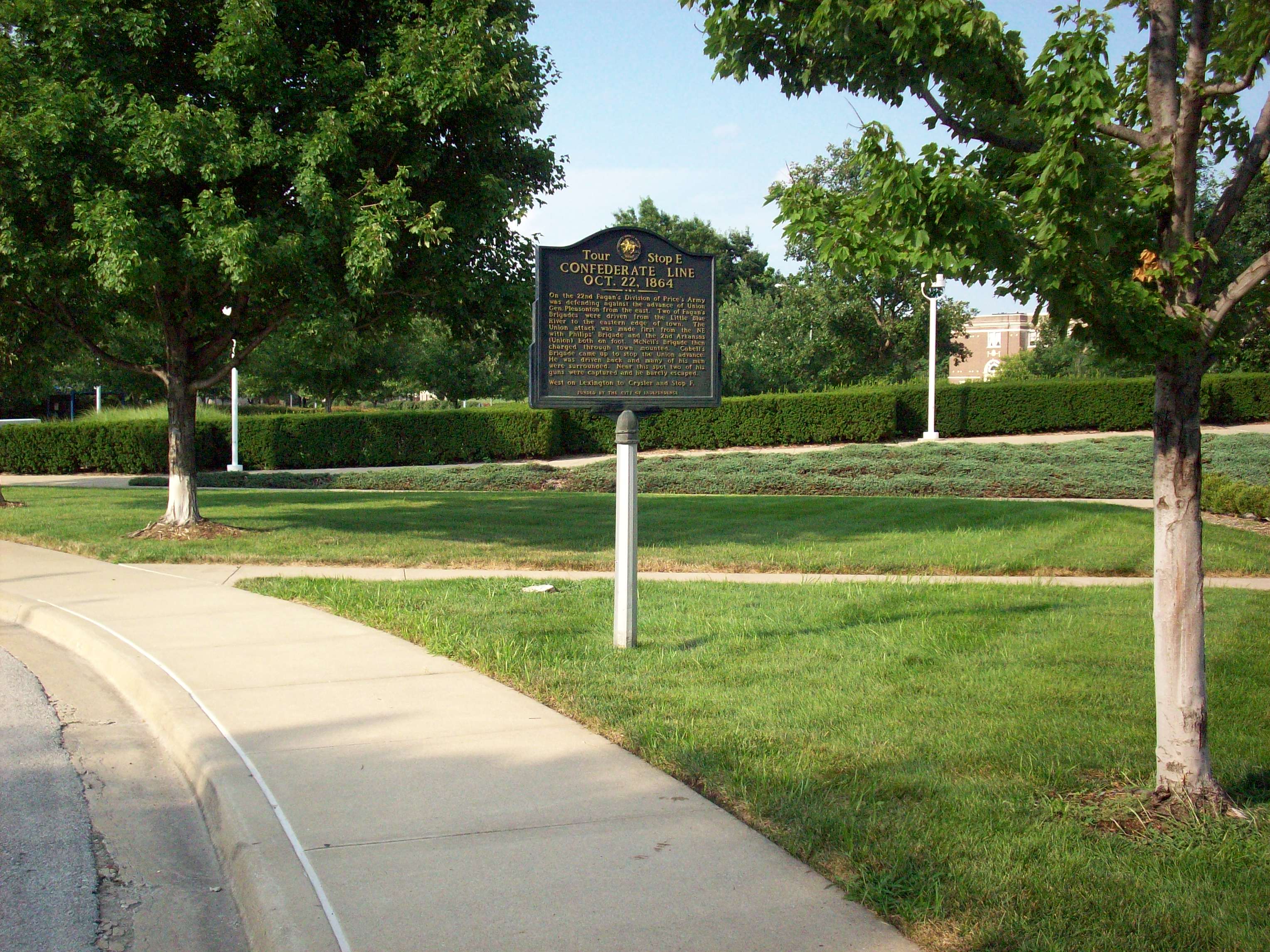
Street Fighting at the Temple Lot
Around 2:00 PM, McNeil resumed the advance with the 17th Illinois and 13th Missouri Cavalries as his main line and the 5th Missouri State Militia Cavalry as skirmishers. Pleasonton committed Sanborn's brigade, with the 2nd Arkansas Cavalry leading the attack. The Arkansans advanced faster than planned, reaching Independence ahead of the rest of the line. They dismounted in the streets and prepared for hand-to-hand combat. The 13th Missouri Cavalry's attack shattered Confederate resistance at the Temple Lot. The Union troopers charged directly at Hughey's battery, shooting down all of the battery's horses and routing the defenders. They captured Hughey's two cannons -- which had themselves been captured from Union forces at the Battle of Pleasant Hill -- along with 300 Confederate prisoners. Brigadier General Cabell nearly fell into Union hands and lost his sword during his escape. The 13th Missouri Cavalry lost only 10 men in the charge.
Fighting After Dark
Both McNeil's and Sanborn's brigades were too exhausted and disorganized to pursue immediately. Clark's brigade held Independence until about 5:00 PM, then began falling back once Price's supply train was safely crossing the Big Blue. Pleasonton brought up fresh brigades under Brown and Winslow. Brown attacked with the 1st Missouri State Militia Cavalry about an hour before sunset, driving the Confederates back but running low on ammunition -- the 1st Missouri alone fired an estimated 11,700 rounds. Winslow's brigade took the lead as darkness fell. The 3rd and 4th Iowa Cavalry and the 4th and 10th Missouri Cavalry pressed the retreating Confederates through the night -- an extraordinary occurrence in a war where armies almost universally halted at sundown. Clark's brigade formed a rear guard with Pratt's Texas Battery, but the 3rd Iowa Cavalry kept pushing. By 10:00 PM the Confederate wagon train had crossed the Big Blue, and by 10:30 Winslow halted his pursuit.
Prelude to Westport
Pleasonton claimed 400 prisoners and reported finding 40 Confederate dead on the field. Price acknowledged losing 300 to 400 men. Union losses were heaviest in McNeil's brigade but exact figures are unknown. During the post-battle cleanup, Union soldiers took over a local bank and hotel as hospitals and rescued 40 of Blunt's wounded men who had been captured during the Battle of Little Blue River the day before. The next morning, October 23, brought the decisive engagement. Shelby and Fagan attacked Curtis at the Battle of Westport while Pleasonton struck Marmaduke from the rear. The Confederate line broke. Price retreated into Kansas, suffering further defeats including a catastrophic rout at the Battle of Mine Creek on October 25. Union pursuit continued until the Arkansas River on November 8. Price had entered Missouri with 12,000 to 13,000 men. He returned to Texas with roughly 3,500. The Independence battlefield has since been consumed by the city's growth. A 2011 study concluded it was 'beyond hope of meaningful landscape preservation.' A self-guided driving tour covering 10 sites is the primary way to trace the battle today.
From the Air
Located at 39.086°N, 94.441°W in Independence, Missouri. The battlefield has been entirely built over by urban development and is not distinguishable from the air. The fighting ranged from the Little Blue River crossing in the east through the streets of downtown Independence to positions southwest of town toward the Big Blue River. Kansas City International (KMCI) is approximately 30 miles northwest. Lee's Summit Municipal Airport (KLXT) is roughly 10 miles south. Charles B. Wheeler Downtown Airport (KMKC) is about 12 miles west. The Temple Lot in downtown Independence and the historic courthouse square are the most identifiable landmarks from lower altitudes. The Big Blue River corridor to the west and the Little Blue River to the east provide natural reference points from 3,000-5,000 feet.