Second Battle of Springfield
Brigadier General Egbert Brown had 1,343 men and a decision to make. On the afternoon of January 7, 1863, riders from the Ozark garrison galloped into Springfield with alarming news: somewhere between 4,000 and 6,000 Confederate cavalrymen were riding hard for the city. Brown could destroy the Union Army of the Frontier's entire winter supply depot and retreat, or he could stand and fight. The memory of General Grant's recent, scathing censure of the Union commander who had surrendered the Holly Springs supply depot in Mississippi surely weighed on his mind. Brown chose to fight. By dawn the next morning, civilians and soldiers alike were armed and positioned behind a network of four nearly completed earthen forts and a stockaded college building, each commanding the high ground around Springfield. What followed was one of the Civil War's rarest engagements: an urban, house-to-house battle in the Missouri Ozarks.
Three Columns from Arkansas
The Confederate plan was ambitious. On December 31, 1862, Brigadier General John S. Marmaduke led three columns of cavalry out of Pocahontas and Lewisburg, Arkansas, aiming to sever the Union supply line between Rolla and Springfield. His scouts reported that Springfield's massive depot of military stores was weakly defended. Marmaduke's main column pushed north through Forsyth, Missouri, while Colonel Emmett MacDonald's second column destroyed Fort Lawrence at Beaver Creek. A third column under Colonel Joseph C. Porter was ordered to converge on Springfield. If everything went according to plan, all three commands would arrive together and overwhelm the outnumbered garrison. Everything did not go according to plan. Porter's column never arrived, and MacDonald only reached Springfield by mid-morning on the day of the attack. The late convergence gave Brown precious hours to prepare.
Streets on Fire
To give his artillery clear firing lines, Brown ordered ten homes along South Avenue burned at the last minute. The smoking ruins greeted the Confederates as they advanced from the south on the morning of January 8. Colonel Joseph Orville Shelby took tactical command, launching piecemeal assaults against Fort Number 4 on the east side of South Avenue. His men advanced over open ground, seeking cover behind tree stumps, rock piles, and the charred remains of the houses Brown had torched. The frontal attacks failed. Shelby then shifted to an oblique assault from the west, his men drawn by the cover of a ravine leading uphill toward town. At its head stood a two-story brick academy surrounded by a stockade, which the Union had been using as a prison but had neglected to garrison. The Confederates seized the building and turned it into a fortress, pouring fire back toward Fort Number 4. The fiercest fighting of the day erupted around this stockade -- hand-to-hand combat, the capture of a Union cannon, and a desperate counterattack that pushed the Confederate line back to State Street.
Sunset Repulse
As the January sun sank toward the Ozark hills, Marmaduke ordered one final assault against Fort Number 4. Once more the Union defenders held. Night fell, and the Confederates withdrew down the Ozark Road to the Phelps farm, the site that is now Phelps Grove Park. Of the approximately 2,099 Union troops engaged, 165 became casualties. Confederate losses were at least 150, though Marmaduke himself admitted his returns were incomplete -- later estimates place the figure closer to 280 killed, wounded, or captured. The absence of Porter's column had been decisive. Within four days, the Confederate raiders retreated to Arkansas. Springfield remained firmly in Union hands, continuing its role as a critical supply and medical center for the western theater.
Walking the Battlefield Today
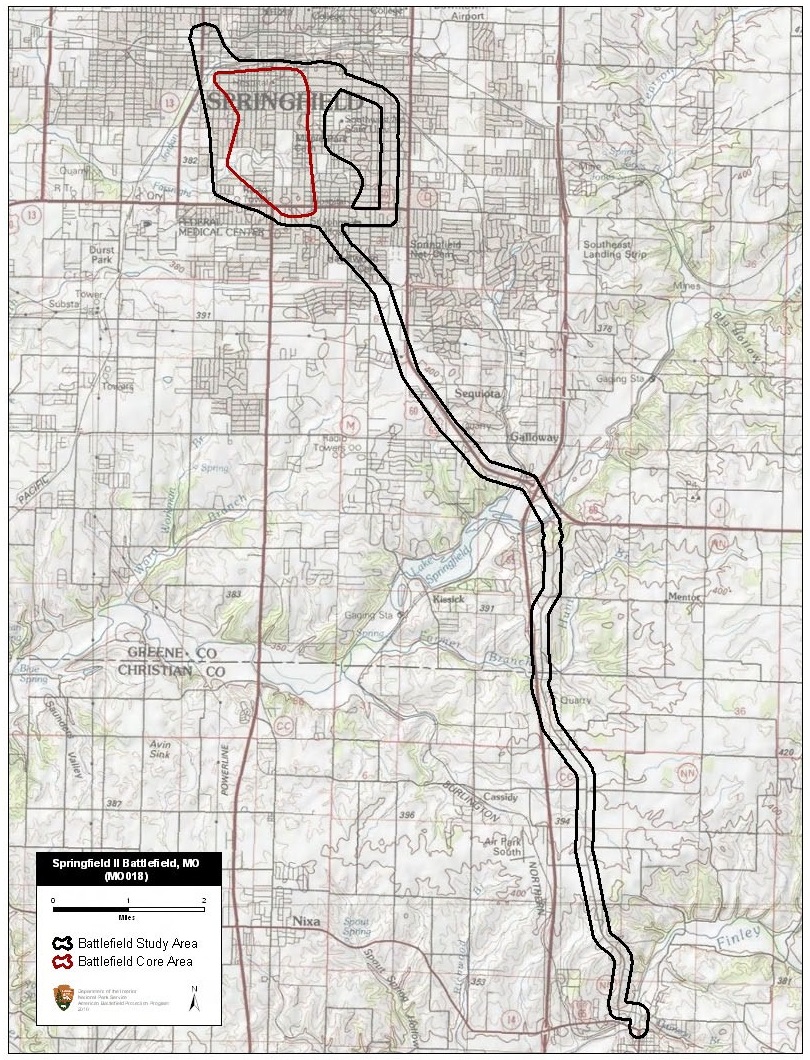
Unlike most Civil War battlefields, this one lies entirely within a modern city. A series of twelve interpretive markers now trace the course of the fighting through downtown Springfield, designed to be followed as a walking tour. The first marker stands at Park Central Square. Among the stories the markers tell is that of Spencer McCoy, a young Confederate killed in the fighting. He was the son of John C. McCoy, founder of Kansas City. The elder McCoy was permitted to travel to Springfield to claim his son's body; they are buried together in Union Cemetery in Kansas City. The battle also played out near what is now the intersection of Grand Avenue and Grant Street, where Shelby's men charged up the ravine, and at Campbell Avenue and State Street, where the captured stockade stood. Springfield had seen war before -- the First Battle of Springfield in 1861, and the better-known Battle of Wilson's Creek nearby -- but the Second Battle was unique in its urban, close-quarters character.
From the Air
Located at 37.195N, 93.302W in the Ozark Plateau of southwest Missouri, elevation approximately 1,300 feet MSL. Springfield-Branson National Airport (KSGF) lies to the northwest. Downtown Springfield, where the battle took place, is clearly visible from altitude. Phelps Grove Park marks the Confederate withdrawal route. The city sits at the junction of major highways visible from altitude. Best viewed at 3,000-5,000 feet AGL on approach from the south, retracing the Confederate advance route through the Ozark hills.