Seibal: The City That Outlived Its Own Destruction
"They destroyed the writing. They chopped the writing off the statues that were made." These phrases, carved into stone at Dos Pilas and Aguateca, record an act of cultural annihilation carried out at Seibal in AD 735. When the Dos Pilas king Ucha'an K'in B'alam defeated Seibal and captured its ruler Yich'aak B'alam, he did not merely impose vassalage on the largest city along the Pasion River. He ordered the obliteration of its historical record - every earlier inscription systematically defaced, every carved monument stripped of its text. A century later, against all probability, Seibal would be reborn under new leadership, outlasting its conqueror and nearly every other city in the Maya lowlands.
Place of the Ceiba Trees
Seibal takes its name from a corruption of the Spanish word ceibal, meaning a place where many ceiba trees grow - the ceiba being the sacred world-tree of Maya cosmology. The site occupies bluffs about 100 meters above the Pasion River, a major tributary of the Usumacinta that served as the region's principal trade artery. First settled around 900 BC, the city reached its initial peak in the Late Preclassic around 200 BC, with an estimated population approaching ten thousand. Then came centuries of decline through the Early Classic, a hollowing-out that left the city vulnerable. The social order was that of priest-kings and nobility in the ceremonial center, commoners in the periphery. Surveys have counted 436 structures per square kilometer in the site core, thinning to 244 in the surrounding areas - the archaeological footprint of a city that was, at its height, genuinely urban.
Vassal and Survivor
After the catastrophic defeat of AD 735, Yich'aak B'alam was not executed. Instead he was kept as a vassal, depicted under the feet of his conqueror on Aguateca Stela 2. A hieroglyphic stairway was installed at Seibal recording the city's new subordinate status. The next king of Dos Pilas, K'awiil Chan K'inich, presided over rituals at Seibal in 745 and 747 - a reminder, carved in stone, of who held power. But the Petexbatun kingdom that had subjugated Seibal was itself fragile. When Tamarindito and other vassal cities rebelled and destroyed Dos Pilas in AD 761, the shockwave freed Seibal. Ajaw B'ot took the throne in AD 771, restoring it as an independent capital. After AD 800, however, the city fell into a thirty-year hiatus. No monuments were erected. The silence lasted until AD 830, when everything changed.
Foreign Masks and Wind Gods
In AD 830, a figure named Wat'ul Chatel arrived from Ucanal to the east and was installed as Seibal's new ruler. Behind him stood an alliance of Caracol and Ucanal - cities attempting to reopen the old Pasion-Usumacinta trade route as the Classic Maya collapse engulfed the region around them. Wat'ul Chatel built an innovative radial pyramid in the South Plaza of Group A, with stairways ascending all four sides and a square shrine with four doors. The temple's stucco frieze featured larger-than-life sculptures of the king above each doorway, with twelve smaller figures spaced around the cornice. Between AD 849 and 889, seventeen stelae were carved in a striking hybrid style: one lord wears the beaked mask of Ehecatl, the central Mexican wind god, with a Mexican-style speech scroll curling from the mouth. Others show foreign-style foot slippers and squared cartouches. Some bear non-Maya calendrical glyphs, including cipactli, the crocodile glyph used for the first day of the central Mexican 260-day calendar. These carvings reflect the influence of Chontal Maya warrior-merchants from the Gulf Coast, who controlled trade along the Pasion.
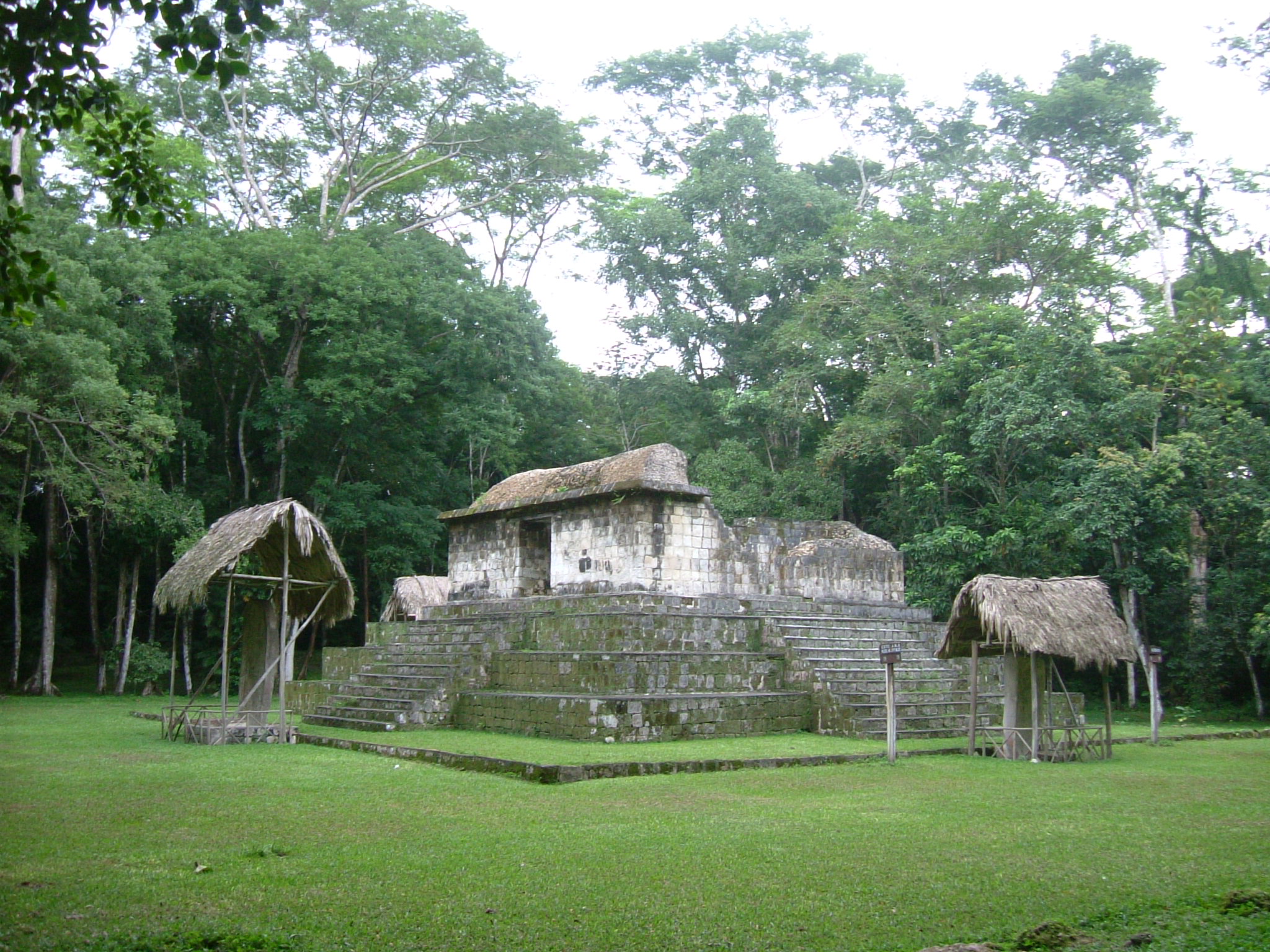
The Last Monuments
Wat'ul Chatel's final stela was erected in AD 889 - one of the last dated monuments raised anywhere in the Maya lowlands. By 900 the city was nearly empty. By 930 it was completely abandoned. The late stelae show a marked decline in quality over those forty years, the carvings growing flatter and cruder, as if the craftsmen capable of working monumental stone were disappearing along with everything else. The ruins slept until around 1890, when loggers for the Hamett Mahogany Company stumbled across them. Federico Arthes, a logging company owner, reported the ruins in 1892 and took plaster casts of the stelae for the 1893 World's Columbian Exposition in Chicago, where archaeologists first learned of the site. Teoberto Maler explored Seibal for Harvard's Peabody Museum in 1895 and 1905. Major excavations came in 1964-1968 under Gordon R. Willey, and again in 2006. Today only two structures have been restored: the A-3 radial platform and the circular Structure C-79, topped by a jaguar altar resting on pedestals shaped like crouching figures - a monument dated to about AD 870, near the end of Seibal's improbable second life.
From the Air
Located at 16.512N, 90.061W on bluffs 100 meters above the Pasion River in Guatemala's Peten department, approximately 100 km southwest of Tikal. The site core covers just over one square kilometer across three hilltop groups (A, C, D) connected by causeways. The Pasion River below is the primary navigation landmark from altitude. Closest airport: Mundo Maya International Airport (MGMM) near Flores, roughly 90 km northeast. Best viewed at 2,000-4,000 feet; look for the river bend with elevated terrain on its southern bank. The jungle canopy is dense but the restored structures may be visible as clearings.