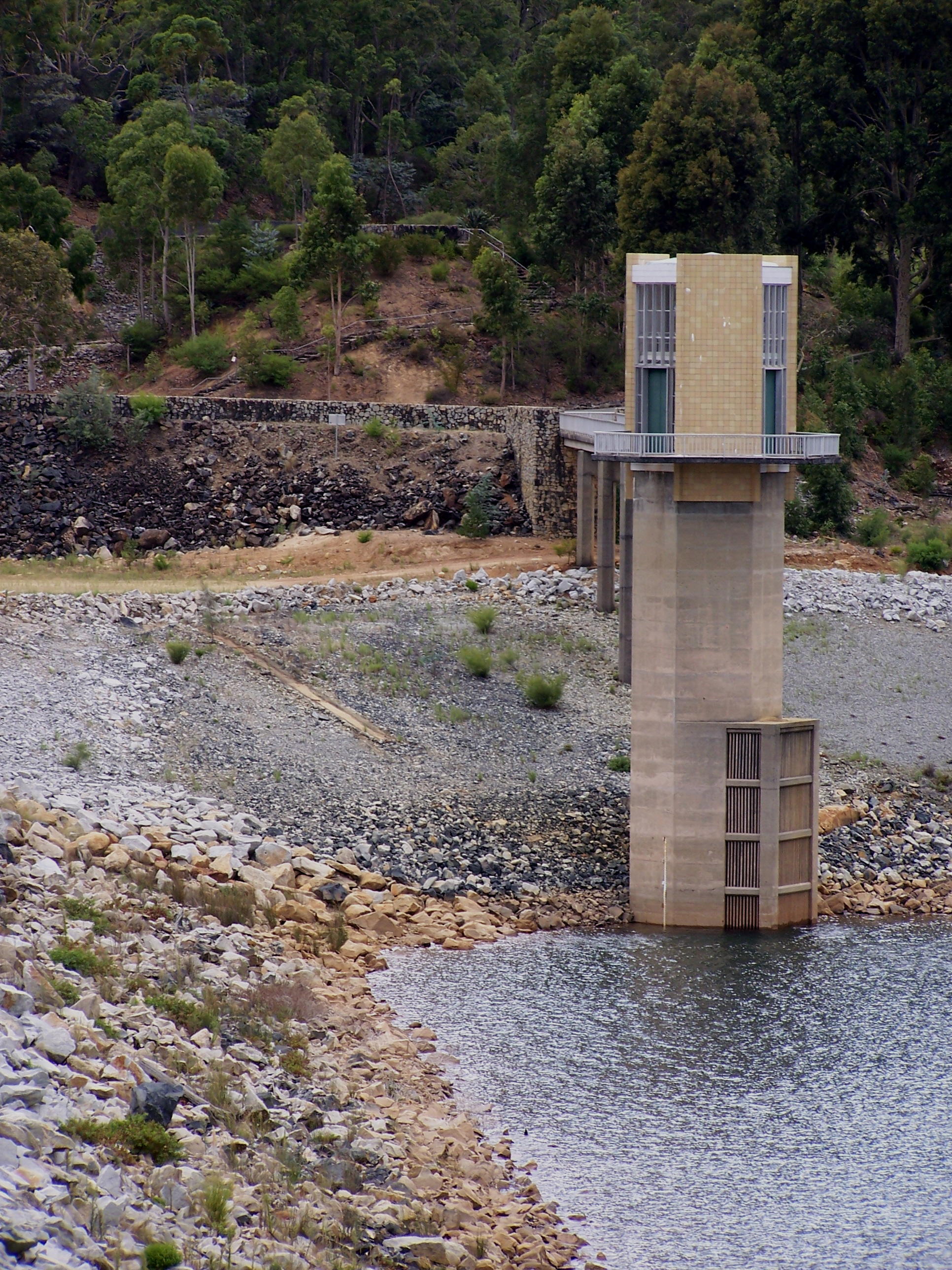
Serpentine Dam
In 2011, water supplies across Perth and the South West reached critically low levels after nearly a year without significant rain. It was the kind of headline that forced a sprawling city of two million to confront an uncomfortable truth: in a drying climate, every reservoir matters. Serpentine Dam, completed in 1961 and tucked into the jarrah-clad Darling Plateau about 12 kilometres south of Jarrahdale, is one of the reservoirs that matters most. Supplying an average of 39 billion litres per year - with another 2 billion from natural inflows to its companion, the Serpentine Pipehead Dam - it forms a critical node in Western Australia's Integrated Water Supply System, the largest such scheme managed by the Water Corporation.
Engineered for a Thirsty Coast
The dam sits within a catchment of 664 square kilometres on the Darling Plateau, where the reservoir surface rests at 217 metres above sea level and the catchment's highest point, Mount Cuthbert, rises to 582 metres on the eastern boundary. The dam wall stands 55 metres tall at its lowest foundation, impounding a reservoir that stretches 16 kilometres through forested valleys. It is one of 15 dams built in Western Australia since the 1920s as part of the IWSS, a network that pipes water from the scarp's catchments to Perth, Mandurah, and beyond. Before these systems existed, Perth's limited water sources became polluted, fuelling outbreaks of typhoid and diphtheria that hit the city's poorest communities hardest. Serpentine Dam was built, in part, to ensure that history would not repeat itself.
The Bauxite Bargain
Beneath the jarrah canopy that feeds the catchment lies bauxite ore, and Alcoa has mined it here since 1963. The process is brutal on the landscape: forest clearing, soil stripping in two layers, blasting of lateritic duricrust, and removal of the friable bauxite underneath. The northern Jarrah Forest, including the Serpentine catchment, has been significantly affected. Alcoa has committed to rehabilitation at a rate of 1,300 tree stems per hectare, with lost forest areas projected to be replaced by 2032. Hydrologists have modelled the trade-off in precise terms: annual inflow to Serpentine Dam was projected to increase by 3.5 percent between 2011 and 2030 as cleared land sheds more water, but then decrease by 4.5 percent from 2030 to 2050 as regenerating forest begins drinking it back. It is an equation where ecology and infrastructure are tangled at the roots.
Guarding the Water
Pathogens are a persistent threat to any open catchment, and at Serpentine the risks arrive from unexpected directions. Off-road driving on unauthorised tracks accelerates erosion, lifting soil particles into waterways where pathogens adsorb to them and resist disinfection more effectively. Feral vehicles uproot vegetation and smother the riparian buffers that filter runoff before it reaches the reservoir. The catchment also hosts 1,355 hectares of private land on its southeastern edge, used for Tasmanian bluegum plantations, private dams, and remnant native bush. In 2007, much of this land was sold to a Boddington Gold Mine venture; to compensate for the State Forest disturbed by the expansion, the mine traded other plots of equivalent conservation value, which became Crown Land under the Department of Environment and Conservation.
Trails Through the Catchment
Despite its role as a protected water source, the Serpentine catchment is far from off-limits. The Bibbulmun Track, one of the world's great long-distance walking trails, passes through the catchment roughly 25 kilometres upstream of the dam, linking the Monadnocks and White Horse Hills campsites. The Munda Biddi mountain bike trail crosses the catchment's northern edge. Orienteering, rogaining, and picnicking are approved activities, and the Water Corporation operates a picnic area directly downstream of the dam. Horse-riding events have been held on the northwest side, and the Darling 200 Rally once ran motor events through the area in spring. Swimming, boating, and fishing remain unauthorised - a reminder that this landscape serves a utilitarian purpose that overrides recreation.
A Drier Future
Perth's climate is shifting. Rainfall has declined measurably since the 1970s, and the prospect of consecutively dry years is no longer hypothetical. The Serpentine Dam is intended to continue supplying the metropolitan area, but planners acknowledge that the existing IWSS dams alone may not meet future demand. Desalination plants have already been added to the network, and the Serpentine Pipehead Dam now stores both natural inflows and desalinated water. The catchment lies within State Forests Number 14 and 67, managed for conservation, timber production, recreation, and increasingly, the anxious calculus of how much water a warming continent can still wring from its forested hills.
From the Air
Coordinates: 32.40S, 116.10E. The dam appears as a long, narrow reservoir stretching through forested valleys of the Darling Plateau. Visible from 3,000-5,000 ft AGL as a blue ribbon amid dark green jarrah forest. Nearest airports: YPJT (Jandakot), YPPH (Perth Airport). The Bibbulmun Track and Munda Biddi trail corridors may be visible as cleared paths through forest canopy.