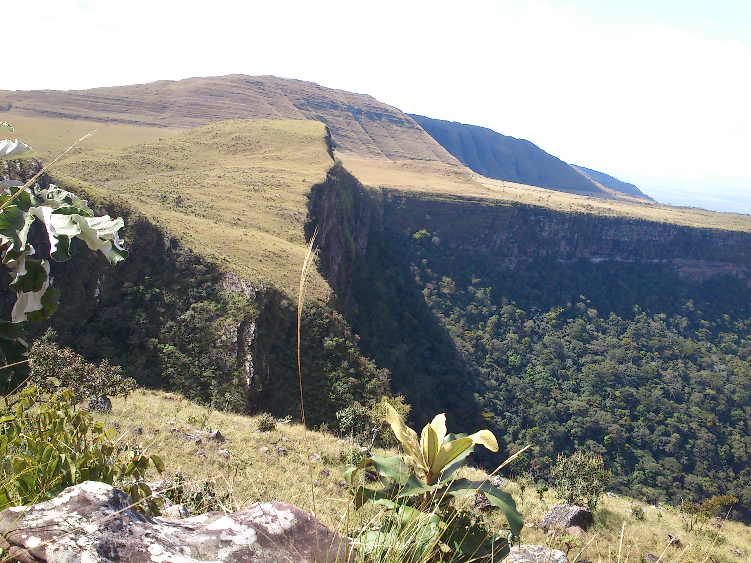
Serra Ricardo Franco State Park
The Jatoba waterfall drops 248 meters off the edge of a sandstone plateau, the longest vertical plunge in the state of Mato Grosso. Below it, seasonal forest stretches toward the Guapore River and the Bolivian border. Above it, the Serra de Ricardo Franco rises like a natural fortress, its flat summit connected to the Serra de Santa Barbara and Serra de Sao Vicente in what geographers call the most prominent relief feature of the Brazilian midwest. This is Serra Ricardo Franco State Park, 158,621 hectares of contested ground where conservation and commerce have been fighting since before the park was even created.
A Park Born Into Conflict
When the state of Mato Grosso established Serra Ricardo Franco State Park by decree on November 4, 1997, squatters were already living inside its boundaries. The park was designed to protect water resources and preserve samples of the ecosystems spanning the transition from cerrado to Amazon rainforest, but the land it occupied was also land that ranchers and soybean farmers wanted. The tension was immediate. By 2003, efforts were underway to reduce the park's size, and the state government let the deadline for expropriating private holdings within the park quietly expire. The squatters stayed. The loggers kept logging. The gold miners dug in.
The Governor and the Soybeans
In November 2004, the State Environment Foundation presented a proposal to Governor Blairo Maggi, himself one of the world's largest soybean producers, to cut 100,000 hectares from the park. The rationale was straightforward: the government could no longer afford to buy out the landowners inside the park boundaries. The areas to be removed were those already occupied before 1997, extending down to the foot of the mountains. In exchange, the foundation proposed designating 70,000 hectares of the removed land as a weaker environmental protection area. The mayor of Vila Bela da Santissima Trindade endorsed the plan enthusiastically. He was not concerned about losing ecological funding, he said, because it was small compared to the revenue the new land could generate when planted with soybeans. The calculus was blunt: trees were worth less than beans.
Between Two Worlds
The park sits in an ecotone, the biological boundary where cerrado grassland gives way to Amazon rainforest, and species from both biomes share the same territory. Giant anteaters, creatures of the open cerrado, live alongside giant otters that hunt in Amazonian waterways. Neotropical otters appear in small groups or isolated pairs along the Guapore River. Jaguars, tapirs, and monkeys move through seasonal semi-deciduous forest that drops its leaves in the dry months, then erupts with green when the rains return. At least 174 species of fish inhabit the park's rivers and tributaries. Large areas of rocky fields along the plateau margins remain scientifically unstudied, their flora and fauna essentially unknown. On its western edge, the park borders Bolivia's Noel Kempff Mercado National Park, a UNESCO World Heritage Site, making this stretch of the border one of the most ecologically significant frontiers in South America.
Gold Miners in the Forest
Despite its protected status, large sections of Serra Ricardo Franco have been heavily degraded by logging, mining, deforestation, and burning to create cattle pasture. In November 2015, staff from the state environmental agency SEMA and military police entered the park searching for roughly 40 illegal gold miners who had relocated there after being expelled from the nearby Serra da Borda. The park has no completed management plan, which means it cannot be officially opened to the public. As of 2016, only the Namorados waterfall trail circuit was accessible, used primarily by local residents. The irony is thick: a park with waterfalls, endemic species, and ecotourism potential that could sustain the local economy instead hemorrhages value to illegal extractors. The Amazon Region Protected Areas Program has provided support, but the fundamental problem remains. A park on paper is not the same as a park in practice.
From the Air
Located at 14.60S, 60.29W in western Mato Grosso on the Bolivia border. The Serra de Ricardo Franco plateau is clearly visible from altitude as a flat-topped mesa rising above the surrounding lowlands, with the 248-meter Jatoba waterfall visible as a white thread on the escarpment. The park borders Bolivia's Noel Kempff Mercado National Park to the west. Nearest significant airport is Vilhena (SBVH) approximately 250 km southeast. Best viewed at 10,000-20,000 feet where the plateau edge and waterfall are most dramatic.