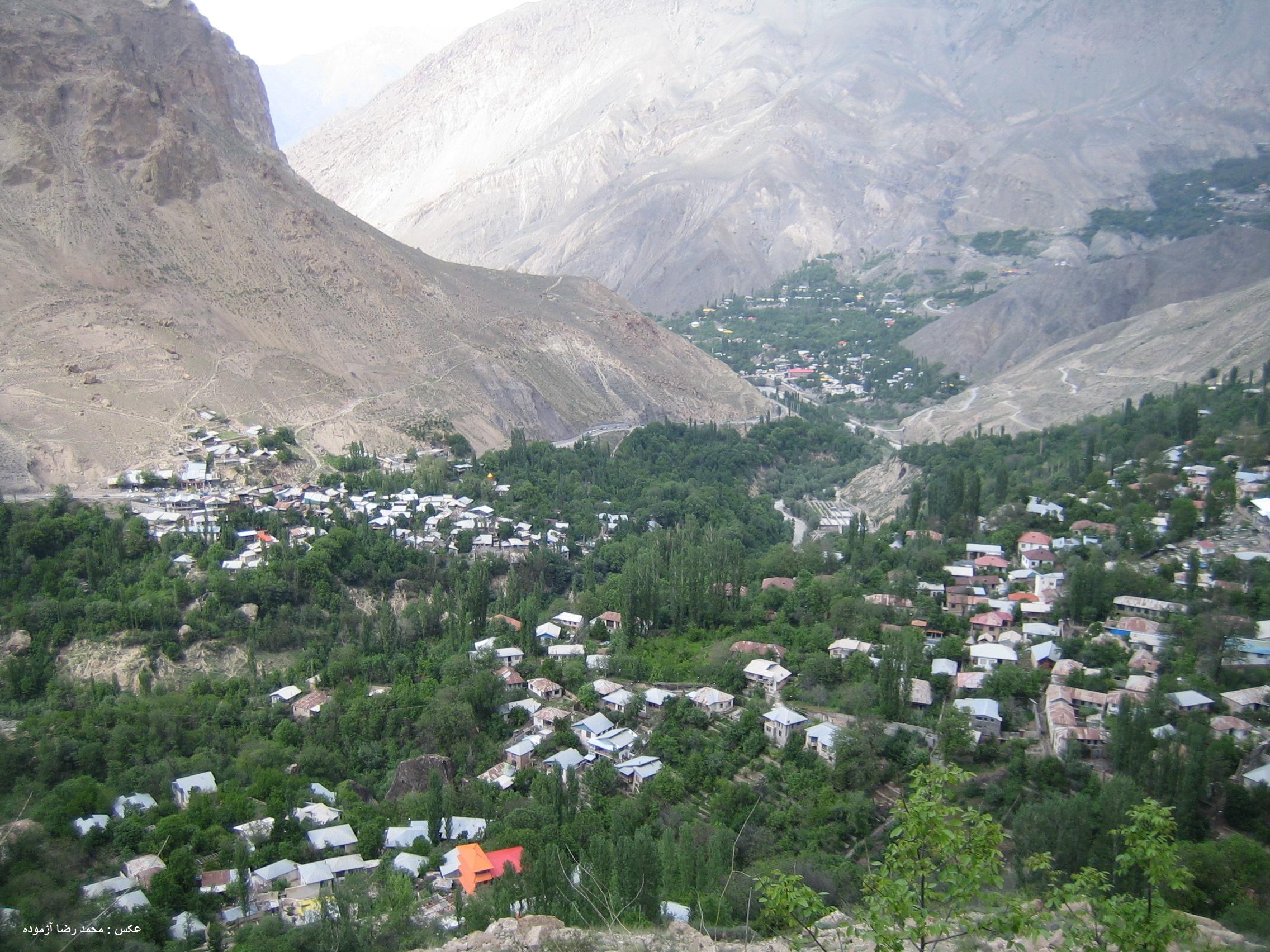
Shahandasht
The name tells you everything. Shahandasht -- 'Field of the Kings' in Persian, from 'shah' meaning king, the plural '-an,' and 'dasht' meaning field -- is a village of just 69 people perched in the mountains of Mazandaran province. With a population that would barely fill a school bus, it guards an unlikely concentration of natural and historical wonders: a triple waterfall cascading 180 meters down a cliff face, a pre-Islamic castle balanced on the rocks above it, and a cave whose entrance requires a two-kilometer hike along a livestock trail. The kings are long gone, but their field remains extraordinary.
Water Falling Three Times
The Shahandasht waterfall is a registered national monument of Iran, and for good reason. Water drops in three distinct stages down a cliff face, with a combined height of 180 meters. The cascade sits in the Larijan District of Amol County, where the southern slopes of the Alborz Mountains meet the lush Caspian-facing valleys of Mazandaran. The waterfall is fed by snowmelt and mountain springs, and its flow varies dramatically by season. In spring, when the high peaks shed their winter snow, the three tiers roar. By late summer, the flow diminishes to a delicate veil. The waterfall has drawn visitors for centuries, but it is what sits at the very top of the falls that makes the site truly unusual.
The Castle Above the Falls
Perched on the rocks directly above the Shahandasht waterfall sits Malek Bahman Castle, also known as Fereshteh Castle -- 'Angel Castle' in Persian, or sometimes Queen Qala Castle. The fortification dates to pre-Islamic times and was registered as a national monument on August 10, 2000. Its position is astonishing: anyone approaching the castle had to climb past the waterfall itself, making it one of the most naturally defended positions in Iran. The castle's walls and foundations cling to the clifftop, visible from the valley below as a dark silhouette against the sky. Nearby stands the Si Tower, whose Persian name means 'thirty,' another pre-Islamic structure registered as a national monument in 2003. These fortifications suggest Shahandasht held strategic importance long before it became a village of thirty-one households.
Into the Earth
Two kilometers from the village, along a dirt road used primarily by livestock herders, lies the entrance to Elias Tangeh Cave. Locals call it As Tangeh Cave. The cave sits on the southwestern slope of the Elias Tangeh valley, positioned 85 kilometers northeast of Tehran and 75 kilometers south of the coastal city of Amol. The cave has not been extensively studied, and its depths remain largely unmapped. What draws visitors is less the cave itself than the journey to reach it: the trail passes through mountain terrain where the Alborz range transitions from the arid slopes facing Tehran to the greener, rain-fed valleys that drain toward the Caspian Sea. The walk offers views of both the waterfall and the castle from angles impossible to reach by road.
Thirty-One Households
At the 2016 census, Shahandasht had a population of exactly 69 people living in 31 households. The village also contains a Qajar-period mosque, locally called a Tekiyeh, registered as national monument number 9354 in 2003. Despite its tiny size, Shahandasht is remarkably well-documented in Iran's heritage registries: the castle, the tower, and the mosque all carry official registration numbers. The village sits in Bala Larijan Rural District within the broader Larijan District, an administrative division that stretches across some of the most dramatic mountain terrain in northern Iran. For a place with fewer residents than most apartment buildings, Shahandasht carries a weight of history and natural spectacle that its population alone would never suggest.
From the Air
Located at 35.91N, 52.26E in the Alborz Mountains of Mazandaran province, northern Iran. The triple waterfall (180 m total) and clifftop castle are potentially visible from low altitude in clear conditions. The nearest major airport is Tehran Mehrabad (OIII) roughly 85 km to the southwest. Terrain is steep and mountainous. The village sits on the southern slope of the Alborz range, between Tehran to the south and the Caspian coast to the north.