Shahrizor
Its name means "kingly forest." For at least seven thousand years, people have lived on the Shahrizor Plain, a broad sweep of fertile land in what is now the Kurdistan Region of Iraq. Watered by the tributaries of the Tanjaro River, which feeds the Diyala and ultimately the Tigris, the plain sits between the modern city of Sulaymaniyah and the Hewraman highlands to the east. Empires have claimed it, armies have crossed it, and religions have sanctified it. But the soil keeps producing, and the people keep coming back.
The Kingly Forest
The etymology tells you something about what this place once was. Shahrazur likely comes from two Iranian words: shah, meaning king, and a term for forest, yielding "kingly forest" or "royal forest." The archaeologist Ernst Herzfeld, noting that classical sources spelled the name with an initial "s" rather than "sh," proposed an alternative reading: "white forest," linking it to ancient Avestan legends. For adherents of the Yarsan faith, a religion indigenous to the Kurdish lands, the Shahrizor Plain holds a status that transcends etymology. They regard it as sacred ground where God will descend for the Last Judgement. The 12th-century geographer Yaqut al-Hamawi offered yet another origin story, tracing the name to a son of the mythic tyrant Zahhak, whom he credited with founding the famous city of Sharazor. Three explanations, three layers of meaning, all pointing to the same conclusion: this place has always mattered.
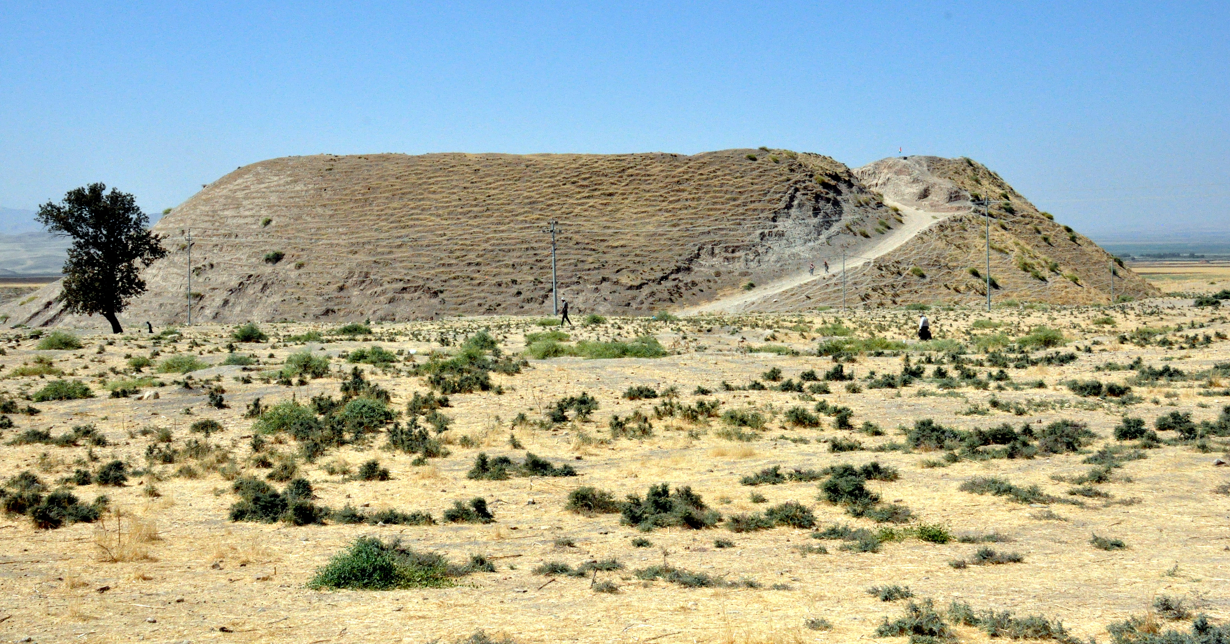
Seven Millennia of Footprints
Archaeological survey work, intensifying since 2009, has confirmed what the landscape suggests: the Shahrizor valley has been continuously occupied since the Late Neolithic and Chalcolithic periods. The Halaf culture left traces here. So did the Ubaid culture. Sites like Bakr Awa, Tell Begum, Gird-i Qalrakh, and Bestansur, the last of which sits on UNESCO's World Heritage Tentative List, have yielded painted pottery dating to around 3000 BCE. During the 3rd millennium BC, the plain belonged to the kingdom of Lullubi. By the Iron Age, it formed the heart of the Zamua kingdom, which stretched from Lake Urmia to the upper Diyala River. The Neo-Assyrian king Ashurnasirpal II found the region rebellious and had to subdue it by force. Conquering the Shahrizor has never been the hard part. Holding it is another matter.
Crossroads of Faith and Power
Arab geographers associated the plain with biblical legends of Saul and David, suggesting the presence of an ancient Jewish colony. Under the Sassanid Empire, the region served as one of five provinces in the satrapy of the Medes. In the 4th century, inhabitants who had converted to Christianity faced Sassanid persecution. Bishop Shahdost Shahrazori and 128 of his followers were killed for their faith. From the 11th century, Shahrizor was incorporated into the Ardalan Principality and served as its first capital, the relics of which survive at the historic site of Yassin Tepe. It later passed to the Baban Principality. The area also became a center for Zaydism among a Kurdish minority before that branch of Islam declined in the region.
Dynasties and the Dust They Leave
The medieval period brought wave after wave of new rulers. The Annazid, Aishanid, and Ayyubid dynasties all controlled these lands. During the Ayyubid era, Saladin himself granted the region and the city of Erbil as a fief to the emir Gokbori in 1190. Yaqut al-Hamawi, writing in the 13th century, described the region of Sharazor as stretching from Erbil in the west to Hamadan in the east, encompassing many cities, towns, and villages. He noted that the inhabitants were entirely Kurds who defended themselves from the sultan and governed their own territory. That observation, made eight centuries ago, still resonates. The Shahrizor Plain has changed hands many times, but the Kurdish presence has remained constant, rooted in the same fertile soil that first drew settlers here millennia before any dynasty had a name.
From the Air
Located at 35.45N, 45.45E in the Kurdistan Region of Iraq, east of Sulaymaniyah. The plain is visible as a broad, green agricultural expanse between mountain ridges. Nearest airport is Sulaymaniyah International Airport (ORSU). Best viewed at 8,000-12,000 feet AGL. The Tanjaro River and its tributaries provide visual reference lines. The Zagros foothills rise to the east.