Ship Island
In 1969, Hurricane Camille's storm surge sliced Ship Island in half. For fifty years, the gap - known as Camille Cut - widened as currents pulled sand from the wound. East Ship Island shrank with every passing hurricane until, after Hurricane Ike in 2008, scientists surveying the coast had trouble finding it at all. Then in 2019, the U.S. Army Corps of Engineers finished pumping enough sand to close the cut and rejoin the two halves into one island again. It was the latest chapter in a story of relentless destruction and stubborn renewal that stretches back more than three centuries on this narrow strip of sand twelve miles off Gulfport, Mississippi.
Five Flags Over Sand
Ship Island possesses the only deep-water harbor between Mobile Bay and the Mississippi River, a geographic accident that made it irresistible to every power that ever entered the Gulf. French explorer Pierre Le Moyne d'Iberville charted the island on February 10, 1699, and used it as a base of operations while locating the mouth of the Mississippi River. The French named it Ile aux Vaisseaux - Island of Ships. French, Spanish, British, Confederate, and Union flags have all flown here. Some early immigrants to the French colonies died upon arrival and were cremated on the island in a furnace. Ship Island was never a place anyone stayed by choice; it was a place people passed through on their way to somewhere else, its value measured entirely by the depth of its harbor.
The Fort and the Native Guard
Construction of what became Fort Massachusetts began in 1859, part of the Third System of coastal fortifications. Mississippi's secession in 1861 interrupted the work. Confederates seized the unfinished fort, exchanged cannon fire with a Union warship on July 9, then abandoned the island by September. Union forces moved in and turned Ship Island into a staging ground for the capture of New Orleans, with up to 18,000 troops encamped on the sand. The fort was renamed Fort Massachusetts in 1862, probably honoring the USS Massachusetts. Among those stationed here was the 2nd Louisiana Native Guard led by Colonel Nathan W. Daniels, a unit composed of African American soldiers and one of the earliest such regiments in the United States Army. Construction halted in 1866 with the fort still unfinished - it remains incomplete to this day.
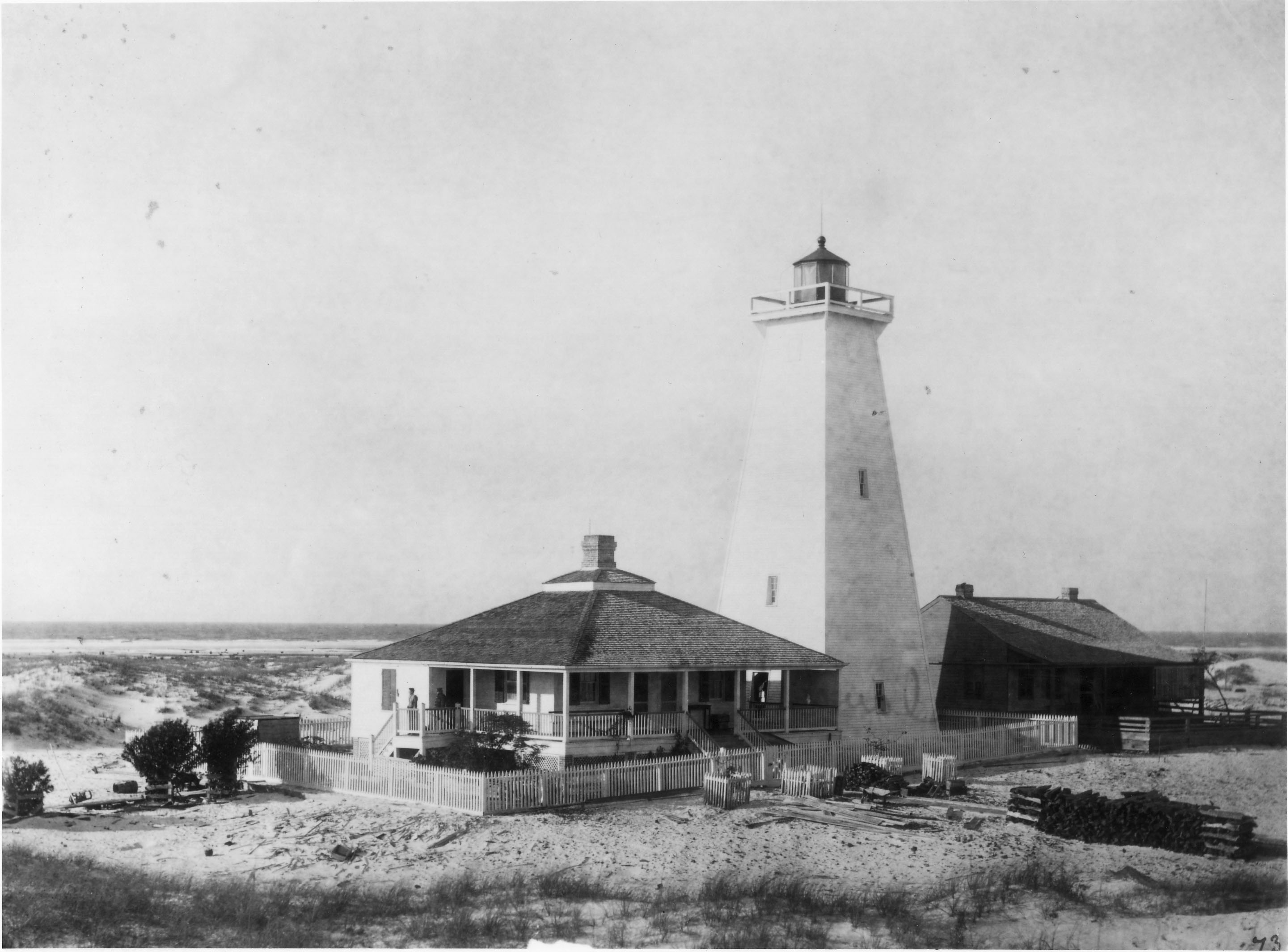
Quarantine, Lighthouses, and Coast Guard Patrols
After the military moved on, Ship Island found new uses. In 1880, it became the site of the country's first quarantine station, screening arrivals for disease before they reached the mainland. A brick lighthouse built in 1853 was replaced by a wooden one in 1886 after waves damaged the original. During World War II, the Coast Guard ran anti-submarine beach patrols here, scanning the Gulf for enemy vessels. In 1942, the Army Air Corps converted the old quarantine station into a military recreation facility. Keesler Air Force Base in Biloxi continued using it for recreation through 1955. Each era left its mark on the island, and each mark was eventually erased by wind and water - the wooden lighthouse was accidentally burned down by campers in 1972, and a commemorative reproduction built in 1999 was reduced to rubble by Hurricane Katrina in 2005.
The Hurricane Cycle
No place on the American coast has a more punishing hurricane record than Ship Island. Camille split it in 1969. Georges washed away a mile of East Ship Island's beach in 1998. Katrina in 2005 almost completely submerged the eastern half and destroyed every visitor facility on the western half - ranger station, restrooms, concessions, pier, boardwalk, staff quarters - while Fort Massachusetts, built to withstand naval bombardment, survived with minimal damage. Gustav and Ike struck back-to-back in 2008, and by the time scientists arrived two weeks after Ike, the eastern island had vanished entirely. Yet the island keeps coming back, rebuilt by sand dredged from shipping channels and pumped onto its shores. Today Ship Island serves as a tourist destination within the Gulf Islands National Seashore, accessible by ferry from Gulfport, twelve miles to the north. Visitors swim, fish, and tour the brick fort that has outlasted everything the Gulf has thrown at it.
From the Air
Located at 30.22°N, 88.92°W, roughly 12 miles south of Gulfport, Mississippi, in the Gulf of Mexico. Ship Island appears as a narrow east-west barrier island - since the 2019 restoration project closed Camille Cut, it reads as a single continuous strip again. Fort Massachusetts is the most visible man-made structure, a curved masonry fortification on the western end. The island sits between Cat Island to the west and Horn Island to the east in the Mississippi-Alabama barrier island chain. Gulfport-Biloxi International Airport (KGPT) is 12nm north; Keesler Air Force Base (KBIX) is 14nm northeast. The ferry route from Gulfport's Small Craft Harbor is often visible as a wake line across Mississippi Sound. Best viewed at 1,000-2,000 feet to appreciate the island's fragile geometry against the Gulf.