Si Thep Historical Park
For more than thirty years, Thailand nominated its ancient temples and royal cities for UNESCO cultural heritage status and was turned down every time. Then, on 19 September 2023, the ancient town of Si Thep broke the streak, becoming Thailand's first successful cultural World Heritage Site since Ban Chiang in 1992. The achievement was fitting: Si Thep is not a monument to a single dynasty or a single faith. It is a palimpsest of a thousand years of belief, power, and exchange, layered into laterite ruins in the Pa Sak valley of Phetchabun province.
From Farming Village to Mandala Center
Si Thep began as a prehistoric farming settlement roughly 2,500 to 1,500 years ago, tucked into the Pa Sak river valley in what is now central Thailand. In its earliest phase, the community occupied only the inner town, burying its dead with offerings that suggest connections to India and to communities in the central plains and the Moon River basin to the northeast. As the settlement grew, it expanded into an outer city. A monarchy emerged, and with it came Vaishnavism. Hindu influences reshaped the city's spiritual life, connecting Si Thep to the great powers of the era: India, Funan, Chenla, and the Dvaravati cultural sphere that was spreading across the region.
A Golden Age Under the Dharma Wheel
Between the 8th and 10th centuries, Si Thep reached its peak. Mahayana Buddhism became the dominant spiritual influence, producing art that blended Indian, Dvaravati, and local traditions into something distinctive. Irrigation systems fed the surrounding farmland. Together with Lavo, Si Thep functioned as a center of the mandala-style Dvaravati state, a loose network of allied cities rather than a centralized kingdom. Trade routes connecting the central plains to the northeast passed through Si Thep's territory, and the city controlled access to them. Then something changed. Whether driven by shifting weather patterns, disease, or political pressure, Si Thep's prosperity evaporated. Lavo became the sole regional power, eventually falling under Khmer hegemony in the 10th and 11th centuries.
Angkor's Shadow and the Long Silence
Under Angkorian influence from the 11th to 13th centuries, Shaivism reshaped Si Thep once more, and the city maintained links to Phimai in the Mun River basin. But the era of Jayavarman VII brought policies that marginalized Si Thep further. By the 14th century, the city was effectively abandoned. To the south, a new kingdom was rising on the banks of the Chao Phraya River. Its founders called their capital Krung Thep Dvaravati Si Ayutthaya, a name that deliberately invoked the mandala traditions of the very civilization Si Thep had helped define. Genetic studies in the 20th century confirmed what the name implied: the ancient Mon people of Dvaravati left a lasting mark on the population of central Thailand.
Rediscovery and Recognition
Modern archaeology arrived at Si Thep in 1904, when Prince Damrong Rajanubhab surveyed the site. It was declared an ancient monument in 1935 and became a historical park in 1984. Scholars have debated its identity ever since. Some believe Si Thep was Ayojjhapura, the predecessor to Ayodhya mentioned in Pali chronicles and the Jinakalamali. Historian Tatsuo Hoshino has proposed it as the chief center of the Qian Zhi Fu Kingdom. What the ruins make clear, regardless of which ancient name applies, is the scale of the place: an inner city ringed by walls, an expansive outer city, and structures like Khao Khlang Nai, Prang Si Thep, and Prang Song Phi Nong that testify to centuries of building, rebuilding, and reinvention.
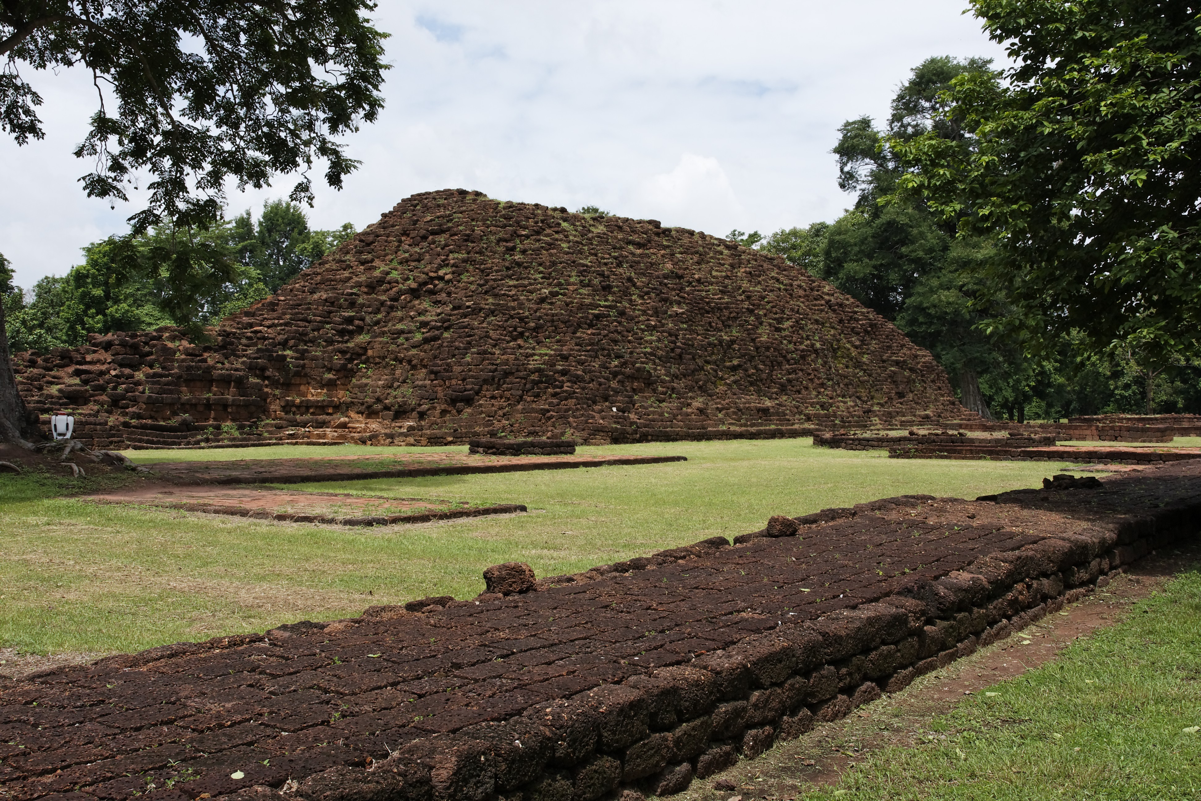
What Remains in the Valley
Walking the park today, the layered history is visible in the stone. Hindu prangs stand near Buddhist monuments. Laterite foundations map the outlines of vanished halls. The inner city structures, including Khao Khlang Nai, reflect the earliest phases of construction, while features outside the walls, such as Khao Khlang Nok and Prang Ruesi, tell the story of expansion and spiritual evolution. Unlike Thailand's more famous historical parks at Sukhothai and Ayutthaya, Si Thep rewards patience over spectacle. There are no towering prangs competing for the skyline, no rows of restored Buddha images. Instead, the ruins speak of something older and less certain, a civilization that flourished, connected to the wider world, and then withdrew into silence.
From the Air
Si Thep Historical Park is located at 15.47°N, 101.15°E in Phetchabun province, central Thailand. The park sits in the Pa Sak river valley with low hills nearby. Nearest airports include Phitsanulok Airport (VTPP) approximately 130 km to the northwest and Nakhon Ratchasima Airport (VTNR) to the east. Best viewed at 2,000-4,000 ft AGL to appreciate the layout of inner and outer city walls. The surrounding terrain is agricultural lowland transitioning to forested hills to the east.