Sia Boey Urban Archaeological Park
The name gives away its origins. "Sia Boey" in Hokkien means "end of the town" - the Malay equivalent, "Ujong Pasir," says the same thing. In the 1880s, this was where George Town's urban grid ran out of steam, where the Prangin Canal met a cluster of shophouses and a market hall that served as the commercial and social nerve center of Penang's Hokkien community. By the early 2000s, the market had relocated, the canal was filthy, and the site nearly vanished under a planned transit station. What saved it was buried just beneath the surface.
A Market at the Edge of Town
George Town's Hokkien settlers built their lives around the Prangin Canal in the mid-1880s, establishing a market hall at its center with shophouses radiating outward. The trading community was never exclusively Chinese - Malays, Indians, and Acehnese merchants all operated in the area, giving Sia Boey its character as a crossroads where Penang's ethnic communities overlapped. The market thrived for over a century, a place where commerce and conversation were inseparable. When the Sia Boey Market finally relocated to Macallum Street Ghaut in the early 2000s, it left behind aging buildings and an open question: what happens to a neighborhood when the activity that defined it moves away?
The Canal That Nearly Disappeared
The answer, initially, was demolition. Planners earmarked the vacant site as Penang Island's transit hub. The Komtar LRT Station was designed to sit directly on top of the idle market building - a plan that would have erased the heritage structure entirely. Local resistance forced the station to Magazine Road instead, but the site remained in limbo for years. Then, in October 2015, archaeologists from the Centre for Global Archaeological Research at the University of Science Malaysia made a discovery that changed the conversation. Beneath the neglected ground, they found a granite construction that turned out to be the Old Prangin Canal Basin, a piece of George Town's 19th-century infrastructure that had been buried and forgotten. The archaeological potential of the site gave preservation advocates something concrete to rally around.
Digging Up a Park
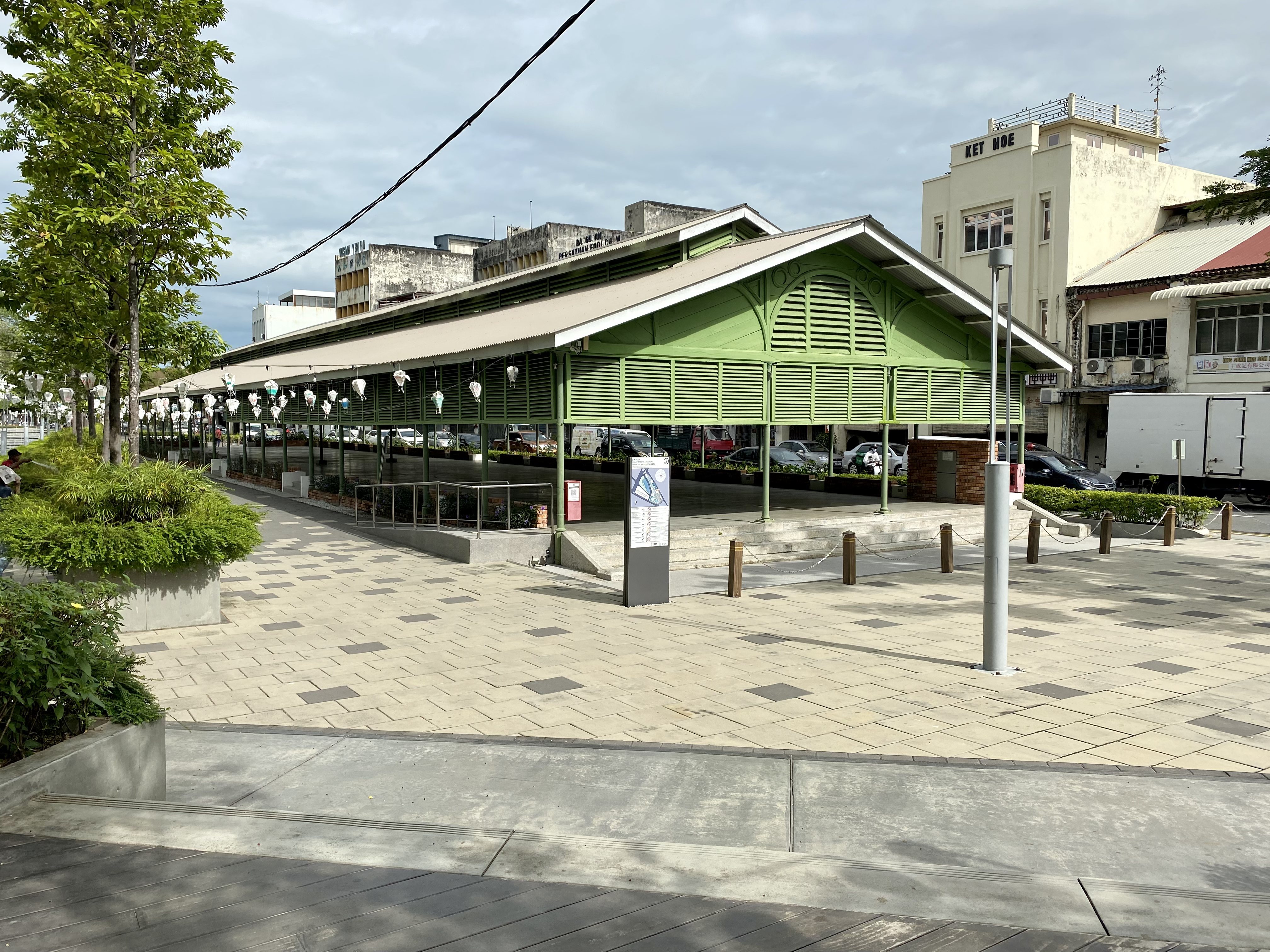
The Penang Development Corporation, working with George Town World Heritage Incorporated, seized on the discovery to propose something Malaysia had never attempted: an urban archaeological park. The Technical Review Panel approved the rejuvenation plans in February 2018, and work began in earnest that March. The old canal was diverted and restored. Workers rehabilitated the site between May and August 2018, uncovering layers of George Town's commercial past as they went. The project cost RM9.1 million for the canal work and archaeological components, with another RM5.1 million going toward restoring the Old Prangin Market building. On November 9, 2019, Penang's Chief Minister Chow Kon Yeow opened the country's first Urban Archaeological Park to the public.
Where Heritage Breathes
Today the park occupies a rare niche in George Town's landscape. The revitalized Prangin Canal runs through it, stocked with koi fish that flash orange and white beneath the surface. Mature trees that survived the decades of neglect provide shade over walkways and a children's playground. The restored shophouses frame the edges, their presence a reminder that this was once a working commercial district rather than a designed green space. As an addition to George Town's UNESCO World Heritage Site, Sia Boey attempts something ambitious: proving that conservation and urban development can coexist on the same patch of ground. The park offers programming and community space for local residents, turning what was nearly a transit station into a place where the layers of Penang's multicultural history remain visible and accessible.
From the Air
Sia Boey Urban Archaeological Park is located at approximately 5.4125°N, 100.3336°E, within the dense urban core of George Town on Penang Island. From the air, it appears as a green pocket amid the tight grid of George Town's heritage zone. The nearest airport is Penang International Airport (WMKP), roughly 12 kilometers to the south at Bayan Lepas. The park sits near the KOMTAR tower, George Town's tallest building, which serves as an excellent visual reference from altitude.