Siaolin Village
At 6:16 on the morning of August 9, 2009, the side of Xiandu Mountain let go. Twenty-three million cubic meters of waterlogged soil plunged downhill at 50 meters per second -- roughly the speed of a car on a highway -- and slammed into the Qishan River valley below. The debris buried the northern half of Siaolin Village instantly, then dammed the river. Within fifty minutes, the dam failed. A second wall of mud, 38 percent solid, erupted downstream and swallowed what remained. The flow averaged 44.6 meters deep. When it was over, 169 homes were gone. Four hundred and seventy-one people were dead. A minor planet, discovered by the Lulin Observatory, was later named Siao Lin in their memory.
The People of the River Terrace
Siaolin Village was not ancient, but its people were. The Taivoan, an indigenous plains people related to but distinct from the Siraya, had lived in the Tainan region for centuries before colonial pressure set them in motion. In the early eighteenth century, as Siraya people moved into the Yujin Basin, Taivoan communities began migrating south from Tainan to Kaohsiung. By the mid-1700s, some Taivoan from Aliguan had settled a river terrace to the north, drawn by hunting grounds in the surrounding mountains. During the Japanese colonial period, the government deliberately relocated more Taivoan people to this terrace to serve as a buffer against mountain indigenous groups and to control the valuable camphor forests in Jiasian and Namasia. The settlement became Siaolin Village in 1904, reportedly named after the local Japanese police officer, Kobayashi. By 2009, the village was home to one of the largest surviving Taivoan communities, carrying cultural traditions that had survived three centuries of displacement.
Five Days of Rain
Typhoon Morakot arrived on August 6, 2009, and did not relent for five days. The rainfall was unprecedented -- not merely heavy but geologically transformative. According to National Taiwan University professor Chen Hong-yu, the sediment carried by the Qishan River and the nearby Laonong River during those five days exceeded 80 percent of what the Gaoping River, their shared outlet, carries in an entire year. Siaolin sat in a valley along the Qishan River, flanked by the Alishan Range to the west and the Yushan Range to the east. The landscape that made the valley beautiful -- steep slopes, narrow channels, abundant water -- was precisely what made it lethal. Xiandu Mountain, upstream from the village, had been absorbing water for days. Witnesses later reported hearing two enormous bangs from the mountain just before the slope collapsed.
The Bus Driver Who Turned Back
Among the stories that emerged from the disaster, one stands apart. A bus driver named Bang Rong-gui, sixty years old, was leaving Siaolin when he saw the first landslide strike. He drove his passengers to safety in Wulipu, the higher-elevation settlement to the south. Then he turned around and went back. He managed to pick up thirty more survivors before a second landslide buried the bus. Everyone aboard was killed. The rescue effort that followed was agonizing. Helicopters from Shanlin District were grounded by the weather. Highway 29 had collapsed, blocking ground access. It was not until the next day that twenty-one rescuers -- eight firefighters and thirteen soldiers -- reached Siaolin by helicopter. They found two buildings standing. Over the following days, 61 people were rescued from Siaolin and 14 from surrounding villages. Officials who entered on foot estimated that 500 to 600 people might have died. The final confirmed toll was 471.
Aftermath and Memory
Xiaolin Elementary School was rebuilt in Wulipu in 2012. A memorial park was constructed at the site of the destroyed village, planted with 100 trees -- one for each family lost. Controversy followed the disaster. Some blamed a Water Resources Agency pipeline project, under construction since 2003, that diverted water from the Laonong River near the landslide site. Critics argued the construction had weakened the soil; the government maintained that the rainfall was the sole cause. The pipeline project continued for a year after the disaster before public pressure halted it. Geologists who surveyed the site afterward discovered a previously unknown fault line beneath the landslide. For the surviving Taivoan community, the loss was not only personal but cultural. Siaolin had been one of the last places where Taivoan traditions persisted in daily life. The people who rebuilt in Wulipu and other settlements carried their heritage with them, but the place where it had been rooted -- the river terrace the Japanese had assigned them, the valley their ancestors had chosen for hunting -- was buried under tens of meters of mud.
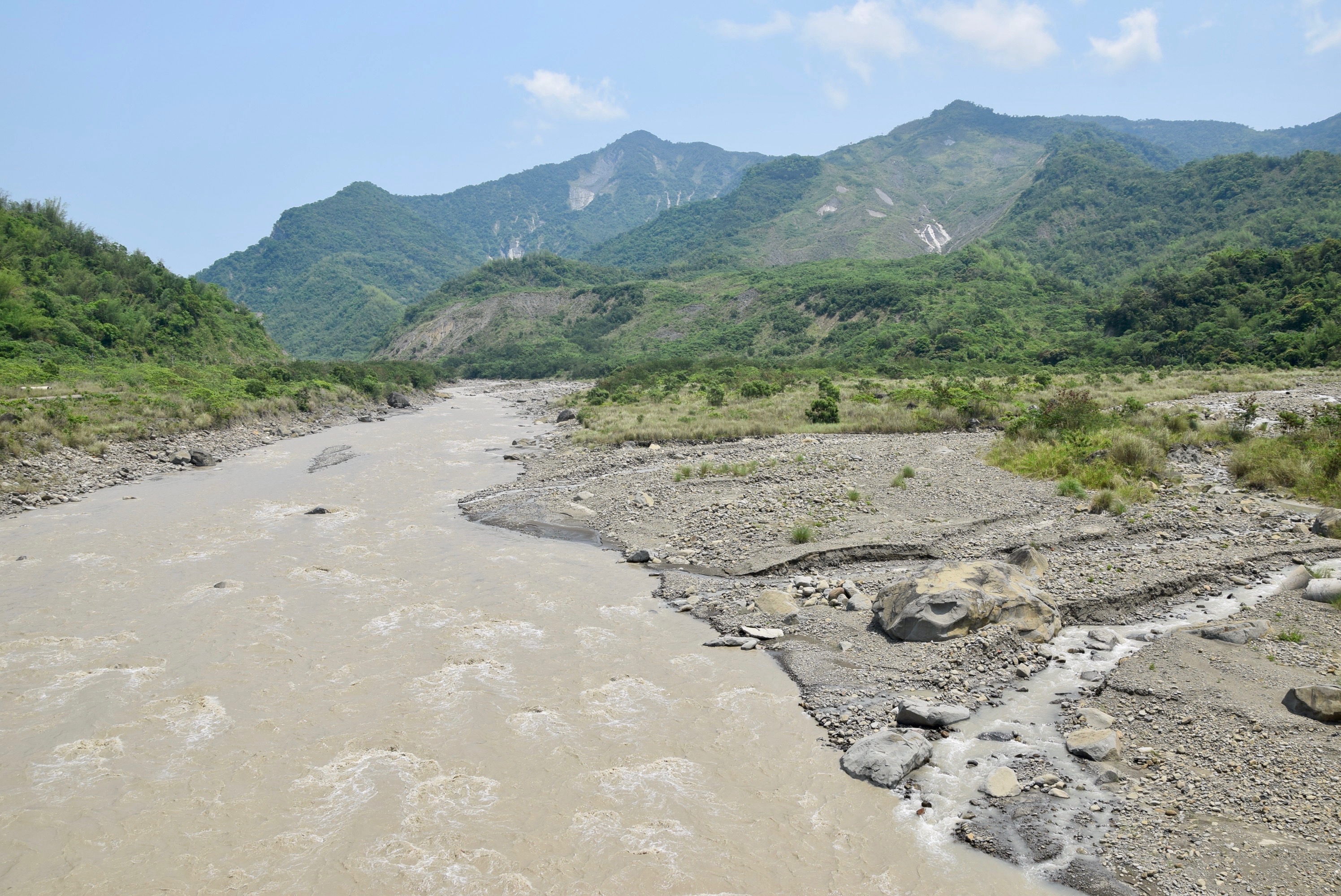
From the Air
The former site of Siaolin Village is located at 23.163N, 120.644E in Jiasian District, Kaohsiung. The landslide scar on Xiandu Mountain and the altered course of the Qishan River are visible from the air as dramatic changes in terrain coloring and river morphology. The area is mountainous, flanked by the Alishan Range to the west and the Yushan Range to the east. Nearest airports include Kaohsiung International Airport (RCKH) approximately 50 km to the southwest. The terrain is extremely rugged with peaks exceeding 1,400 meters. Exercise caution in this area due to mountain weather and terrain.