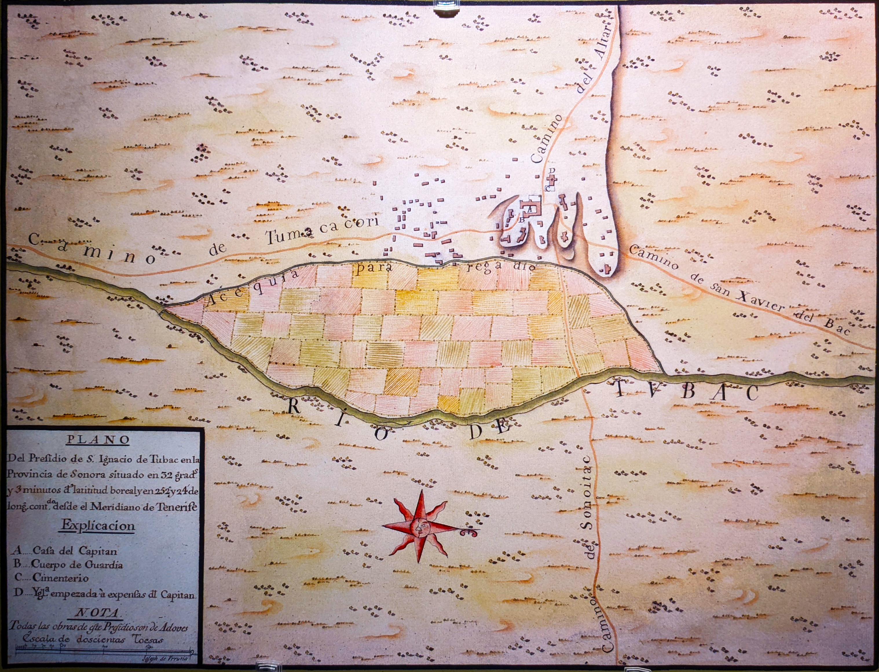
Siege of Tubac
The exact date has been lost to time, but the story remains vivid: August 1861, a town squeezed between two hostile forces, and a choice between surrender and a midnight run through Apache lines. Tubac's siege was not a famous Civil War battle or a celebrated last stand. It was the messy, desperate conclusion to a settlement that should never have survived as long as it did, a Spanish presidio turned American town caught between the Apache Wars and the chaos of secession. When the dust settled, Tubac was gone, burned to the ground, its residents scattered across the desert.
Trapped Between Enemies
More than two hundred Chiricahua Apache warriors descended on Tubac sometime in early August 1861. They took up positions on one side of the old Spanish presidio, which had stood since 1752 as one of the northernmost outposts of New Spain. But the Apache were not the only threat. Mexican bandits, seizing opportunity in the chaos, occupied the other side of town. They avoided the main fighting, content to wait and plunder whatever remained. The townspeople found themselves compressed into a shrinking island of safety, desperately hoping for rescue. For three days, gunfire echoed off adobe walls as Tubac's residents held their ground.
Reinforcements Under a Rebel Flag
A dispatch rider slipped through Apache lines and rode hard for Tucson, fifty miles to the north. The plea reached Captain Granville Henderson Oury, who assembled a force of twenty-five militiamen. They marched south carrying a Confederate flag, for Arizona had declared allegiance to the Confederacy just weeks before. Oury's men fought their way into Tubac and helped repel the final Apache assault. But victory was temporary. The warriors withdrew to a distance but refused to leave entirely, establishing a loose siege that prevented any escape. Food ran low. Ammunition dwindled. The situation had merely evolved from desperate to untenable.
The Midnight Escape
There would be no heroic defense, no reinforcements from distant forts. The garrison, along with the town's women and children, made the only rational choice: they would run. Under cover of darkness, the combined force of settlers and militiamen slipped out of Tubac. Apache scouts spotted them, and one final skirmish erupted in the desert night. But the Arizonans broke through. Behind them, flames rose as Apache warriors burned what remained of the presidio. Mexican bandits picked through the ashes for anything worth carrying away. After more than a century of continuous occupation, Tubac ceased to exist.
The Long Road East
The refugees reached Tucson around August 15, 1861, but found no safety there. The entire region was collapsing into violence. The Tubacans joined a larger exodus heading east toward the Rio Grande and the town of Mesilla, in Confederate-held New Mexico Territory. The journey would prove nearly as dangerous as the siege itself. Apache warriors attacked the convoy at Cookes Canyon, and again at the Florida Mountains. Among those who survived the crossing was Charles Debrille Poston, a Republican who would later meet with President Abraham Lincoln to advocate for Arizona becoming its own territory, separate from New Mexico.
Ghost Town to Artists' Colony
After the Civil War, U.S. troops briefly returned to Tubac, but found nothing worth protecting. The town remained abandoned through the 1880s. Rebuilding began slowly, and by 1908 a small community of fewer than two hundred people had returned. Today approximately one thousand residents call Tubac home, many of them artists and gallery owners drawn to the historic presidio grounds and the stark beauty of the Santa Cruz Valley. The siege is commemorated in local history, a reminder that survival on this frontier was never guaranteed, and that some stories end not with victory but with a desperate run through enemy lines.
From the Air
Located at 31.63°N, 111.05°W in the Santa Cruz River valley, approximately 45 miles south of Tucson. The historic presidio site is visible as a small developed area along Interstate 19. Tubac sits 3 miles north of Tumacacori National Historical Park, making both sites viewable on a single north-south pass. Nearest major airport is Tucson International Airport (KTUS), 45nm north. The Rio Rico-Nogales area to the south and the Santa Rita Mountains to the east provide visual references.