Siegelsum
In a 1450 land contract, somebody wrote down the place name Sygildsum and signed off on the sale. Twenty-five years later a priest signed a deed addressed to Sigelsum. By 1478 a notary recorded Sygheldsum. Around 1500 the income register of the local parishes called it Sigelzum or sometimes Sergum, depending on who was holding the pen. On the East Frisian maps that David Fabricius drew in 1589 and 1613, the village had settled into Sigelsum. An engineer's map of 1674 wrote it Sygelsumb. By 1735 the Aurich district administrator was using Siegelßum, and that spelling - minus the eszett - eventually stuck. The place has barely moved in five hundred years; only its name has migrated.
Sygheld's Home
Underneath all those variant spellings, linguists agree, lies a single grammatical shape. The ending -um derives from Old Frisian hem, meaning home, and it almost always combines with a personal name. Sygheld, Segheld, or some similar form belonged to whoever first claimed dry ground here and built a farmstead worth identifying. His name became the place. There is no record of Sygheld himself - no chronicle entry, no tomb, no genealogy - only the toponym that outlasted him by perhaps a thousand years. The folk etymology that ties the name to a sluice (Siel in German) or to brickworks, both of which the village did have, is wrong; it is the kind of plausible mistake that vernacular speakers reach for when the original meaning has gone dark.
On the Edge of the Brookmerland
Siegelsum sits south of the larger town of Marienhafe in the East Frisian Brookmerland, a region whose name itself encodes its character: the Land of Marshes. The village is an Ortsteil - a constituent district - of the municipality of Upgant-Schott, which belongs in turn to the Samtgemeinde of Brookmerland. None of this would have meant anything to medieval Sygheld; the layered German administrative geography is a modern overlay on what was, for most of its history, simply a cluster of farms on a slightly raised patch of land. Today the village is one of those places you can drive through without noticing - low brick houses, a few barns, the flat horizon broken only by the spire of a church somewhere over the fields.
Map by Map, the Place Comes Into Focus
The cartographic record of Siegelsum is unusually rich for such a small settlement. David Fabricius - the astronomer-pastor murdered in 1617 - drew it onto two East Frisian maps in 1589 and 1613, before his death cut short a longer programme of regional surveying. Ubbo Emmius, founder of the University of Groningen, included it on the oldest comprehensive map of East Frisia, published in 1595. In 1674 the engineer Johann von Honaert mapped it again as part of a Hanoverian survey. Each map records the name slightly differently, but each places the dot in roughly the same patch of marsh. The settlement was small enough to be missed, important enough to be marked.
Independence Lost in a Single Day
For most of its documented history, Siegelsum was its own municipality - tiny, autonomous, accountable for its own taxes and its own pastor. The early 1970s reorganisation of German local government, designed to merge small communities into more efficient administrative blocks, swept away that independence almost overnight. On 1 July 1972 Siegelsum was incorporated into Upgant-Schott. The village kept its name on the road signs, kept its houses and its cemetery, but its standing as a self-governing entity ended with the stroke of a pen. The same reform consolidated thousands of small Lower Saxon villages in the same week, drawing the modern administrative map in a single coordinated push.
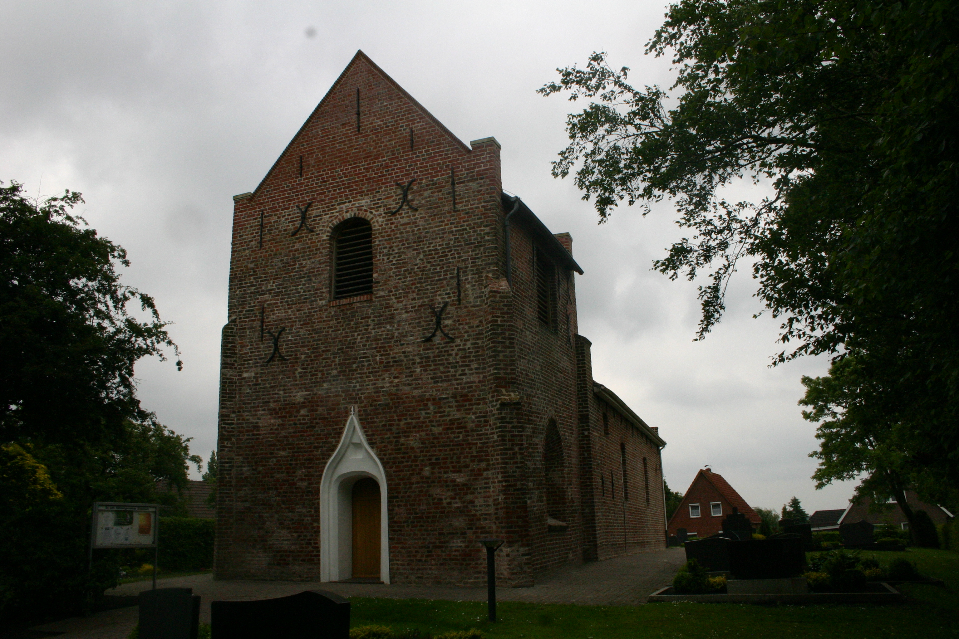
What's Left When the Sources Run Out
Siegelsum has no famous sons or daughters in any standard reference. It has no significant battle, no industry, no architectural landmark beyond the small village church. Its Wikipedia entry consists almost entirely of name variants and administrative changes, which is itself a kind of biography - the biography of a place that has simply persisted, generation after generation, through the long slow accumulation of farming, marrying, dying, and being buried in the same dozen square kilometres of marsh. Sygheld would probably recognise the contours of the fields if you sent him back. The names of his neighbours, however, would have changed beyond recognition - except, perhaps, for his own.
From the Air
Siegelsum lies at 53.50°N, 7.29°E in the East Frisian Brookmerland, about 9 nm south-southeast of Norden and 2 nm south of Marienhafe. From 1,500-2,500 feet look for the small cluster of village buildings and church spire amid the geometric drainage pattern. Nearest airfields: Norden-Norddeich (EDWS) about 10 nm north, Emden (EDWE) about 14 nm southwest. Frequent low cloud near the coast; visibility generally better inland.