Sierra Vista Open Space Preserve
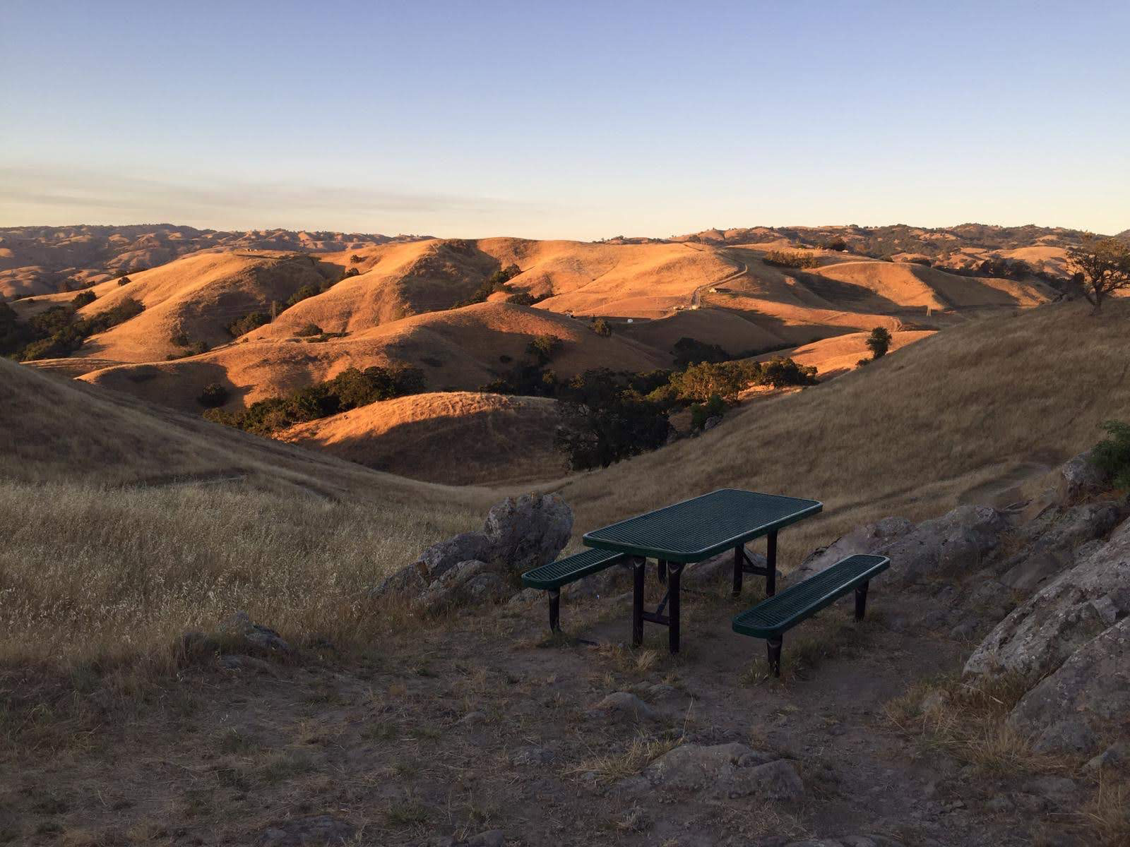
From the ridgeline, you can see the entire story of California laid out in a single glance. To the west, the office parks and freeway interchanges of Silicon Valley stretch toward the bay. To the east, oak-studded hills roll away into the Diablo Range without a rooftop in sight. Sierra Vista Open Space Preserve occupies the seam between these two worlds, 1,678 acres of grassland, chaparral, and woodland perched in the eastern foothills of Santa Clara County where the land still belongs to golden eagles and mountain lions.
The Ridge Above the Valley
For decades, the only way into Sierra Vista was through Alum Rock Park, San Jose's oldest municipal park, via a steep trail that kept casual visitors away. The preserve existed in a kind of quiet isolation, managed by the Santa Clara Valley Open Space Authority but accessible mainly to determined hikers willing to earn the climb. That changed in 2014, when a new trailhead and parking lot opened along Sierra Road, suddenly putting one of the most dramatic viewpoints in the South Bay within reach of anyone with a pair of walking shoes. The East Bay Times called the newly accessible vistas of Silicon Valley "stunning" -- and they were not exaggerating. On a clear day, the panorama extends from the salt ponds at the bay's southern tip to the Santa Cruz Mountains on the far horizon.
Walking the Fault Line
The 4.5-mile Calaveras Fault Trail does exactly what its name suggests: it follows the trace of the Calaveras Fault, one of the major active faults in the San Francisco Bay Area's complex seismic web. Hikers walk directly above a fracture in the earth's crust that last produced a significant earthquake in 2007. The trail descends from the Sierra Road entrance gate into the Penitencia Creek drainage, dropping through grasslands into the shade of valley oaks. The 2-mile Sierra Vista Trail connects the western and eastern sections of the preserve and forms a segment of the Bay Area Ridge Trail, the ambitious 550-mile loop that will eventually encircle San Francisco Bay along the surrounding ridgelines.
A Refuge for the Rare
The preserve's ecological value extends well beyond scenery. Penitencia Creek and its tributaries provide critical habitat for the California red-legged frog, the species that inspired Mark Twain's famous jumping frog story and is now federally listed as threatened. The California tiger salamander, another threatened species, breeds in the seasonal pools that form in the grasslands each winter. Golden eagles patrol the ridgeline thermals. Bobcats and grey foxes hunt through the oak woodlands at dawn and dusk, while mountain lions -- Silicon Valley's most improbable neighbors -- move through the preserve on corridors that connect the Diablo Range to the broader landscape. The watershed protection the preserve provides for Penitencia Creek benefits not just wildlife but the downstream communities that depend on clean water.
Silicon Valley's Wild Edge
What makes Sierra Vista remarkable is not just its wildlife or its trails but its proximity to one of the most intensively developed landscapes in America. The preserve sits barely five miles from downtown San Jose, the tenth-largest city in the United States. Engineers who spend their days in fluorescent-lit offices can be standing among golden eagles and coyote brush within a thirty-minute drive. The Open Space Authority acquired the land in pieces over many years, assembling the preserve parcel by parcel as development pressure pushed deeper into the foothills. Opening Sierra Vista to the public in 2002 was an act of deliberate counterbalance -- a declaration that even in a valley synonymous with technological progress, some ground would remain unbuilt, some creeks would run unculverted, and some ridgelines would stay wild.
From the Air
Located at 37.41N, 121.80W in the eastern foothills of San Jose, California. The preserve's grassland ridgelines and oak woodlands contrast visibly with the developed valley floor to the west. Best viewed at 2,000-3,000 feet AGL where the transition from urban to wild is most dramatic. Nearby airports: Reid-Hillview (KRHV, 3nm W), San Jose International (KSJC, 8nm NW). Alum Rock Park borders the preserve to the west; the Diablo Range extends east.