Sinhagad
They scaled the cliff in the dead of night using a tamed monitor lizard named Yashwanti. The year was 1670, the commander was Tanaji Malusare, and the fortress he was climbing to recapture had already passed between empires more times than anyone could easily count. When word of the victory reached Shivaji, the Maratha king did not celebrate. His general was dead. "Gad ala, pan Sinha gela," he reportedly said -- "The fort is conquered, but the Lion is lost." The fortress was renamed Sinhagad, the Lion's Fort, and the story became inseparable from the stone.
A Cliff That Invites Conquest
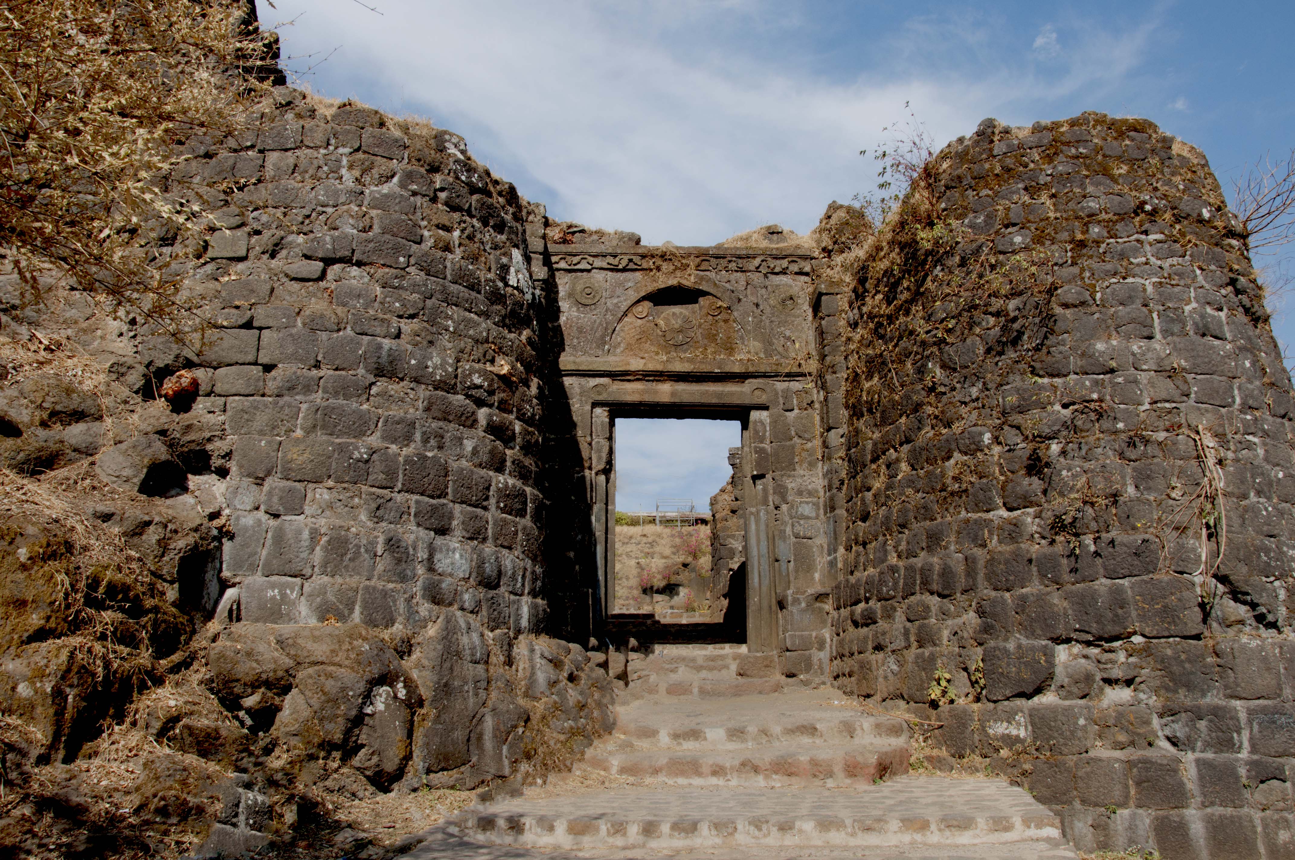
Perched on an isolated cliff of the Bhuleswar range in the Sahyadri Mountains, Sinhagad sits about 760 meters above the surrounding ground and 1,317 meters above sea level. The location, roughly 28 kilometers southwest of Pune, was chosen for an obvious reason: the slopes are so steep that the fort is its own first line of defense. Two entry gates -- Pune Darwaja to the northeast and Kalyan Darwaja to the southeast -- control access to the summit. On clear days, the view from the top reveals the outlines of Rajgad, Purandar, and Torna forts, fellow sentinels of the Maratha empire scattered across the surrounding ridgelines. Below, Khadakwasla Dam glimmers in the distance.
Centuries of Changing Flags
Originally called Kondhana, after the sage Kaundinya, the fort was held by the Koli chieftain Nag Naik until 1328, when forces of Muhammad bin Tughluq captured it after an eight-month siege. What followed was a relay of power: Delhi Sultanate, Bahmani Sultanate, Ahmadnagar Sultanate, Sultanate of Bijapur. Shivaji first gained control in 1647 through persuasion rather than force, convincing the Adilshahi commander Siddi Amber that the young prince could manage its defenses. When the Bijapur sultan retaliated by imprisoning Shivaji's father Shahaji, the fort was traded for his release in 1649. Shivaji recaptured it again in 1656, lost it to the Mughals through the Treaty of Purandar in 1665, and took it back a third time through Tanaji's legendary night assault in 1670. The Mughals regained it after Sambhaji's death, the Marathas retook it in 1693, lost it to Aurangzeb in 1703, and recovered it again in 1706.
The Night Raid That Named a Fort
Tanaji Malusare was a Koli Subedar in Shivaji's army, and the task he accepted was nearly suicidal. The cliff face was vertical. According to tradition, his men used a tamed Bengal monitor lizard -- called a ghorpad in Marathi -- to carry a rope to the top, its claws gripping the rock where human hands could not. Tanaji and his men scaled the wall under cover of darkness and engaged the garrison commanded by Udaybhan Singh Rathod, a Rajput sardar loyal to the Mughals. The fighting was fierce and close. Tanaji was killed, but his brother Suryaji rallied the troops and took the fort. Shivaji's grief at losing his general became the fort's new identity. A memorial to Tanaji was established on the summit; in February 2019, restoration workers unearthed the original commemorative stone, buried under layers of cement, concrete, and oil paint, believed to be around 350 years old.
From Battleground to Retreat
The Marathas held Sinhagad from 1706 until 1817, using it alternately as a refuge from enemies threatening Pune and as a prison for political rebels. Rajaram I, the third Maratha Chhatrapati, took asylum here during a Mughal raid on Satara and died at the fort on 3 March 1700. During the Third Anglo-Maratha War (1817–1818), the East India Company's General Pritzler laid siege on orders from Mountstuart Elphinstone, and on 2 March 1818 the fort surrendered and passed into British hands until Indian independence in 1947. In the modern era, Sinhagad found a different kind of fame. Bal Gangadhar Tilak, the freedom fighter known as the Father of Indian Unrest, used the fort as a summer retreat -- and it was here that Mahatma Gandhi met with Tilak after returning from South Africa. Today, a television relay tower planted in 1973 shares the summit with ancient walls, and the fort draws hikers from Pune on a 2.7-kilometer trail that gains 600 meters of elevation.
From the Air
Located at 18.37N, 73.76E, about 28 km southwest of Pune. The fort is perched on a prominent cliff of the Bhuleswar range at 1,317 m above sea level and is highly visible from the air. A TV relay tower on the summit aids identification. Recommended viewing altitude: 4,000-6,000 ft AGL. Nearest airport: Pune Airport (VAPO). Khadakwasla Dam is visible to the northeast, and the forts of Rajgad, Torna, and Purandar are visible on surrounding ridgelines.