Sittwe
The name translates roughly as 'the place where the war meets,' and Sittwe has spent centuries living up to it. In 1784, when Burmese king Bodawpaya sent an army of 30,000 to crush the Arakanese kingdom of Mrauk U, the defenders made their stand here, at the mouth of the Kaladan River, fighting on both land and water before being overwhelmed. The Rakhine called the battlefield Saittwe. The Burmese shortened it to Sittwe. The wars have kept coming ever since -- British, Japanese, junta, insurgent -- and the city at the confluence of the Kaladan, Mayu, and Lay Mro rivers has absorbed them all, its population swelling and shrinking with each tide of conflict.
Relics and Rice
Before the battles, there were stupas. Four of them crown the ridge above what was once a small fishing village: Akyattaw, Thingyittawdhat, Letyatalundaw, and Letwetalundaw, each claiming to encase a relic of the Buddha -- a piece of jawbone, a thighbone, shinbones left and right. The British, who stormed the settlement under General Morrison in 1825 during the First Anglo-Burmese War, found them crumbling. Morrison and his men were soon felled not by defenders but by malaria and cholera, and the garrison was temporarily abandoned. Yet the port was chosen as Arakan's seat of government the following year, largely because the former capital of Mrauk U was considered even less healthy. Renamed Akyab after the hill's most prominent pagoda, the town grew into a major rice-exporting hub. By the 1860s, even the United States maintained a consular agency here, operating under the Consulate General in Kolkata.
Monks Who Changed History
Sittwe has a particular claim on Myanmar's tradition of political Buddhism. U Ottama, the monk who first organized religious protest against British colonial rule, was born here and practiced at the century-old Shwezedi Monastery, which still stands near the waterfront. When the 2007 Saffron Revolution erupted against the military government, it was monks in Sittwe who led the earliest marches -- a direct echo of Ottama's legacy, separated by nearly a century but animated by the same conviction that spiritual authority carried political weight. At the end of the Strand Road, the Viewpoint -- known simply as 'Point' -- looks out over the Bay of Bengal and the Kaladan's mouth. It remains the city's most beloved landmark, a place where residents gather at sunset regardless of whatever crisis is unfolding behind them.
A City Under Siege
Since 2012, the Myanmar government has confined tens of thousands of Rohingya people in camps at Sittwe. Some 140,000 Rohingya live in makeshift shelters with limited electricity, restricted food supplies, and no freedom to move or work beyond the camp perimeter. The beach at Ohn Daw Gyi became a departure point for desperate boat journeys across the Bay of Bengal. Then the broader conflict arrived. In early 2024, the Arakan Army -- an ethnic Rakhine armed group that had seized most of Rakhine State during the ongoing Myanmar Civil War -- encircled the capital. Sittwe became one of the last holdouts of the ruling military junta in the region, its airport the only remaining escape route. A city whose name commemorates an ancient battle found itself, once again, at the intersection of war.
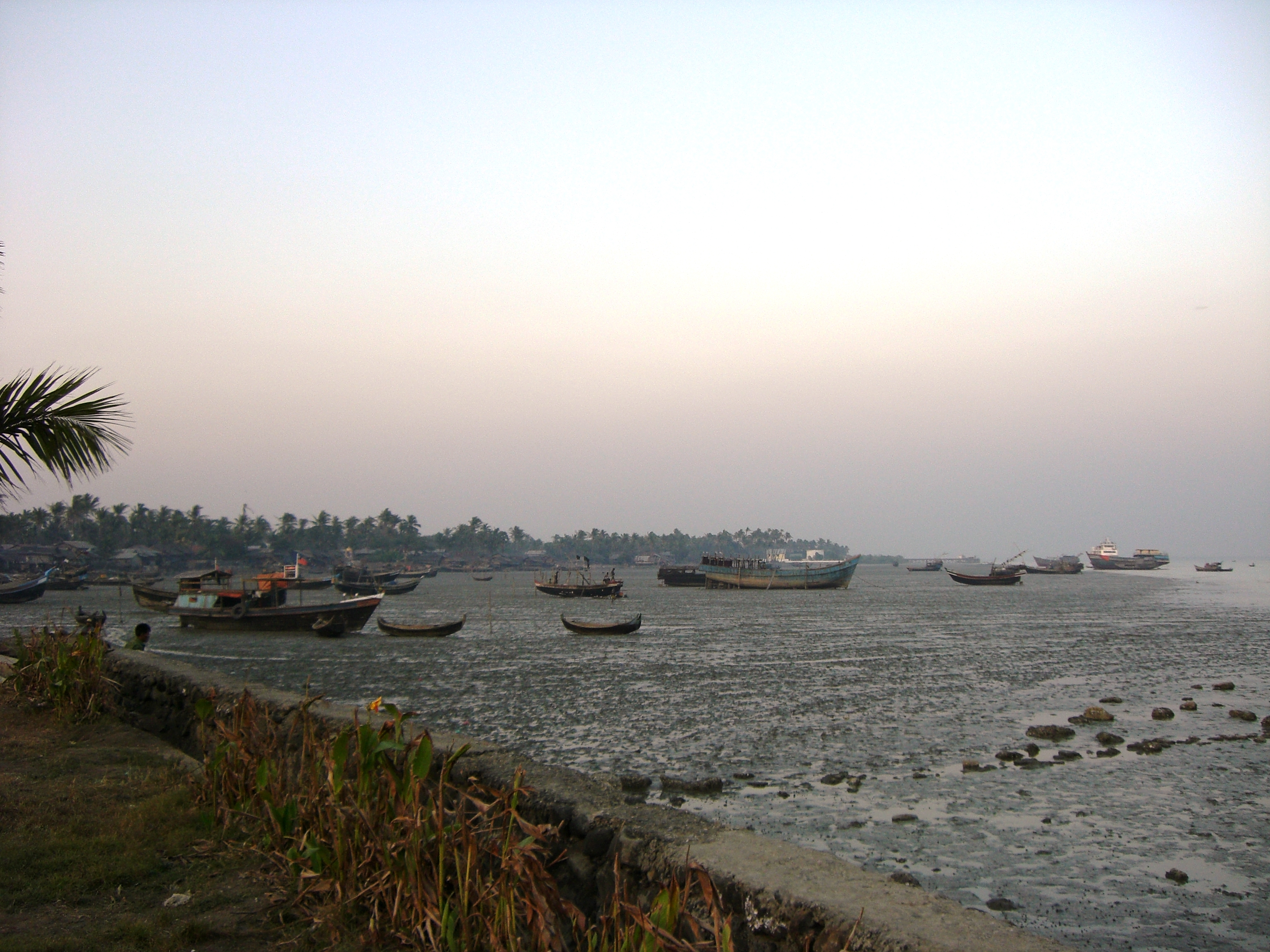
Where Three Rivers Meet the Sea
Sittwe's geography is its destiny. The city occupies an estuarial island formed where the Kaladan, Mayu, and Lay Mro rivers converge before emptying into the Bay of Bengal -- a natural harbor that attracted conquerors, colonizers, and, eventually, international development money. India announced the Kaladan Multi-Modal Transit Transport Project in 2007, a $120 million effort to link India's landlocked northeastern states to the ocean via Sittwe's port and the Kaladan River corridor into Mizoram. The project promised dredging, new berthing terminals, and a direct shipping connection to Kolkata. The tropical monsoon climate dumps more than a meter of rain per month during the June-to-August wet season, transforming the landscape into a labyrinth of swollen waterways. In the cooler dry months, from December through February, the humidity lifts and the light over the bay sharpens. Sittwe's population -- estimated at over 120,000 as of 2019 -- is predominantly Rakhine, alongside Rohingya Muslims and Burmese from other regions, a demographic layering as complex and contested as the city's history.
From the Air
Located at 20.14N, 92.90E on the western coast of Myanmar at the mouth of the Kaladan River, where it meets the Bay of Bengal. From altitude, Sittwe is identifiable as the largest urban area at the tip of a peninsula surrounded by river channels and tidal flats. The city's estuarial island setting is distinctive. Sittwe Airport (VYSW) is immediately adjacent to the city. Nearby military airfields served during WWII. The Dhanyawadi Naval Base is visible along the coast. The flat, low-lying terrain contrasts with the Chin Hills rising to the east. Best viewed at moderate altitude where the river confluence pattern is clear.