Slope Point
The trees give it away before the signpost does. Approaching Slope Point on foot across open farmland, you notice the macrocarpa groves leaning hard to the north, their trunks and branches bent at violent angles as if recoiling from something behind them. They are. Antarctic winds travel over 3,200 kilometres of unbroken ocean before hitting this headland, the southernmost point of New Zealand's South Island, and they arrive with a force that has permanently reshaped every tree that tried to grow here. Farmers planted these groves to shelter their sheep. The wind turned them into sculptures.
The End of the Land
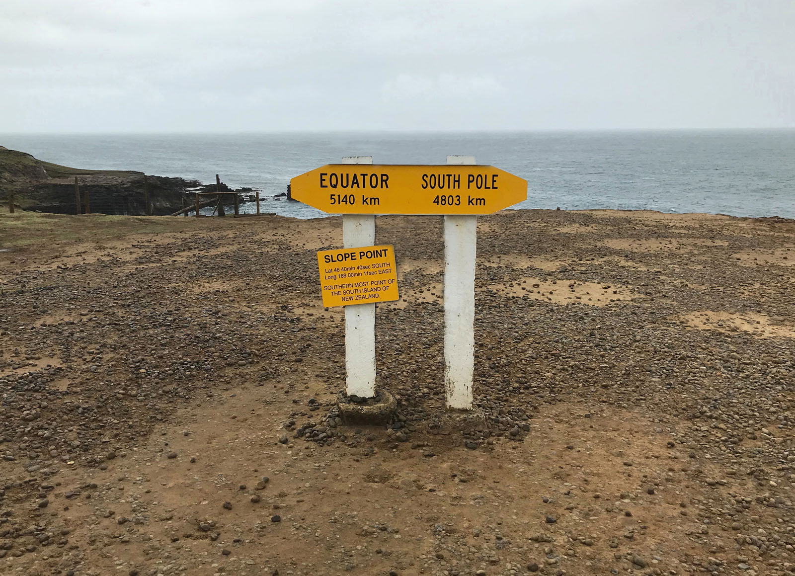
Slope Point sits at approximately 46.67°S, 169.00°E, on the southwestern edge of the Catlins near Toetoes Bay, 24 kilometres south of the small settlement of Waikawa and 70 kilometres east of Invercargill. There is no road to it. A 20-minute walk across sheep paddocks, following a line of dilapidated yellow markers, leads to eroded cliffs that drop away to the sea. No houses stand anywhere nearby. The land is given over entirely to sheep farming, and the landscape has the stripped, essential quality of a place where human presence is tolerated but not encouraged. At the cliff edge, a signpost erected by the New Zealand Automobile Association states the distances to the equator and the South Pole. The point lies roughly equidistant between the two, a geographic fact that registers differently when you are standing in the wind that connects them. A small solar-powered lighthouse operates on the farmland, its beam a concession to the shipping lanes that pass through the Foveaux Strait to the west.
Shaped by the Roaring Forties
The wind at Slope Point is not occasional weather. It is the defining characteristic of the place. The prevailing westerlies and southerlies that rake across this latitude, part of the band of fierce winds known as the Roaring Forties, arrive without the interruption of any landmass between here and Antarctica. The result is visible in every living thing that grows above ground level. The wind-bent trees have become Slope Point's most photographed feature, their canopies swept uniformly northward as though combed by an invisible hand. Some lean at angles so extreme they appear to be falling. They are not. They grew this way, each year's new growth pushed sideways by the relentless gales until the entire tree followed the path of least resistance. The grass, too, lies flat much of the time, rippling in waves that move across the paddocks like water. On a calm day, which is rare, the silence feels almost unnatural, as though the landscape is holding its breath between gusts.
A Farmer's Boundary
For all its geographic significance, Slope Point is working farmland. The headland belongs to a sheep station, and access is closed during lambing season from September through November. The yellow markers that guide walkers across the paddock are a courtesy, not a formal trail, and the experience of reaching the point is less a tourist destination than a pilgrimage to a boundary. There are no facilities, no gift shop, no interpretive panels beyond the AA signpost. You walk out, stand at the edge, register that you are farther south than any other point on this island, and walk back. The nearby locality of Haldane, named after the European family who settled here, is scarcely larger than a crossroads. The Catlins coast stretches to the northeast, a succession of bays, headlands, and native bush that remains one of the least developed coastlines in New Zealand. Slope Point is where that wildness reaches its geographic extreme, the place where the South Island finally runs out of land and gives way to the Southern Ocean and, beyond it, the ice.
From the Air
Located at 46.68°S, 169.00°E, the southernmost point of the South Island. The headland is visible from the air as a promontory extending south from the Catlins coastline, with eroded cliffs dropping to the sea. The wind-bent tree groves are distinctive from low altitude (1,000-3,000 feet), appearing as asymmetric dark patches on otherwise open sheep pasture. Toetoes Bay lies to the west, and the Catlins coast stretches northeast. The nearest airport is Invercargill (NZNV), approximately 70 km to the west. The Foveaux Strait separates the South Island from Stewart Island to the south. Expect strong winds at low altitude, particularly from the south and west.