Snohomish County Centennial Trail
The rails are gone, but the path they cut through Snohomish County remains. In 1889, the Seattle, Lake Shore and Eastern Railway pushed a line northward from Seattle toward Canada, carrying timber, metal, mail, and tourists bound for the mining town of Monte Cristo and the ice caves at Big Four Inn. A century later, after the tracks had been abandoned and the railway swallowed by Northern Pacific and then Burlington Northern, the county turned that right-of-way into something new. The Snohomish County Centennial Trail opened its first segment in 1989 -- the centennial of Washington statehood -- and by 2013 stretched 30 miles from the city of Snohomish to the Skagit County line, a ribbon of asphalt and packed gravel following the old railbed through some of the most quietly beautiful landscape in the Puget Sound lowlands.
From Iron Rails to Running Shoes
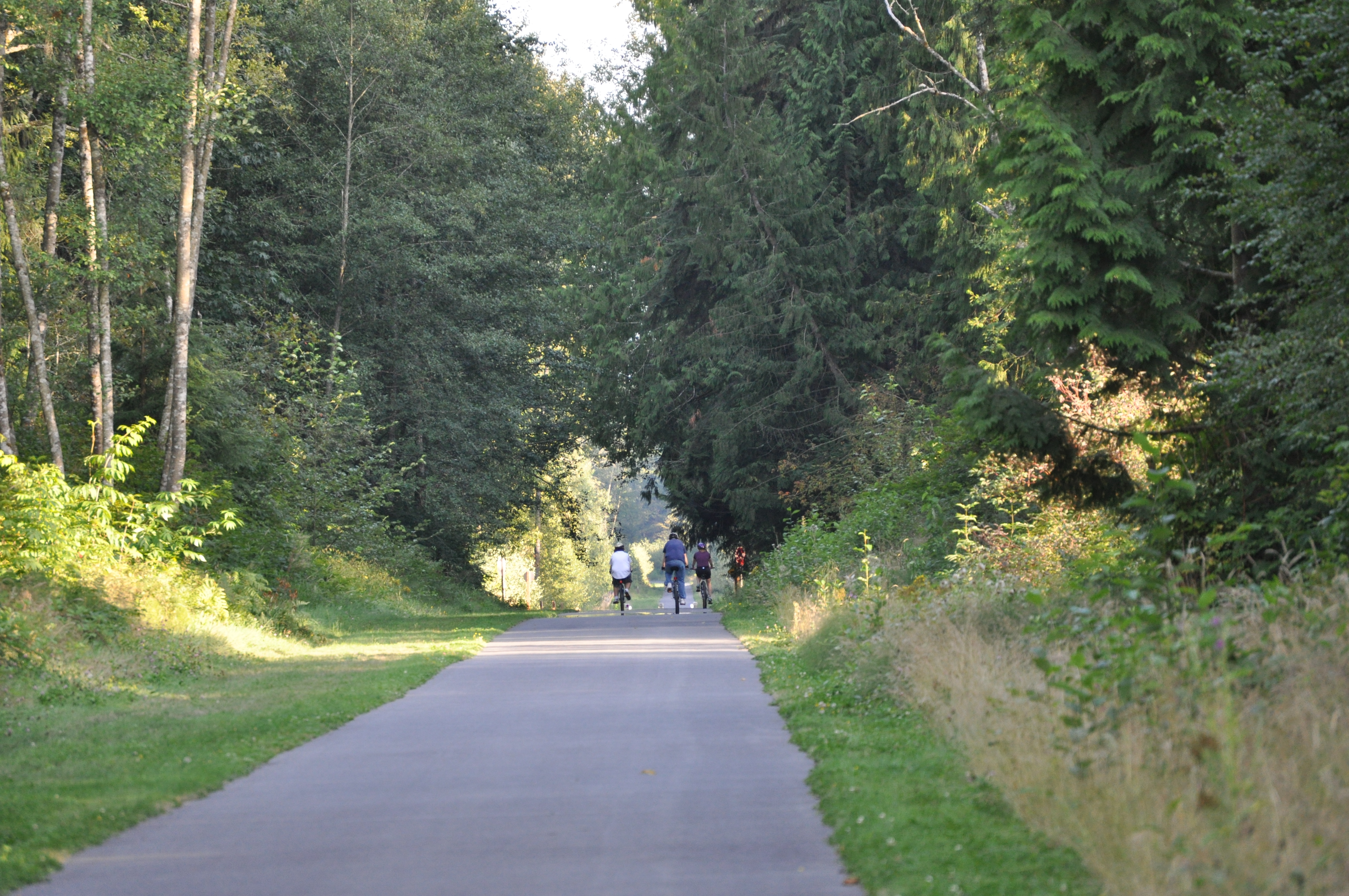
The Sumas Branch of the Seattle, Lake Shore and Eastern Railway was built in 1889, the same year Washington became a state. The line linked Seattle with Canada and connected eastward toward Stevens Pass, serving a young region hungry for transportation. Timber and lumber were its bread and butter, but the railway also carried tourists to the Stillaguamish River and the mountain scenery beyond. After decades of service under successive owners -- Northern Pacific, then Burlington Northern -- the line was abandoned in stages: the Lake Stevens to Arlington section in 1972, the Snohomish to Lake Stevens section in 1987. Two years later, Snohomish County began converting the abandoned corridor into a multi-use trail. The 10-foot-wide paved path for walkers, runners, and cyclists runs alongside a 6-foot equestrian trail, preserving the railroad's linear logic through a landscape that has changed around it.
Threading the Lowlands
The trail begins where the Snohomish River Trail ends, at Maple Avenue and Pine Street in the city of Snohomish, and heads northeast along the Pilchuck River. It passes through Machias, curves northwest past Lake Stevens, and skirts the wetlands of Lake Cassidy, where the Rhododendron trailhead takes its name from the state flower. Beyond Lake Cassidy, the route enters the Quilceda Creek watershed and approaches Arlington from the south, passing through downtown before crossing the Stillaguamish River on a former railroad trestle. The final stretch runs north through Bryant to the Skagit County line near Lake McMurray. From above, the trail reads as a thin, straight line cutting through a patchwork of farmland, forest, and suburban development -- the unmistakable signature of a rail corridor repurposed.
The Nakashima Barn
Near the trail's northern end stands the Nakashima Heritage Barn, home to a public art installation called "History Quilt." Created by artists Ellen Southard and Teresa Stern, the piece depicts the site's transformation from native forest to sawmill to dairy farm to recreational trail. But the quilt carries a harder story, too. The Nakashima family, who built the barn and farmed the land, were Japanese Americans forced to sell their property at a fraction of its value during World War II internment. They lost their farm not to market forces or bad luck, but to government policy that stripped an entire community of its property and freedom. The artwork does not flinch from this history. It celebrates what the Nakashimas built while making visible what was taken from them -- a memorial woven into the fabric of a place most visitors experience as a pleasant afternoon walk.
A Trail Still Growing
The Centennial Trail's ambitions extend well beyond its current 30 miles. A future phase could connect it to the Sammamish River Trail and the Burke-Gilman Trail, creating a continuous path from Seattle's urban core deep into rural Snohomish County. In 2016, Snohomish County purchased the northern portion of the Eastside Rail Corridor -- a rail line running from the Woodinville-Maltby border to the city of Snohomish -- from the Port of Seattle for $3.5 million, funded through the county's Conservation Futures Program. The vision is to stitch together abandoned rail corridors into a regional network, the way the original railways once stitched together the communities they served. It is an elegant reversal: the infrastructure that connected these towns by rail now connects them by trail.
From the Air
Located at approximately 47.92N, 122.09W. The trail runs 30 miles from Snohomish northwest to the Skagit County line, roughly paralleling State Route 9. Its linear rail corridor alignment is visible from altitude as a thin line through farmland and suburban development. The old railroad trestle crossing of the Stillaguamish River near Arlington is a notable landmark. Paine Field (KPAE) is approximately 8 miles to the west. Arlington Municipal Airport (KAWO) is adjacent to the trail's northern segments. Best viewed at 4,000-6,000 feet to trace the full corridor.