Soconusco
The Aztecs called it Xoconochco -- "place of sour cactus" -- three Nahuatl words pressed together and recorded in the Mendoza Codex. The Maya knew it as Zaklohpakab. Both names point to the same narrow corridor of volcanic soil and heavy rainfall wedged between the Sierra Madre de Chiapas and the Pacific Ocean, in the far southwest corner of Chiapas state along the Guatemalan border. Soconusco has always been defined by what its ground can grow. Cacao cultivation here stretches back thousands of years, fueling the rise of the Mokaya people and contributing to what became the Olmec civilization. Empires fought over this strip of earth not for its strategic position but for its harvests -- and that pattern has repeated, in different languages, ever since.
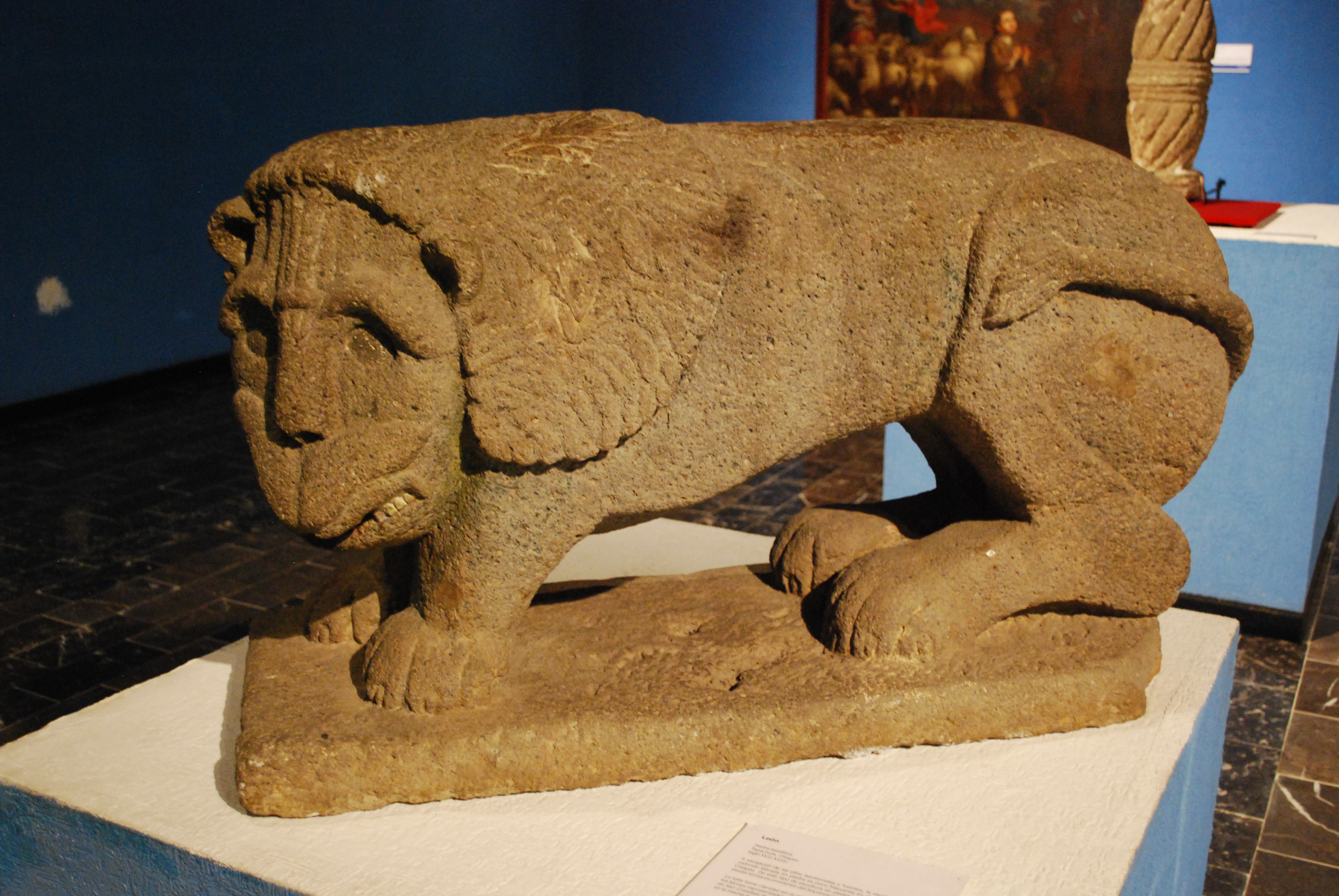
Where Civilizations Took Root
The archaeological site of Izapa, dating to about 1500 BC, sits on this coastal plain and is considered one of the most important in all of Chiapas. Classified as Mixe-Zoque, Izapa served as a civil and religious center for roughly a thousand years, and its steles and sculpted stonework have provided scholars with critical evidence linking the older Olmec civilization to the later Maya. It is at Izapa that the Mesoamerican ceremonial 260-day calendar is thought to have been developed -- a counting system that would organize ritual life across cultures for centuries. Before the Aztec conquest, Soconusco was divided among competing city-states centered at places like Mapastepec, Huixtla, and Mazatan. In 1486, the Aztec emperor Ahuitzotl swept through, demanding tribute in cotton cloth, bird feathers, jaguar skins, and cacao. Rebellions flared repeatedly; Moctezuma Xocoyotzin dispatched troops to suppress them in 1502 and again in 1505.
Conquest and the Cost of Coffee
The first Spanish arrived in 1522. Chronicler Bernal Diaz del Castillo estimated a native population of about 15,000, though other accounts suggest as many as 75,000 people lived here in the 1520s. Pedro de Alvarado's forces rolled through in 1524 on their way into Central America, and what followed was a familiar devastation: disease and displacement erased much of the indigenous population over the next decades. Centuries later, a different kind of transformation arrived. In 1890, Mexican president Porfirio Diaz and German chancellor Otto von Bismarck struck a deal to exploit the region's agricultural potential. Four hundred and fifty German families settled near Tapachula, carving fincas out of the jungle and giving them names that recalled the homeland -- Hamburgo, Bremen, Lubeck, Prussia, Hanover. Between 1895 and 1900, these estates harvested 11.5 million kilograms of coffee. The labor that made this possible came largely from indigenous peoples recruited from other parts of Chiapas, often through coercion.
Volcano, Mangrove, Dark Sand
At Soconusco's southern tip, the Tacana Volcano rises to 4,100 meters along the Guatemala border, carrying every climate zone from tropical lowland to alpine cold within its slopes. Despite being active, the land around it is densely populated. Below, the Chiapas coast stretches more than 200 kilometers as an almost unbroken ribbon of beach, interrupted only by estuaries and lagoons where rivers drain from the Sierra Madre into the Pacific. The La Encrucijada Reserve protects vast expanses of mangroves that shelter ocelots, iguanas, alligators, and nesting sea turtles. At Playa San Benito, dark grey sand meets rough surf, and palapa restaurants line the shore serving the day's catch. Near the coast lies the Chantuto Archaeological Site, one of the earliest human settlements in the Chiapas region, marked by ancient mounds of discarded shells -- evidence that people were harvesting this coastline long before anyone thought to name it.
The Swiss Chiapas and a Southeast Asian Fruit
In the mountain town of Union Juarez, on the slopes of Tacana, wooden houses built in a style reminiscent of Switzerland earned the town its nickname: La Suiza Chiapaneca. Coffee plantations surround it, and the cooler climate draws hikers and mountain tourists. Nearby Tuxtla Chico preserves colonial-era architecture, including the Candelaria Church and a distinctive house known as the Casa del Portal de Madera. A field research station at Finca Rosario Izapa studies cacao and tropical fruits -- a direct continuation of the agriculture that has defined Soconusco for millennia. The region's economy still cycles through booms and busts tied to export crops: first cacao, then coffee, then tropical fruits and flowers. The most recent addition to the agricultural roster is rambutan, a spiny Southeast Asian fruit that has found a productive home in this volcanic soil, another chapter in Soconusco's long history of making foreign things grow.
From the Air
Located at 15.32N, 92.73W in the far southwest corner of Chiapas, Mexico, along the Guatemalan border. From altitude, the region appears as a narrow green strip between the Pacific coast and the Sierra Madre de Chiapas. The Tacana Volcano (4,100 m) is a prominent landmark at the southeastern end. Tapachula International Airport (MMTP) is the nearest major facility. The coastline features extensive mangrove lagoons visible as dark patches along the shore.