Somass River
The Nuu-chah-nulth people named it for what it does: Somass means 'washing.' Where the Stamp River flows out of Great Central Lake and the Sproat River descends from its namesake lake, the two merge and become the Somass -- a short, powerful waterway that carries the drainage of 1,412 square kilometers of Vancouver Island forest, mountain, and lake country southeast into Alberni Inlet and the harbour of Port Alberni.
Where Two Rivers Meet
The Somass begins at a confluence. The Stamp River brings water from Great Central Lake, itself fed by snowmelt and rainfall from the peaks of the interior. The Sproat River carries the outflow of Sproat Lake, a broad body of water west of Port Alberni that once served as the base for Martin Mars water bombers. When these two rivers join, the Somass inherits their combined force -- a drainage basin larger than many European city-states. The river flows generally southeast and south, crossing Highway 4 outside Port Alberni in Tseshaht First Nation territory. The crossing marks a transition: upstream, the river runs through forest and First Nations reserves; downstream, it enters the tidal zone where fresh water mingles with the Pacific.
The Tidal Reach
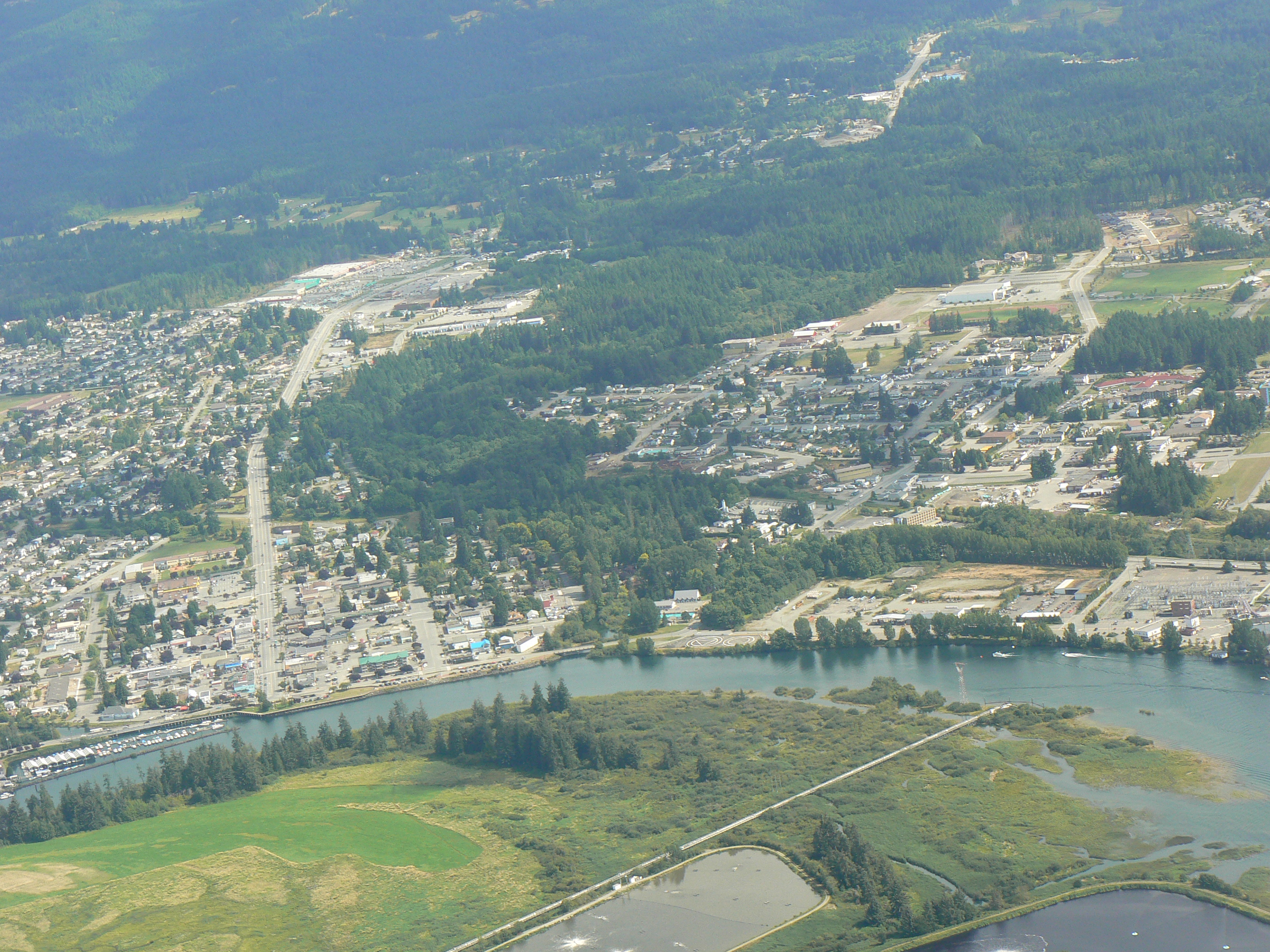
Several kilometers of the Somass's lower course are tidal, a characteristic that transforms the river twice daily. At high tide, saltwater pushes upstream, and the river swells to fill its banks. At low tide, mudflats and gravel bars emerge, and the Somass reveals its working infrastructure -- the Clutesi Haven Marina sits in the tidal zone, surrounded by boats that rise and fall with the inlet's rhythm. Black bears are known to appear on the exposed banks at low tide, foraging for fish in water that moments earlier was deep enough for boat traffic. The tidal reach connects the river to the broader marine ecosystem of Alberni Inlet and, beyond it, Barkley Sound and the open Pacific.
Lifeblood of the Valley
The Somass is the Alberni Valley's central artery, both ecologically and historically. All five species of Pacific salmon -- chinook, coho, sockeye, pink, and chum -- use the river system, migrating upstream through the Somass to spawn in the Stamp and Sproat Rivers and the lakes beyond. The annual salmon runs have sustained the Tseshaht and Hupacasath peoples for thousands of years and continue to define the valley's culture and economy. Port Alberni earned the World Fishing Network's 'Ultimate Fishing Town' designation in part because of what the Somass delivers. The Robertson Creek Hatchery on the Stamp River supplements natural runs, releasing chinook, coho, and steelhead smolts that eventually pass through the Somass on their way to the ocean.
A River You Can Read
From the air, the Somass tells the story of Port Alberni more clearly than any map. Follow the silver thread upstream and you find the two source rivers diverging into mountain country. Follow it downstream and you reach the head of Alberni Inlet, where the river fans into the harbour past industrial wharves, marinas, and the waterfront of a city that exists because this water is here. The mouth of the Somass is visible in aerial photographs as a pale plume of sediment spreading into the darker inlet water -- fresh water meeting salt, forest meeting sea. On a snowy morning, mist rises from the river's surface in thick curtains, blurring the boundary between water and air. The Somass is not long, but it carries a great deal.
From the Air
Located at 49.23N, 124.82W on central Vancouver Island. The Somass River is visible as a short but prominent waterway flowing southeast into Alberni Inlet at Port Alberni. The confluence of the Stamp and Sproat Rivers that forms the Somass is visible upstream to the northwest. Nearest airport is Port Alberni Airport (CBS8). The tidal zone and Clutesi Haven Marina are visible near the river's mouth.