Where Gold Seekers Crossed and the River Kept Flowing
The Bridgeport Covered Bridge has been standing since 1862, its wooden span crossing the South Yuba River at the downstream end of a canyon that stretches 22 miles into the Sierra Nevada. It is the longest single-span wooden covered bridge in the world, and it anchors a state park that encompasses over 11,000 acres of granite ledges, swimming holes, wildflower meadows, and Gold Rush history. South Yuba River State Park follows the South Fork of the Yuba River from Malakoff Diggins State Historic Park downstream to the hamlet of Bridgeport in Nevada County, protecting a landscape that has been attracting people since the 1849 Gold Rush and has never entirely stopped.
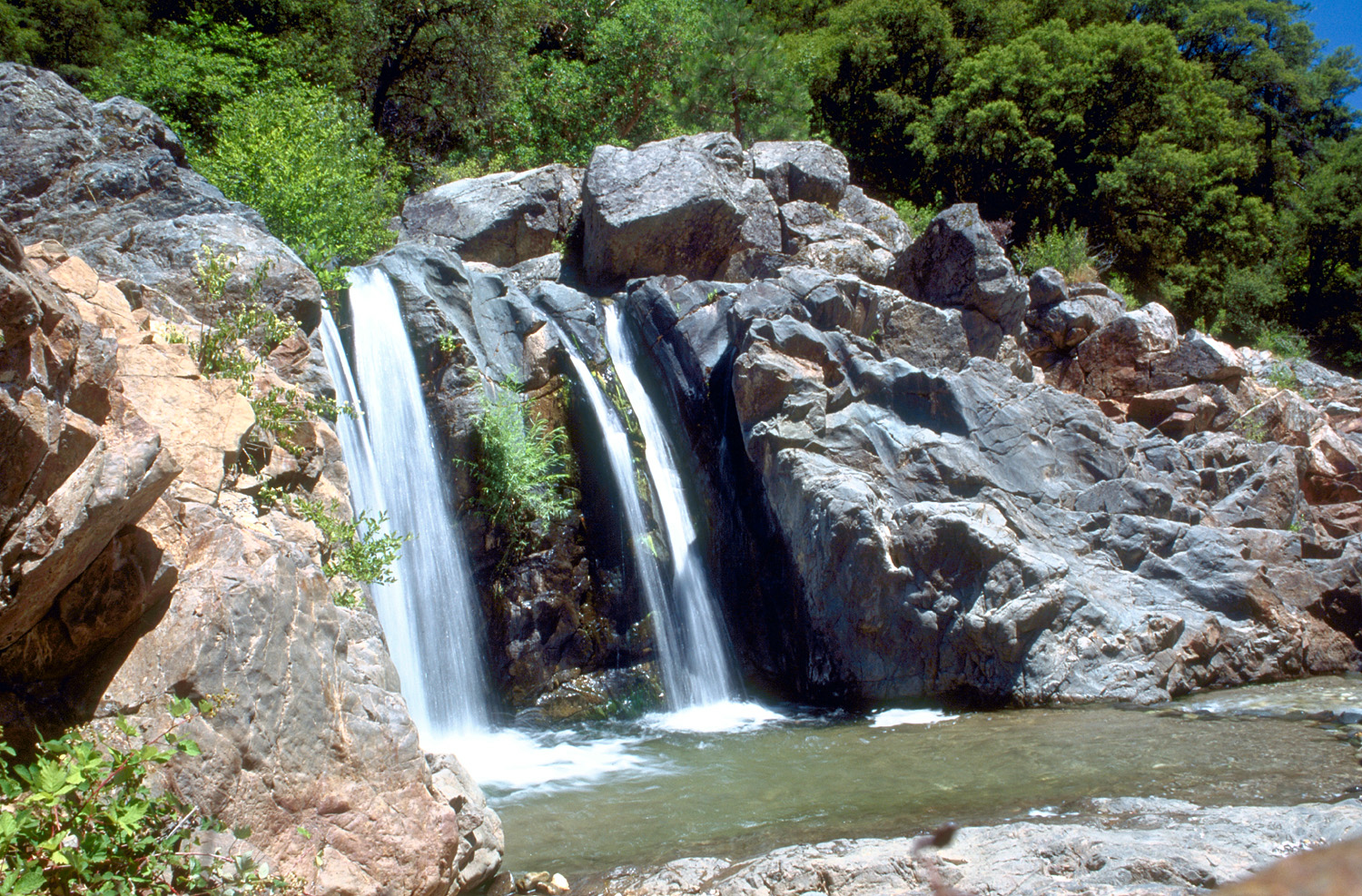
Granite and Water
The South Yuba River does not flow gently. It pours over massive granite ledges, drops into deep pools, slides through calm riparian meanders, and then accelerates again around the next bend. The geology here is the Sierra Nevada at its most exposed - ancient granite pushed up from below, carved by millennia of snowmelt into a canyon that is both beautiful and unforgiving. The park protects 22 miles of this river corridor, a stretch designated as wild and scenic, where the water alternates between white rapids and still pools of startling clarity. Diverse rock formations line the banks, sculpted by the same forces that created the gold deposits that drew thousands of people to this canyon in the mid-nineteenth century. The river shaped the rock, and the rock shaped everything that followed.
The Bridges That Survived
Nineteenth-century engineers built several bridges along this stretch of the South Fork, and the most remarkable of them still stands. The Bridgeport Covered Bridge, completed in 1862, was designed to shelter its wooden structural members from Sierra weather - rain, snow, and the relentless summer sun that can crack exposed timber. Its single span crosses the river near the park's visitor center in Bridgeport, a former stage stop that served travelers heading into the gold fields. Downstream, the 1865 Purdon Crossing bridge marks another era of construction along the canyon. These bridges were not built for scenic value. They were practical crossings for miners, merchants, and settlers navigating terrain that offered few easy paths. That they survive as landmarks says something about both the quality of their construction and the community's determination to preserve them.
Gold Country Scars
The California Gold Rush arrived in this canyon between 1849 and the early 1850s, and it left marks that are still visible. The park sits adjacent to Malakoff Diggins State Historic Park on its northeastern boundary, where hydraulic mining blasted entire hillsides away with high-pressure water cannons to expose gold-bearing gravel. Along the South Yuba, the evidence is subtler but persistent - abandoned mine sites, tailings piles slowly being reclaimed by forest, and the altered contours of stream banks where miners redirected water to run through sluice boxes. The park offers gold panning demonstrations, connecting visitors to the technique that started it all, the simple act of swirling water and sediment in a pan and watching for the glint of heavy metal settling to the bottom. The gold is mostly gone. The scars and the stories remain.
Swimming Holes and Summer Heat
When summer temperatures in the surrounding communities of Grass Valley and Nevada City climb past a hundred degrees, the South Yuba River becomes the region's collective relief valve. Natural swimming holes along the canyon draw crowds to pools carved into granite by centuries of current, places where the water runs cold even when the air shimmers with heat. The park is accessed from Highway 20 west of Grass Valley or Highway 49 north of Nevada City, and on the hottest days both routes carry steady traffic toward the river. Beyond the swimming holes, the park offers hiking and mountain biking through terrain that shifts from oak woodland to mixed conifer forest as elevation changes along the canyon. The Independence Trail, a converted mining ditch flume, provides wheelchair-accessible passage through the landscape - one of the few fully accessible nature trails in the Sierra.
Eleven Thousand Acres, Two Stewards
South Yuba River State Park is a partnership. The California Department of Parks and Recreation manages roughly 2,000 acres directly, while the federal Tahoe National Forest administers the remaining 9,000 acres. This shared stewardship reflects the park's geography - the canyon cuts across jurisdictional boundaries just as the river cuts through rock, indifferent to the lines drawn on maps. The combined acreage protects a corridor of extraordinary ecological diversity, from riparian zones thick with willows and alders to dry ridgelines where manzanita and ponderosa pine dominate. Birdwatchers come for the variety of habitats compressed into a relatively small area. Botanists come for the wildflower displays that carpet the slopes each spring. And on any given summer afternoon, families come for the simplest reason of all - to sit on a warm granite ledge and let the cold river wash away the heat.
From the Air
South Yuba River State Park extends along the South Yuba River canyon at approximately 39.293N, 121.195W in the Sierra Nevada foothills of Nevada County, California. The canyon and river are visible from altitude as a distinct green corridor cutting through the forested hills. Best viewed at 3,000-5,000 feet AGL to appreciate the full 22-mile canyon extent. The Bridgeport Covered Bridge is identifiable near the park's western end. Nearest airport: Nevada County Air Park (GOO), approximately 8 nm southwest. Auburn Municipal Airport (AUN) is about 30 nm south. Highway 49 and Highway 20 intersect nearby as visual reference points.