
Spaceport 1
Two hundred and forty-four people wrote in to oppose it. A petition gathered nearly a thousand signatures. Six people wrote in support. Yet on a headland called Scolpaig, on the western edge of North Uist, the diggers arrived in November 2024. Spaceport 1 is being built, and the Outer Hebrides, a place of standing stones and corn crakes and machair, is preparing to launch rockets to orbit.
The Site at Scolpaig
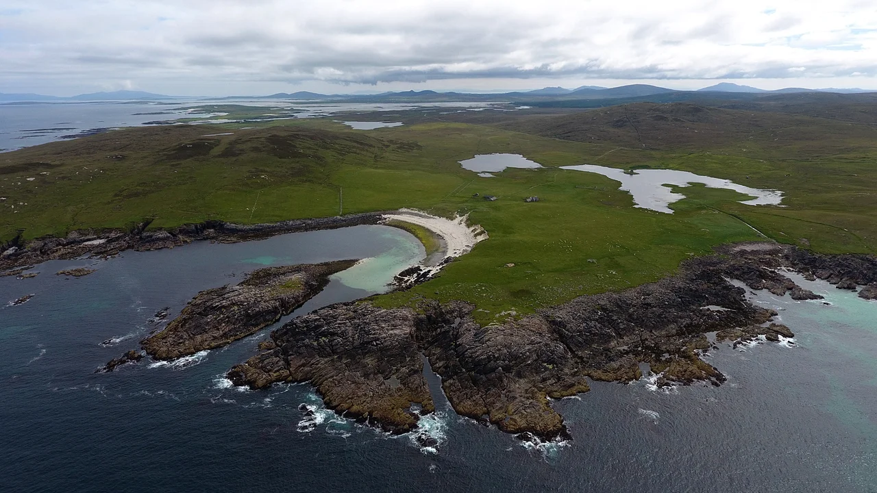
Scolpaig sits at the northwest tip of North Uist, where the land breaks apart into skerries and the Atlantic rolls in unbroken from Newfoundland. The site is designed as a low-impact, multi-customer sub-orbital vertical launch facility, with the capacity to carry payloads of up to 500 kilograms into Sun-synchronous and polar orbits. Polar orbits are useful because rockets fired due south can pass over both poles on each circuit, ideal for Earth observation satellites that need to image the entire planet. The Outer Hebrides offer something rare in Europe: an open Atlantic corridor with almost no aircraft or shipping traffic to dodge, and a high latitude that makes polar trajectories efficient. The same geography that made these islands feel remote for centuries now makes them aerospace real estate.
The Long Road to Approval
In 2018, the project lost out on £2.5 million in government funding to a rival site at Sutherland, on the Scottish mainland. The Hebridean consortium pressed on regardless. Comhairle nan Eilean Siar, the local council, agreed in 2019 to invest £1 million in the land purchase, partnering with Highlands and Islands Enterprise, the technology firm QinetiQ, and the consultancy Commercial Space Technologies. The council approved the planning application in June 2023. Scottish Ministers declined to call it in. The path was clear, even though many islanders felt it had been cleared too easily. The Royal Society for the Protection of Birds noted that the council was simultaneously the developer, the applicant, and the planning authority. The RSPB's chief concern was the wildlife: the corn crake, whose rasping call from summer hay meadows is one of the most threatened sounds in Britain, along with the Greenland barnacle goose and the ringed plover.
Neighbours in the Sky
Spaceport 1 will not be alone. Just to the south, on Benbecula and South Uist, sits MOD Hebrides, the Cold War-era missile range that has been firing rockets into the Atlantic since 1958. The new spaceport is explicitly designed to build on that infrastructure and that expertise. Scotland now has three rocket sites in development: SaxaVord on Shetland, the Sutherland spaceport on the north mainland, and Spaceport 1 here. The CAA granted airspace approval in December 2025. Construction of the enabling infrastructure, costed at £2.6 million, was led by local contractor Macaulay Askernish. Fibre broadband, new access tracks, parking. The unglamorous foundations of a launch business.
What Gets Lost, What Gets Gained
The arguments cut in familiar directions. Supporters point to fifty to seventy promised jobs in an island chain that has been losing population for two centuries. Opponents point to the machair, the wildflower-strewn coastal grassland unique to the Hebrides and home to species that no longer have anywhere else to go. Scolpaig lies near the North Uist Machair and Islands Special Protection Area, the North Uist Machair Special Area of Conservation, and the Vallay Site of Special Scientific Interest. These designations are not bureaucratic decoration. They exist because what survives here survives nowhere else in Britain. Whether a working spaceport can coexist with corn crakes is the question that will be answered, slowly, in the years to come.
From the Air
Located at 57.65 N, 7.49 W on the northwest coast of North Uist. The nearest airport is Benbecula (EGPL) about 25 km south. Inverness (EGPE) lies east across the Minch. Scolpaig headland is identifiable from the air by its rocky promontory and small lochs. Recommended viewing altitude 2000-4000 ft for site detail, higher for the broader Hebridean coastal context. Westerly winds are common.
Nearby Stories
- Howmore 11 km away
- Amhuinnsuidhe Castle 15 km away
- German submarine U-722 19 km away
- St Clement's Church, Rodel 20 km away
- Hebrides 38 km away
- St Kilda, Scotland 41 km away
- German submarine U-516 145 km away
- The Laki Eruption: The Volcano That Changed World History 882 km away