Spuistraat
There used to be a canal here. From 1380 until 1868, water ran where the trams now run, along what was then the western edge of medieval Amsterdam. The Nieuwezijds Achterburgwal - the New Side Behind Bastion Wall - had been dug as part of the city's outer defense, with a wooden palisade behind it and a stretch of soft earth beyond that. As Amsterdam pushed outward in the 15th century, the canal lost its defensive purpose. By the mid-1800s it had become, as one description had it, "a long, smelly ditch with uneven and narrow quays." The city council voted to fill it in on 28 January 1866. The work was finished in 1868. The new street was named Spuistraat in November 1867 and planted with two rows of chestnut trees.
From Defense to Drainage
Amsterdam in 1380 was a town of perhaps 3,000 to 5,000 people huddled around the Amstel, with the Oude Kerk on one bank and the Nieuwe Kerk on the other. Each side of the city had a defensive line - a canal with a wooden palisade rising behind it. When the city expanded, the existing canals were given the prefix Voorburgwal, meaning "in front of the wall," and the new outer canals became Achterburgwal, "behind the wall." The Nieuwezijds Achterburgwal was dug in 1380. By 1450 the Singel had been completed even further out, leaving the Achterburgwal as decoration rather than defense. The brewery De Hooiberg established itself on the parallel Voorburgwal in 1592, ran successfully for centuries, and in 1864 was bought by Gerard Adriaan Heineken - who moved his operation out to Stadhouderskade in 1868 and built the company that still bears his name.
The Architect's Church
At Spuistraat 12A stands the Dominicus church, designed by Pierre Cuypers - the same architect who would later win the contest for the Rijksmuseum. Cuypers built the Dominicus between 1884 and 1893, but the site had a longer ecclesiastical history. From 1845 to 1884 a clandestine Catholic chapel called the Dominicus Schuilkerk had occupied the spot. Before that, the Dominican Order had built another hidden church here in 1624, in the years when public Catholic worship was forbidden in Protestant Amsterdam. These schuilkerken - literally "hidden churches" - were tolerated as long as they didn't look like churches from outside. The Cuypers building does look like a church, because by 1886 it could. The Reformation's hardest restrictions had eased.
Vrankrijk and the Tabakspanden
Spuistraat 216 has a different kind of history. Vrankrijk is a squat - one of Amsterdam's oldest still-operating - that occupied the building in the 1980s and was eventually legalized. Opposite, the Tabakspanden complex was squatted from 1983 onward, becoming a hub of alternative culture, music, and political organizing. The squats survived for more than three decades. In 2015, after the buildings were slated for renovation into luxury apartments, police evicted the remaining occupants in operations that turned violent on 26 March of that year. Vrankrijk itself, having been bought collectively by its occupants in 1992, remains. Walk Spuistraat south of Raadhuisstraat today and the murals are still there - posters layered on posters, political slogans painted over each other, a thin physical record of forty years of resistance that the city decided was finally not worth fighting.
Building by Building
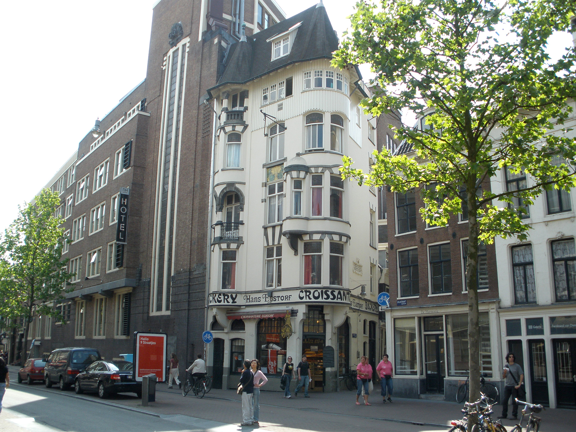
Spuistraat is essentially a back street: most of the addresses lining it are the rear facades of buildings whose front doors open on the parallel Nieuwezijds Voorburgwal. The numbers 111 through 123 are the back of the Handelsvereniging Amsterdam, an Amsterdamse School building whose neorenaissance front sits on the next street. Numbers 137 through 139 form the rear of Magna Plaza - the elegant former main post office built between 1895 and 1899 by Cornelis Peters, now a shopping arcade. Number 175 is the side of the Rijkskantoorgebouw voor het Geld- en Telefoonbedrijf, built around 1924 by royal architect Joseph Crouwel as offices for the postal and telephone monopolies. Number 210 is the Bungehuis, built in the 1930s and later swallowed by the University of Amsterdam's Department of Humanities. Number 274, on the corner with Raamsteeg, is a Jugendstil bakery designed in 1898 by Gerrit van Arkel for a baker named D.C. Stahle. The street is a directory of Dutch architectural fashion from 1880 through the 1930s.
Trams Replacing Boats
The first horsecar ran along Spuistraat in 1877, ten years after the canal was filled. It connected Dam Square to Leidseplein. In 1903 the horsecar was replaced by an electric streetcar - line 2, which still runs through this part of the city. The Blue Tram, the interurban service that linked Amsterdam to Haarlem and the coastal town of Zandvoort, used the southern end of the street from 1914 until the line closed in 1957. Buses replaced the trams in 1961, then ended their routes here in 1974. Today Spuistraat is a one-way street that forms part of the central city loop directing traffic through downtown. Local efforts to shift the traffic burden to the parallel and wider Nieuwezijds Voorburgwal have failed. The street ends in the south at Spui, the small square named for the sluice that once let water out of the system Spuistraat was part of.
From the Air
Spuistraat runs north-south in central Amsterdam at approximately 52.37 N, 4.89 E, parallel to the Nieuwezijds Voorburgwal and one block west of the Singel canal. From altitude it is one of the thin radial streets between the canal rings, lying just west of the Royal Palace and Dam Square. The neighborhood is the medieval core of Amsterdam, threaded with concentric canals. Nearest airport is Schiphol (EHAM), about 12 km southwest. Best identified from the air by spotting Dam Square - a small open plaza with the Royal Palace and the Nieuwe Kerk - then tracing northwest from there.