St. Catherines Island
Copper from Lake Superior turned up in a 4,000-year-old grave on a Georgia barrier island. That single artifact -- a small band found among cremated human remains inside a ring of oyster shells -- rewrote what archaeologists thought they knew about ancient America. The people who built the shell rings on St. Catherines Island were not isolated coastal foragers scraping by on clams. They were connected to trade networks stretching more than 600 miles inland, exchanging goods with Great Lakes communities while constructing monumental gathering places that stood for centuries. The island sits south of Savannah in Liberty County, a 14-mile ribbon of maritime forest, salt marsh, and fine sand beaches covering roughly 22,000 acres between St. Catherine's Sound and Sapelo Sound. It has been continuously inhabited for at least 5,000 years, making it one of the longest-occupied places on the Atlantic seaboard.
Circles in the Forest
Two shell rings stand on opposite sides of St. Catherines Island, each about 70 meters in diameter, each built from thousands of discarded oyster shells piled into careful circles around open central plazas. The St. Catherines Shell Ring on the west side and the McQueen Shell Ring on the east were constructed concurrently, completed around 2000 BC. Radiocarbon dating shows construction spanning several centuries, with the St. Catherines ring started around 4800 years before present and the McQueen ring beginning around 4100 years before present. Inside the rings, archaeologists found postholes suggesting large wooden structures, fire pits, more than 3,000 baked clay objects, bone pins, shell beads, pearls, and fiber-tempered pottery classified as St. Simons ware. The McQueen ring held a burial pit with cremated human and animal remains, including that remarkable copper band traced by elemental analysis to sources on Isle Royale in northwestern Lake Superior. These were not simple refuse heaps. They were ceremonial architecture built by people with social complexity, long-distance connections, and a relationship with this island that lasted millennia.
The Mission at the Edge of Empire
By the time Spanish explorers arrived in the 16th century, the Guale people had long made St. Catherines their home. In 1587 the island became the northernmost permanent Spanish outpost on the Atlantic Coast. The mission of Santa Catalina de Guale operated from 1602 to 1680, serving as the center of the entire Guale missionary province of Spanish Florida. Decades of excavation by archaeologist David Hurst Thomas have uncovered the church, the convento where Franciscan friars lived, a kitchen, wells, and the churchyard. Beneath the church floor lay a cemetery where at least 431 people were buried with grave goods including crosses, Franciscan medallions, Jesuit finger rings, and a cast figurine of the infant Jesus. The mission's end came violently in 1680 when English raiders from Charles Town attacked. Captain Francisco de Fuentes rallied Spanish soldiers and Guale musketeers, but they were overwhelmed. The mission fell, and with it Spain's grip on the Georgia coast loosened for good.
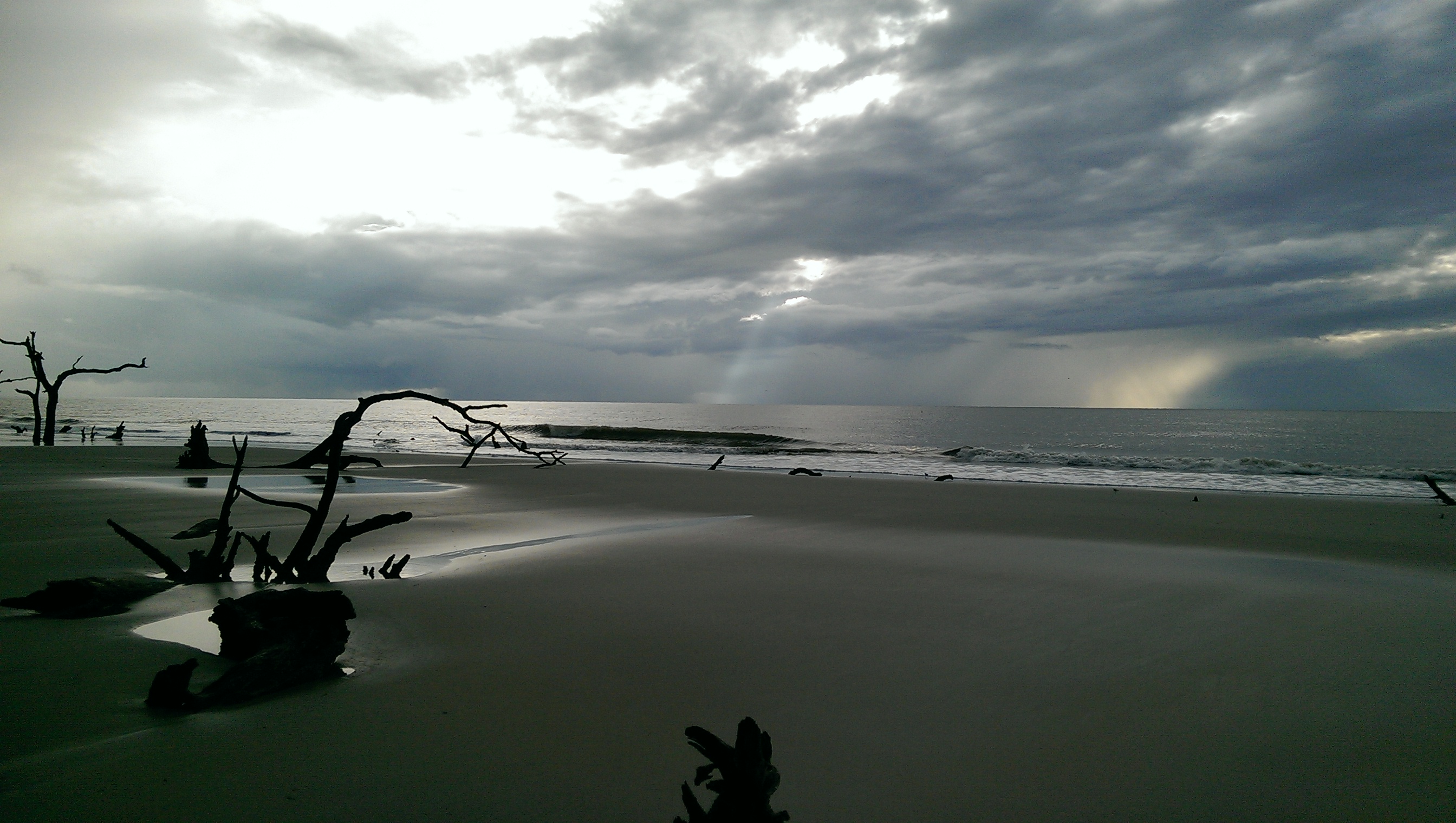
Storm, Cattle, and Solitude
The centuries after the mission's destruction brought plantation agriculture, enslaved labor, and the upheavals of the Civil War. Then, on August 27, 1893, the Sea Islands Hurricane swept across St. Catherines with catastrophic force. Seawater covered the entire island. Every building was destroyed. Only one person who remained on the island during the storm survived. The devastation was so complete that the island essentially reset. In 1943 Edward John Noble, the Life Savers candy magnate, purchased St. Catherines and stocked it with Angus cattle. The black cattle still roam the island freely, habituated to humans, wandering through the maritime forest and along the beaches. Noble's ownership kept the island private, undeveloped, and largely wild. In 1969 St. Catherines was designated a National Historic Landmark, recognized not for any single structure but for the cumulative weight of its archaeological record -- the shell rings, the mission, the layers of human habitation stretching back thousands of years.
An Island Built by Time
St. Catherines is not a simple sandbar. It is a sea island with a dual geological identity: an older Pleistocene core dating to the last ice age, ringed by newer Holocene deposits that accumulated as sea levels rose over the past few thousand years. The Pleistocene portion was once a mainland ridge when glacial ice locked up the oceans and shorelines retreated miles eastward. When the ice melted and seas returned, the ridge became an island again, and barrier beaches built up on its seaward side. Maritime forest covers the ancient core, producing abundant acorns and tree nuts that supported hunter-gatherers for millennia. Artesian springs bubble up through the old soils. Salt marshes fill the space between island and mainland, teeming with fish and shellfish. The island's resources explain its long human occupation: freshwater, food from forest and marsh, high ground safe from all but the worst storms, and a position on the coast that connected its inhabitants to the wider world by water.
From the Air
St. Catherines Island sits at 31.63N, 81.16W off the Georgia coast in Liberty County, about 40 miles south of Savannah. From altitude, it appears as a long, narrow wooded island flanked by salt marshes, with pale beaches on its northeast and south sides. The island stretches roughly 14 miles north to south. St. Catherine's Sound separates it from the mainland to the north, and Sapelo Sound marks its southern boundary. The nearest airports include Savannah/Hilton Head International (KSAV) approximately 40 nm north, and Wright Army Airfield (KLHW) at Fort Stewart closer in. The island is privately managed and has no airstrip. Best viewed at 2,000-4,000 feet AGL in clear conditions, when the contrast between dark maritime forest, pale marsh grass, and tidal creeks is most striking.