The St. Lawrence Seaway: Highway to the Heart of a Continent
Canada called America's bluff. After decades of failed treaties, blocked votes, and Congressional indifference, Prime Minister Louis St. Laurent told President Harry Truman on September 28, 1951, that Canada was done waiting and would build the St. Lawrence Seaway alone. Within weeks, Parliament authorized the St. Lawrence Seaway Authority. The threat worked -- the United States, unwilling to cede control of a continental waterway to its neighbor, finally passed the Wiley-Dondero Seaway Act in 1954. By April 25, 1959, deep-draft ocean vessels were streaming from the Atlantic to the heart of North America, a feat of engineering and political will that had been discussed, debated, and defeated since the 1890s.
Sixty Years of Stalemate
The idea was straightforward: deepen the St. Lawrence River enough for oceangoing ships to reach the Great Lakes. The politics were anything but. First proposed in the 1890s, the seaway became entangled with hydropower development -- supporters argued the deeper channels created by dams were essential for navigation. U.S. proposals before and during the First World War met Canadian indifference. By the 1920s, both the Wooten-Bowden Report and the International Joint Commission recommended the project, yet it stalled repeatedly. Prime Minister Mackenzie King signed a treaty of intent with the U.S. in 1932, but the Senate vote on March 14, 1934, fell short of the two-thirds majority needed for ratification. Railroad associations, Atlantic and Gulf Coast port interests, and internal waterway lobbyists fought the project at every turn -- the railroads stood to lose freight traffic between coastal ports and Great Lakes cities. Ontario's Mitchell Hepburn and Quebec's government opposed it through the 1930s. Roosevelt and Mackenzie King reached an executive agreement in 1941, but Congress refused to assent.
The Bluff That Built a Seaway
After World War II, Ontario was desperate for hydroelectric power, and Canada's patience ran out. St. Laurent's 1951 ultimatum to Truman was backed by genuine intent -- Parliament founded the Seaway Authority that December. Canada began planning to construct the waterway unilaterally, combined with the Moses-Saunders Power Dam, which would be a joint Ontario-New York responsibility since changing water levels required bilateral cooperation. The gambit forced Washington's hand. Eisenhower signed the Wiley-Dondero Act on May 13, 1954, establishing the St. Lawrence Seaway Development Corporation. Groundbreaking took place at Massena, New York, on August 10, 1954. The project employed 22,000 workers and created a superhighway for ocean freighters. On June 26, 1959, Queen Elizabeth II, Prime Minister John Diefenbaker, and President Eisenhower formally opened the seaway with a cruise aboard the royal yacht after addressing crowds in Saint-Lambert, Quebec.
The Lost Villages
Building the seaway required sacrifice that went far beyond political compromise. To create a navigable channel through the Long Sault rapids and accommodate hydroelectric stations near Cornwall, Ontario, and Massena, New York, engineers created Lake St. Lawrence behind a dam. This meant condemning and flooding six entire villages and three hamlets in Ontario -- communities now collectively remembered as The Lost Villages. The flooding began on July 1, 1958. Louisville Landing on the New York side also vanished beneath the water. Today, the submerged ruins draw scuba divers. The Old Power House near Morrisburg, Ontario, sits underwater, encrusted with barnacles and teeming with aquatic life. Shipwrecks along the St. Lawrence corridor offer recreational and technical diving opportunities in water that warms to comfortable temperatures by late summer.
Locks, Limits, and Zebra Mussels
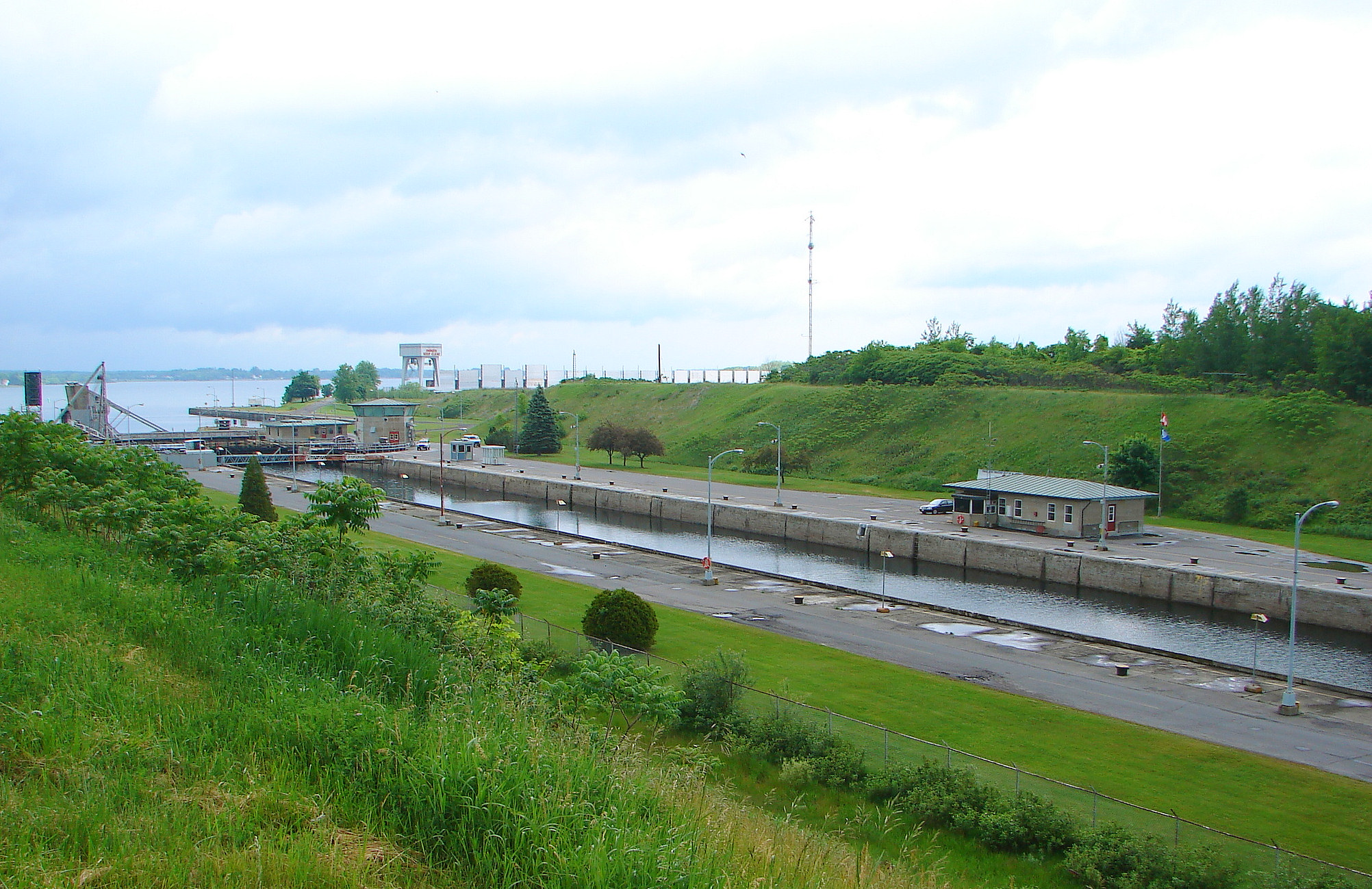
The seaway's fifteen locks -- seven on the St. Lawrence and eight on the Welland Canal -- lift ships from sea level at Montreal Harbor up to Lake Ontario and onward to Lake Erie. The system extends legally from Montreal to Lake Erie, though ships can reach all five Great Lakes via the Great Lakes Waterway, as far inland as Duluth, Minnesota. But the seaway was built with a critical limitation: its locks matched the smaller Welland Canal dimensions rather than the larger Panama Canal locks completed in 1914. Only about 10 percent of modern oceangoing vessels can transit the full seaway. Expansion proposals, floated since the 1960s, have been rejected as too costly and environmentally risky. The seaway's most damaging legacy may be ecological -- it opened a corridor for invasive species into the Great Lakes Basin. The zebra mussel, arriving in ballast water, has wreaked havoc on the Great Lakes ecosystem, clogging water intake pipes and disrupting native species across the entire watershed.
A Working Waterway
The St. Lawrence Seaway moves 40 to 50 million tonnes of cargo annually. About half travels to and from international ports in Europe, the Middle East, and Africa; the rest is coastal trade between American and Canadian ports. Great Lakes shipping generates $3.4 billion in annual U.S. business revenue. Steel arrives inbound; grain ships outbound. The Port of Montreal hosts operations for Maersk, Mediterranean Shipping Company, and Hapag-Lloyd. Since 1997, international cruise liners have transited the seaway -- the first carried 400 passengers to Duluth, and annual cruising passengers have since grown to 14,000. More than 2,000 recreational boats transit each year. The seaway jointly managed by Canada's St. Lawrence Seaway Management Corporation and the U.S. Great Lakes St. Lawrence Seaway Development Corporation, brands itself as 'Highway H2O' -- a nautical link that its earliest advocates believed would transform the communities and economies of the Great Lakes region. Sixty years later, the cargo still flows.
From the Air
The St. Lawrence Seaway stretches from Montreal, Quebec, to Lake Erie, but its geographic heart lies along the St. Lawrence River near 45.30N, 73.93W. From altitude, the lock systems are visible as distinctive stepped structures along the river -- the St. Lambert and Cote Ste. Catherine locks near Montreal, the Beauharnois locks further upstream, and the Snell and Eisenhower locks near Massena, New York. The Welland Canal's flight locks at Thorold, Ontario, are visible from higher altitude as a staircase ascending the Niagara Escarpment. Lake St. Lawrence, the artificial lake created by flooding The Lost Villages, is visible as a widening in the river near Cornwall. Nearest airports include Montreal-Pierre Elliott Trudeau International (CYUL) and Cornwall Regional Airport (CYCC). Best viewed at 5,000-10,000 ft AGL to appreciate the full scale of the lock and canal system.