Stewart Island
In Maori mythology, the South Island is a canoe. The North Island is a great fish hauled from the sea. And Stewart Island? It is the anchor stone - Te Punga o Te Waka a Maui - that held everything in place while the demigod Maui made his catch. The more common Maori name, Rakiura, translates roughly as 'the great and deep blushing,' a reference to the fiery sunsets and the aurora australis that wash across these southern skies. Stand on the shore of Halfmoon Bay after dark and you understand the name immediately. The light here is not ordinary light.
The Anchor Stone
Stewart Island sits 30 kilometers south of the South Island, separated by the notorious Foveaux Strait. On a map it looks small, dwarfed by its northern neighbors. In reality it stretches 64 kilometers long and 40 wide, with 700 kilometers of coastline and exactly 20 kilometers of road. Ten days of tramping covers only the northern third. Few people have seen anywhere near the whole island.
The terrain is ancient granite, some of the oldest rock in New Zealand. Beaches come in every color: black iron sand, white quartz, red garnet, gold that sparkles but is only fool's gold. Paterson Inlet nearly cleaves the island in two, creating a vast sheltered waterway popular with boaters and divers. The climate runs mild and damp - without the rain, there would be no rainforest - and the eastern lowlands grow forest right to the water's edge, canopies of kamahi pierced by towering rimu and miro.
Where the Kiwi Outnumber the People
Roughly 400 people live on Stewart Island. An estimated 15,000 kiwi share the same ground. The math is striking: nearly forty kiwi for every human resident. With fewer predators than the mainland - no stoats, no ferrets - the island has become one of the last strongholds for New Zealand's national bird. The southern brown kiwi, or tokoeka, is the largest of the kiwi species, and here they forage boldly enough that visitors can spot them after dark at the edges of roads, lawns, and even the town rugby field.
Mason Bay, a 20-kilometer crescent of sand on the wild west coast, is probably the easiest place on Earth to see kiwi in the wild. Getting there requires a multi-day tramp or a water taxi, and the beach itself faces screaming westerly gales that send white-horses charging ashore. But the kiwi thrive in the tussock and scrub behind the dunes, and patient watchers are rarely disappointed.
Ulva Island and the Bird Chorus
A short water taxi ride from Golden Bay brings you to Ulva Island, a predator-free sanctuary that may be the closest thing to pristine New Zealand open to the public. Declared rat-free in 1997 after an eradication campaign, Ulva hosts birds that have vanished from the mainland: South Island saddleback, yellowhead, red-crowned parakeet, and the Stewart Island robin. A skilled birder can find all four species within a few hours. Even newcomers will notice the weka - bold, chicken-like ground birds so numerous they practically introduce themselves.
Back on Stewart Island proper, the dawn chorus in spring is extraordinary. Kaka parrots, parakeets, tui, and bellbird fill the forest canopy with sound. Offshore, albatross and petrels wheel above the waves, blue penguins waddle ashore at dusk, and the rarer yellow-eyed penguin can sometimes be spotted along the coast. Sooty shearwaters nest at Ackers Point, visible on late summer evenings as they return from the open ocean.
Island Time
Virtually the entire population lives in Oban, also called Halfmoon Bay, a township where commercial fishing and tourism sustain the economy. There are a few places to eat, a single pub - the South Sea Hotel - and accommodation ranging from backpackers to lodges. Some visitors from twenty years ago never left.
Getting here means crossing Foveaux Strait by ferry from Bluff, an hour-long passage that can be memorably rough, or taking a twenty-minute flight from Invercargill. Most of the island lies beyond the road's end, accessible only on foot, by water taxi, or by helicopter. The backcountry huts cost as little as five dollars a night but sit at least two days' walk from town. Mobile coverage reaches Oban; beyond that, you are on your own.
Southern Lights and Deep Blushing
Stewart Island is one of the best places in New Zealand to witness the aurora australis. The island's latitude, combined with the offset of the magnetic south pole, creates conditions that occasionally produce displays visible to the naked eye. The dark skies beyond Oban help - no city glow competes with the celestial light show. Travellers should not expect a display every night, but when the southern lights appear, the Maori name for this place stops being a translation and becomes a description. Rakiura blushes, deeply and greatly, exactly as the old stories promised.
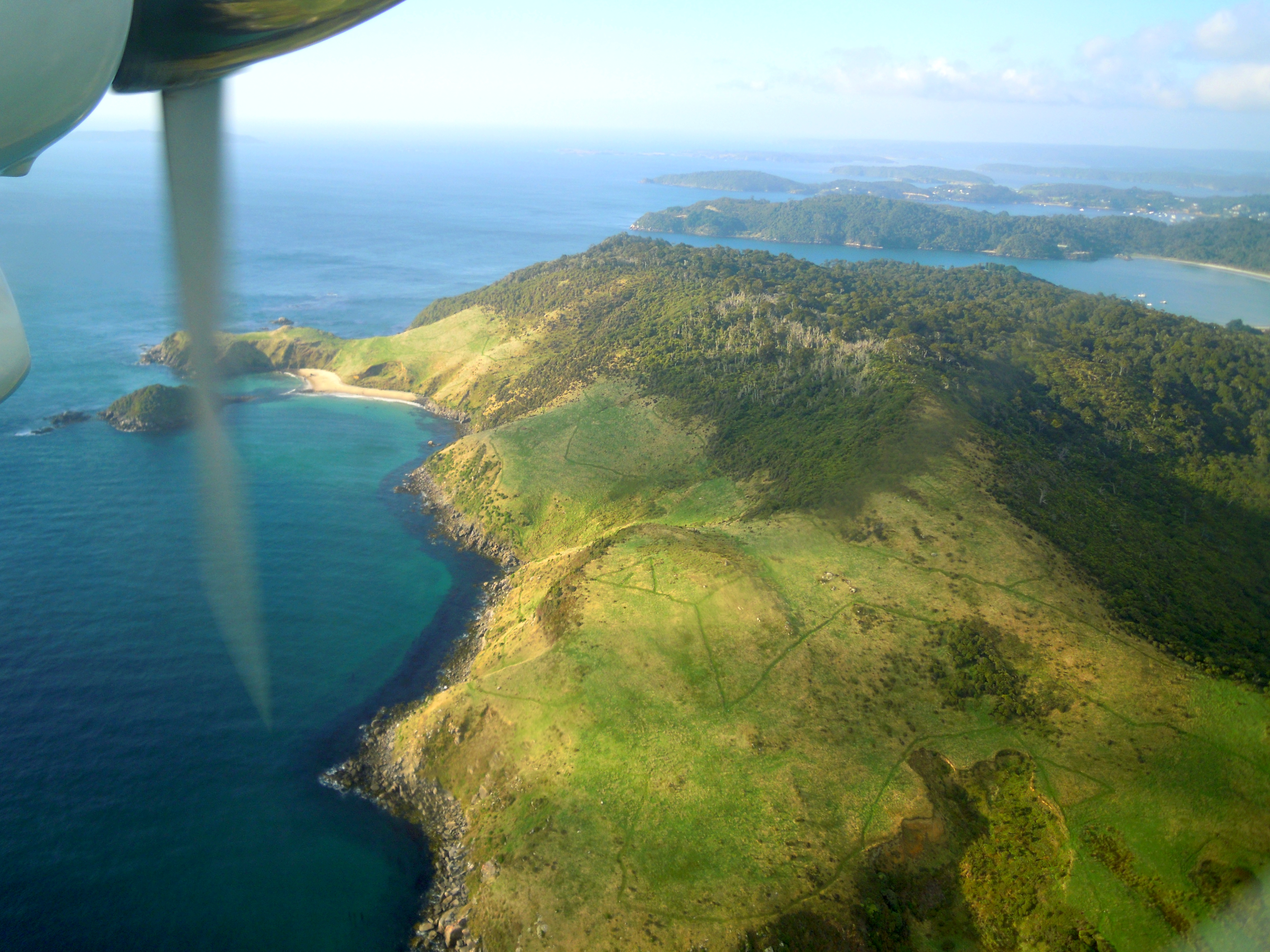
From the Air
Located at 47.00S, 167.90E, Stewart Island lies 30km south of the South Island across Foveaux Strait. Ryan's Creek Aerodrome (NZRC) near Oban handles small aircraft; Stewart Island Flights operates 20-minute turboprop services from Invercargill Airport (NZNV). Approach from the north for views of Foveaux Strait and the island's deeply indented coastline. Paterson Inlet bisects the island and is a prominent visual landmark. The west coast features the long crescent of Mason Bay. At altitude, the contrast between dense native bush and the cleared areas around Oban is striking. Expect maritime weather - cloud, rain, and strong westerlies are common. The island covers 1,746 square kilometers but has minimal development outside Halfmoon Bay.