Stonehenge Landscape
Most visitors to Stonehenge look at the famous circle and miss the landscape that gives it meaning. The stones stand within a 2,100-acre estate that contains nearly 400 ancient monuments, most of them scheduled, spread across rolling chalk downland that Neolithic and Bronze Age people shaped over thousands of years. This is the Stonehenge Landscape, managed by the National Trust, and understanding it transforms the stone circle from an isolated curiosity into the centerpiece of an entire sacred geography.
Rescued from Encroachment
Stonehenge itself was given to the nation in 1918 by Cecil and Mary Chubb, who had bought it three years earlier from the Antrobus family. But the monument was still surrounded by encroaching development. A World War I aerodrome had been built within a stone's throw of the circle, and cottages dotted the nearby fields. In 1927, a public appeal raised funds to purchase the surrounding land and give it to the National Trust. The aerodrome was demolished, the cottages removed, and the landscape began its slow return to something approaching its ancient state. Subsequent land acquisitions, including a major farm purchase in the early twenty-first century, have expanded the Trust's holdings to cover nearly a third of the World Heritage Site.
A Landscape of the Dead and Living
The monuments within this landscape tell stories distinct from the famous circle. The Stonehenge Cursus, an enormous earthwork running roughly east-west for nearly two miles, predates the stone circle and remains one of the most enigmatic Neolithic structures in Britain. Woodhenge and Durrington Walls, the massive henge enclosure to the northeast, appear to have served as a settlement and feasting ground for the living, while Stonehenge itself may have been reserved for the dead. The Avenue, a processional route marked by parallel ditches and banks, connects Stonehenge to the River Avon. Numerous burial mounds, called barrows, cluster along ridgelines, and the Nile Clumps, large groups of trees planted on farmland, are said to represent ship positions at the Battle of the Nile, forming a landscape-scale memorial to Horatio Nelson.
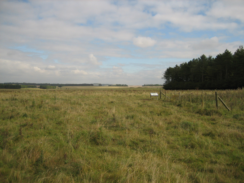
Chalk Grassland Reborn
The Trust is managing one of the largest chalk grassland reversion projects in Europe, aiming to convert 340 hectares of arable farmland back to permanent pasture. Chalk grassland is an extraordinarily rich habitat. Its thin, free-draining soil supports lime-loving plants like knapweed, birdsfoot trefoil, and yellow rattle, while trapping enough heat to sustain rare insects including the Chalkhill Blue and Adonis Blue butterflies. Skylarks, a red-list species, nest in the grass, and the RSPB maintains a reserve on Normanton Down specifically to protect the Stone Curlew. The reversion serves a dual purpose: ecological restoration and improved public access, allowing walkers to explore monuments that were once fenced within private fields.
Festivals and Farewells
The landscape has its modern history too. During the 1970s and 1980s, the Stonehenge Free Festival drew thousands of people to the area each summer, a countercultural gathering that mixed music, alternative lifestyles, and a reverence for the monument's perceived spiritual significance. Damage to archaeological sites, particularly the Cursus barrows, was one of the reasons the festival was banned in 1985, a decision that led to the confrontation known as the Battle of the Beanfield. Today, access is managed more carefully, though English Heritage still opens the stones for the summer and winter solstices and the equinoxes, when druids, neo-pagans, and curious visitors gather in the predawn darkness to watch the sun align with stones placed five thousand years ago.
From the Air
Located at 51.179N, 1.828W on Salisbury Plain, Wiltshire. The landscape is best appreciated from altitude, where the barrow clusters, Cursus earthwork, and relationship between Stonehenge and Durrington Walls become clear. Nearest airports: EGLS (Old Sarum, 6 nm south), EGBW (Boscombe Down, 5 nm east). Recommended viewing altitude 3,000-5,000 ft for full landscape perspective. The A303 road passing close to the stones provides a reference line.