Strait of Juan de Fuca
The strait is named for a man who may never have seen it. In 1592, a Greek navigator called Apostolos Valerianos -- sailing under the Spanish name Juan de Fuca -- claimed to have found a broad inlet on the Pacific Coast of North America while searching for the fabled Strait of Anian, the mythical Northwest Passage. Nearly two centuries later, in 1787, British fur trader Charles William Barkley sailed the Imperial Eagle into the mouth of a waterway between Vancouver Island and the Olympic Peninsula and named it for Fuca, giving credit to a story that historians have debated ever since. Some scholars argue Fuca's account was a fabrication designed to extract money from the English government. Others suggest it was based on leaked intelligence from Francis Drake's 1579 voyage. What is not debated is the strait itself: 96 miles of restless water connecting the Salish Sea to the Pacific Ocean, with the international boundary between Canada and the United States running down its center.
The Naming Dispute That Never Ends
Even the credit for naming the strait is contested. The U.S. Geological Survey's Geographic Names Information System attributes the name to John Meares in 1788, but most historical sources -- including the BC Geographical Names Information System, Washington's Secretary of State, and multiple scholarly atlases -- agree it was Barkley a year earlier. Meares had a well-documented habit of claiming credit for Barkley's discoveries. The strait was explored in detail between 1789 and 1791 by a succession of Spanish navigators: Manuel Quimper, Jose Maria Narvaez, Juan Carrasco, Gonzalo Lopez de Haro, and Francisco de Eliza. Their charts gave form to what Barkley had named, mapping a waterway that stretched from Cape Flattery and Tatoosh Island in the west to the passages leading into Puget Sound, Haro Strait, and the Strait of Georgia in the east. In 2009, both Canada and the United States approved the name Salish Sea as a collective term for the strait, Puget Sound, and the Strait of Georgia -- not replacing the individual names, but acknowledging the Coast Salish peoples whose territory the waters cross.
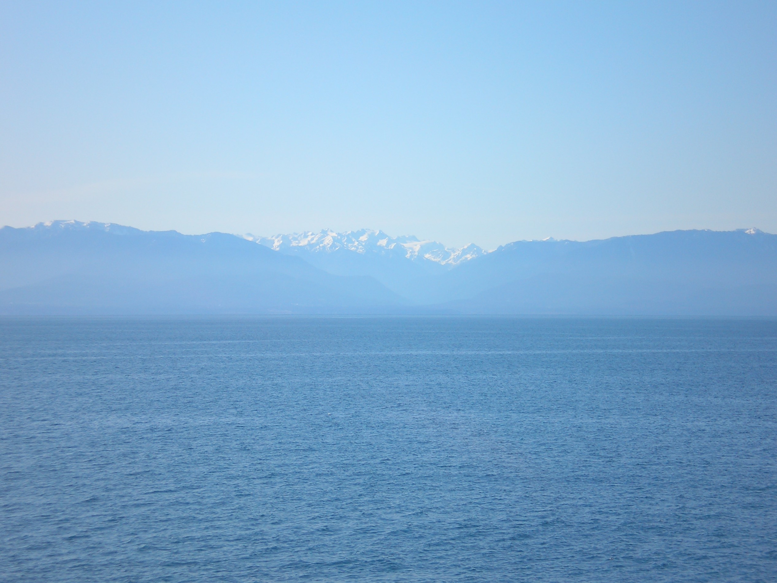
Where the Weather Gets Rough
The Strait of Juan de Fuca is the funnel through which Pacific weather enters the inland waters of the Salish Sea, and the funnel works both ways. Westerly winds and ocean swells push through the mouth of the strait with little obstruction, generating conditions that are, on average, significantly rougher than the sheltered waters to the east. Small-craft advisories, gale warnings, and storm warnings are common, particularly in winter. The strait's orientation amplifies the wind -- air masses accelerate as they squeeze between the Olympic Mountains to the south and the mountains of Vancouver Island to the north. For mariners, the western entrance between Cape Flattery and Carmanah Point is the threshold between ocean and shelter, a transition that has earned the surrounding coastline the grim nickname "Graveyard of the Pacific." The ferry MV Coho has made the crossing between Port Angeles and Victoria since 1959, carrying 475,000 passengers and 130,000 vehicles in 2018 alone.
The Border Down the Middle
The international boundary within the strait is settled -- a line down the center that both nations accept. The dispute lies seaward, in the 200-nautical-mile exclusive economic zone extending west from the strait's mouth. Both Canada and the United States have proposed boundaries based on the principle of equidistance, but with different basepoint selections that produce slightly different lines. Resolution should be simple, but it has stalled because a ruling here could influence other unresolved maritime boundary disputes between the two countries. British Columbia has complicated matters further by rejecting both equidistant proposals and arguing that the Juan de Fuca submarine canyon is the appropriate geomorphic boundary. This position, based on the principle of natural prolongation in international law, creates a dilemma for Canada's federal government: endorsing natural prolongation on the Pacific could undermine Canada's preference for equidistance in the Gulf of Maine boundary dispute on the Atlantic side.
Whales in the Gateway
The strait is a biological highway as well as a maritime one. Humpback whales congregate near the western entrance from June through November, feeding in the productive waters off Neah Bay and La Push. A resident population of killer whales -- the endangered Southern Resident community -- hunts spawning Chinook salmon in the strait and surrounding waters. Transient killer whales pass through as well, preying on California and Steller's sea lions. Gray whales use the strait as a rest stop during their annual migration between Baja California and Alaska, pausing to feed on bottom-dwelling organisms in the shallows. Between March and May, the migratory whales encounter local, non-migratory gray whales that live in the strait year-round -- meetings that are vital for genetic diversity and the formation of new bloodlines. Common murres swim north into the strait's sheltered bays to feed on herring. The gateway to the Pacific is never empty.
From the Air
Located at 48.33N, 124.00W, the Strait of Juan de Fuca stretches 96 miles between the Olympic Peninsula (south) and Vancouver Island (north). It is one of the most prominent water features visible from altitude in the Pacific Northwest, running east-west between Cape Flattery/Tatoosh Island and the San Juan Islands. Nearest airports: William R. Fairchild International (KCLM) in Port Angeles on the south shore; Victoria International (CYYJ) on the north shore. The strait appears as a wide channel separating two mountainous landmasses.