Strait of Malacca
A quarter of everything the world trades by sea passes through a corridor of water narrower than some lakes. The Strait of Malacca stretches 900 kilometers between the Malay Peninsula and the Indonesian island of Sumatra, connecting the Andaman Sea to the South China Sea -- and by extension, the Indian Ocean to the Pacific. At its narrowest, the passage squeezes to just 65 kilometers across. At its shallowest, near the Singapore Strait, the bottom sits only 25 meters below the surface. Ships longer than 350 meters navigate this bottleneck daily, carrying oil from the Persian Gulf, manufactured goods from China, coal, palm oil, and Indonesian coffee to markets across Asia and beyond.
A Tree, a Prince, a Name
The strait takes its name from a city, and the city from a tree. According to historical tradition, Parameswara, a Sumatran prince fleeing political upheaval, rested beneath a Malacca tree -- Phyllanthus emblica, the Indian gooseberry -- at the spot where he would found his new kingdom. He named the settlement Melaka after the tree, and over time the name migrated from city to waterway. That founding act in the early fifteenth century established the Malacca Sultanate, which would grow into one of Southeast Asia's great trading powers, controlling the strait that bore its name. But the waterway's significance predates Parameswara by centuries. Traders from Arabia, Persia, Africa, and southern India had long sailed to the port of Kedah on the Malay Peninsula, riding monsoon winds between June and November and returning between December and May. They carried glassware, camphor, ivory, sandalwood, and precious stones, transporting goods overland to eastern ports like Langkasuka and Kelantan.
Seven Hundred Years of Srivijaya
In the seventh century, the maritime empire of Srivijaya rose from Palembang on Sumatra's eastern coast and seized control of two critical chokepoints: the Strait of Malacca and the Sunda Strait between Sumatra and Java. Through a sustained campaign of raids and conquests against rival ports on both sides of the water, Srivijaya established economic and military dominance that endured for roughly 700 years. The empire profited enormously from the spice trade, from tributary relationships with China, and from commerce with Indian and Arab merchants. After Srivijaya's decline, the strait's importance only grew -- through the rise of the Malacca Sultanate in the fifteenth century, the Johor Sultanate, the British Straits Settlements, and the emergence of modern Singapore at the waterway's eastern end. By the seventeenth century, the strait had become the primary shipping channel between the Indian and Pacific Oceans, a role it has never relinquished.
The World's Busiest Bottleneck
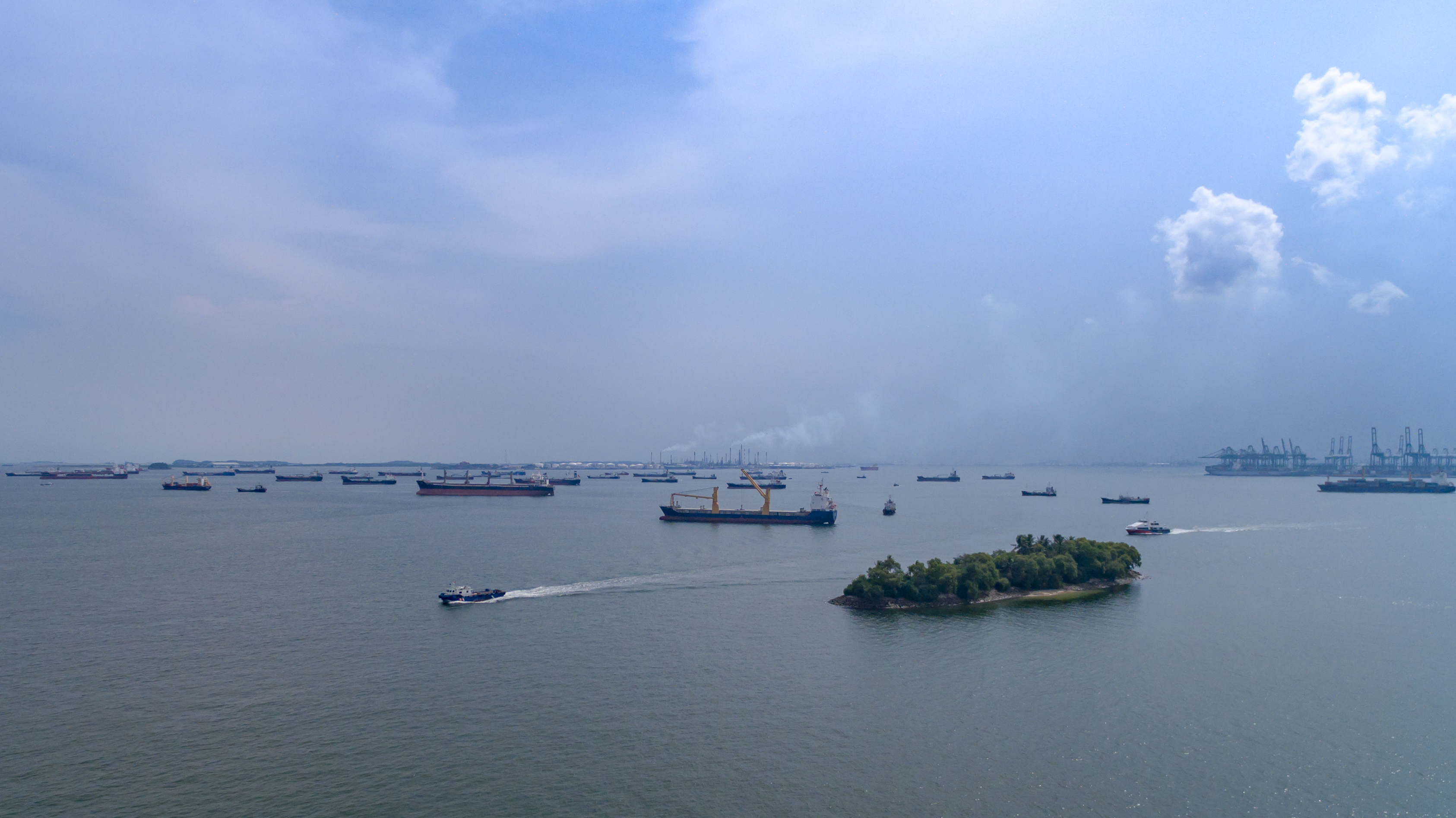
Over 94,000 vessels transited the strait in 2008, making it the busiest in the world. Roughly 25 percent of all globally traded goods pass through these waters. About a quarter of all seaborne oil makes this transit, primarily flowing from Persian Gulf producers to Asian consumers -- an estimated 15.2 million barrels per day by 2011. The sheer volume creates a paradox: the strait is indispensable, yet its physical constraints are unforgiving. The shallowest point, just 25 meters deep near Singapore, defines the Malaccamax -- the maximum vessel size that can squeeze through. Ships exceeding that limit must detour thousands of nautical miles east through the Lombok Strait, the Makassar Strait, and beyond. China, which routes roughly 80 percent of its imported crude oil through this corridor, has identified the vulnerability explicitly. In 2003, President Hu Jintao coined the term "Malacca dilemma" to describe the nation's dependence on a passage it does not control.
Pirates, Wrecks, and Haze
Navigating the strait has never been merely a matter of charts and depth soundings. Piracy surged in the early 2000s, spiking after September 11, 2001, before regional navies coordinated patrols in July 2004 and drove attacks down from their peak to 79 in 2005 and 50 in 2006. Thirty-four shipwrecks, some dating to the 1880s, litter the Traffic Separation Scheme channel, posing collision risks in waters too narrow for comfortable maneuvering. On August 21, 2017, the USS John S. McCain lost ten crew members in a collision with the merchant vessel Alnic MC just east of the strait after a confusion over steering controls. And every year, wildfires in Sumatra generate a choking haze that can reduce visibility to 200 meters, forcing the world's largest ships to crawl through a passage already too tight for the traffic it carries. In January 2025, maritime authorities again flagged rising security risks, advising ships to proceed with heightened precautions.
Alternatives That Never Arrive
For decades, Thailand has floated a seemingly elegant solution: cut a canal through the Isthmus of Kra, the narrow land bridge connecting the Malay Peninsula to mainland Southeast Asia. The canal would shave 960 kilometers off the voyage between the Indian and Pacific Oceans, bypassing the strait entirely. China has reportedly offered to fund the project. But the financial and ecological costs remain prohibitive, and the canal stays on paper. A more modest proposal would run an oil pipeline across the isthmus, with proponents estimating savings of about $0.50 per barrel in delivery costs. Myanmar has proposed something similar. Neither has materialized. For now, the world's commerce continues to funnel through the same narrow passage that Srivijayan rulers controlled more than a thousand years ago -- a testament to the stubborn permanence of geography.
From the Air
The strait stretches roughly from 1°N to 6°N latitude between the Malay Peninsula and Sumatra. Centered near 5.67°N, 95.43°E at the northwestern entrance. From cruising altitude, the water is visible as a long, narrow channel with heavy ship traffic -- hundreds of vessels are typically visible at any given time. Singapore Changi Airport (WSSS) lies at the southeastern terminus; Penang International Airport (WMKP) along the Malaysian coast to the northwest; Sultan Iskandar Muda Airport (WITT) on the Sumatran side at Banda Aceh. Best appreciated at 15,000-25,000 ft where the full geographic bottleneck between the two landmasses becomes clear.