Sudbury Basin
The scar is 1.849 billion years old, and you can see it from the air. The Sudbury Basin stretches across the Canadian Shield in an unmistakable ellipse, the eroded remnant of an impact crater created when an asteroid roughly 10 to 15 kilometers in diameter struck the ancient supercontinent Nuna. The collision was among the most violent events in Earth's geological record. Debris scattered as far as Minnesota. The impact melted rock deep into the crust, and as that molten material cooled, it concentrated nickel, copper, platinum, palladium, and gold along the crater rim. What cosmic violence created, human industry exploited. The Sudbury Basin is both a geological wonder and the foundation of one of the world's most productive mining districts.
The Day the World Shattered
The impactor arrived 1.849 billion years ago during the Paleoproterozoic era. The original crater may have been as large as 250 kilometers in diameter, though subsequent geological processes -- including the Grenville orogeny between 1.4 billion and 1 billion years ago -- deformed it into the current smaller oval shape. Ejecta, the rock fragments blasted outward by the impact, have been found hundreds of kilometers away, including deposits in Minnesota. Models suggest debris was scattered globally, though erosion has erased most evidence beyond the immediate region. The Sudbury Basin ranks among the three largest confirmed impact structures on Earth, after the Vredefort crater in South Africa and the Chicxulub crater beneath Mexico's Yucatan Peninsula.
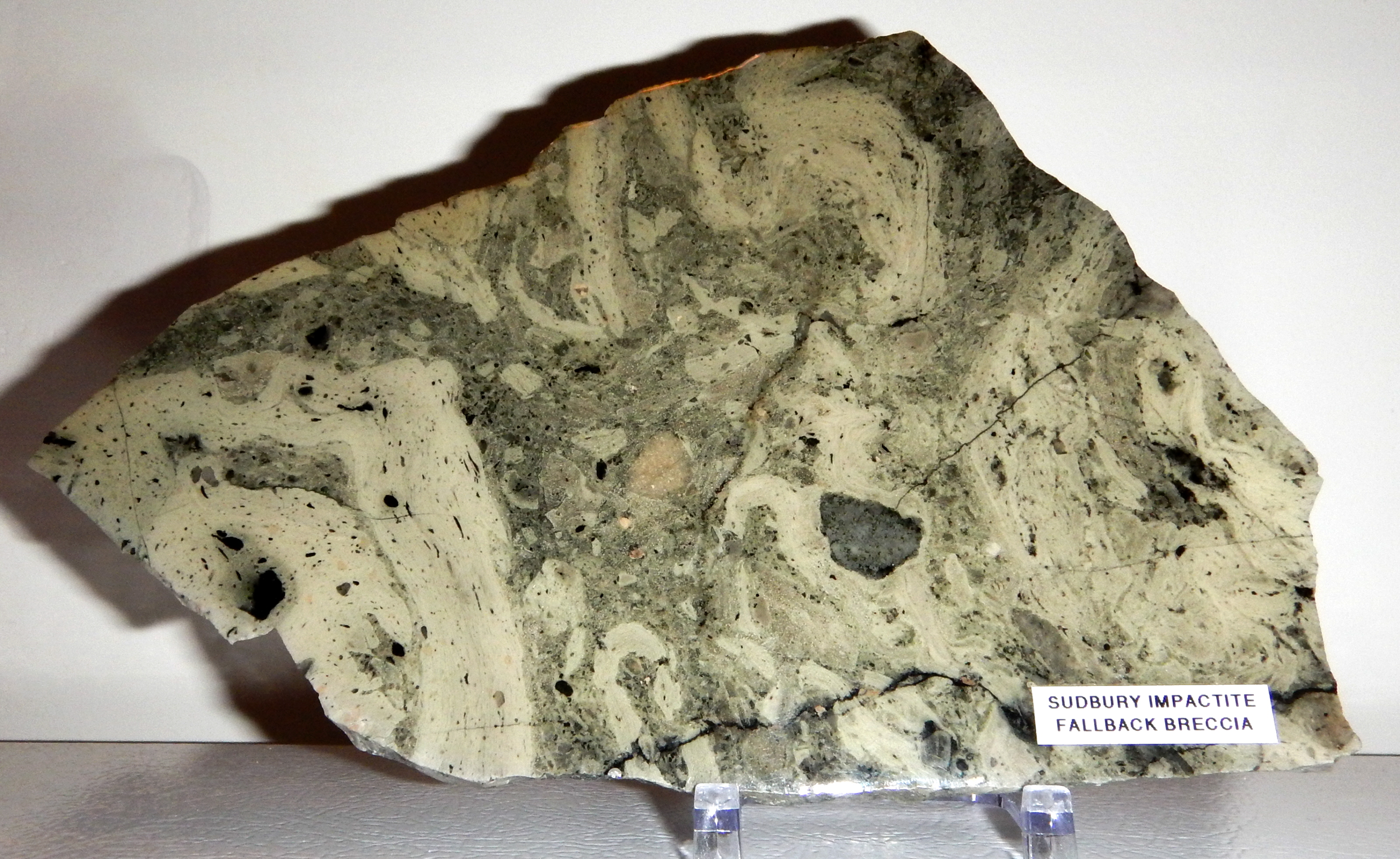
Reading the Rocks
For decades, proving that a meteorite caused the Sudbury structures was difficult. The region had been volcanically active around the same time as the impact, and 1.8 billion years of weathering had obscured the evidence. Reports in the late 1960s described shatter cones and shock-deformed quartz crystals in the underlying rock -- features distinctive of meteorite impacts rather than volcanic activity. Geologists reached consensus by about 1970 that the basin was impact-formed. Then in 2014, analysis of siderophile element concentrations and the extent of impact melting suggested the impactor may have been a comet rather than an asteroid, or at least carried a chondritic composition. The debate over precisely what struck is ongoing, but that something struck is settled science.
Anatomy of a Crater
The Sudbury Basin today measures roughly 60 kilometers long, 30 kilometers wide, and extends several kilometers deep, though the modern ground surface sits much shallower. Geologists divide the basin rim into the North Range, East Range, and South Range, each with distinct rock compositions. The Sudbury Igneous Complex -- the solidified impact melt -- forms the structural backbone. At its base lies norite, overlain by quartz gabbro and granophyre. Below the complex, the footwall rock bears the distinctive signature of the impact: breccia, pseudotachylite, and radial dike systems. The sub-layer between the footwall and the igneous complex is where most of the mineral wealth concentrates.
From Compass Needle to Company Town
In 1856, provincial land surveyor Albert Salter, running a baseline westward from Lake Nipissing, noticed his compass behaving strangely near what would become the Creighton Mine. He had detected the magnetic signature of the massive mineral deposits. The remoteness of the area delayed exploitation until the Canadian Pacific Railway pushed through in the 1880s. In 1883, railway blasting revealed a large concentration of nickel and copper ore at the Murray Mine site. Mining grew rapidly, eventually producing the companies Vale Inco and Falconbridge. The Sudbury region became one of the world's largest suppliers of nickel and copper, with most deposits concentrated along the basin's outer rim -- the geological zone where the impact melt cooled and metals settled.
The Valley Today
Locals call the basin 'The Valley.' The former municipalities of Rayside-Balfour, Valley East, and Capreol sit within it, while the urban core of Greater Sudbury occupies the southern outskirts. An Ontario Historical Plaque commemorates the basin's discovery. Mining continues along the rim, now conducted with far greater environmental care than the smelting operations that once stripped the surrounding landscape bare. The basin remains geologically active as a research site. It has attracted attention from NASA, which sent Apollo astronauts to train in the Sudbury area because the impact geology provided analogs for lunar craters. From altitude, the elliptical shape of the basin is readable in the topography, a wound in the Canadian Shield that never fully healed and never stopped giving.
From the Air
Located at 46.60°N, 81.18°W in northeastern Ontario. The Sudbury Basin is one of the most visible geological features from altitude in the Canadian Shield region. The elliptical crater rim -- roughly 60 km long and 30 km wide -- is traceable in the topography, with the North, East, and South ranges forming elevated terrain around the basin floor. Mining operations, tailings, and the city of Greater Sudbury are visible within and around the structure. Greater Sudbury Airport (CYSB) sits northeast of the basin. Best appreciated at 10,000-20,000 feet AGL where the full elliptical shape becomes apparent. The basin is northwest of Toronto, approximately 400 km by road.