Sudd
The Arabic word "sudd" means barrier, and this swamp has earned the name across millennia. In AD 61, Roman soldiers dispatched by Emperor Nero pushed up the White Nile and could go no further -- the Sudd marked the absolute limit of Roman penetration into equatorial Africa. Centuries later, Victorian explorers searching for the source of the Nile sometimes spent months fighting through the same impenetrable thicket of papyrus and floating vegetation. Alan Moorehead, in his 1960 book "The White Nile," wrote simply: "There is no more formidable swamp in the world." The Sudd still exists, still vast, still defying easy passage -- a freshwater wetland the size of a small country, breathing with the rhythm of the White Nile.
A Swamp the Size of England
The Sudd stretches from Mongalla in the south to the Sobat River confluence near Malakal in the north, spanning roughly 500 kilometers south to north and 200 kilometers east to west. Its average extent exceeds 30,000 square kilometers, but during the wet season it can swell to more than 130,000 square kilometers -- roughly 21 percent of South Sudan's total land area. The size depends primarily on the discharge from Lake Victoria, which controls flood levels in the White Nile system. When Lake Victoria's level rose between 1961 and 1963, the Sudd's combined permanent swamp and seasonal floodplain expanded to 2.5 times their former extent. The swamp consumes roughly 55 percent of the water that enters it through evaporation, which is precisely what made it so attractive to engineers who dreamed of redirecting all that "wasted" water northward to Egypt.
Rivers with Many Names
The hydrology of the Sudd reads like poetry in Arabic. The Bahr al Jabal -- "Sea of the Mountain" -- enters from the south at Mongalla, its defined riverbed gradually dissolving into a labyrinth of meandering channels and lagoons. Downstream of Bor, the Bahr el Zeraf -- "Sea of the Giraffes" -- branches eastward, carrying part of the flow before rejoining the main channel near Malakal. At Lake No, the Bahr el Ghazal -- "Sea of the Gazelles" -- contributes its own seasonal waters from the west. The Sobat River joins at Malakal, and the combined flow continues north as the White Nile, eventually meeting the Blue Nile at Khartoum to form the main Nile. Beneath this system lies heavy clay soil -- impermeable "black cotton" vertisol -- with sandy layers found only at depths of 30 meters or more, meaning groundwater has almost no influence. The Sudd is entirely a surface phenomenon, shaped by rain and rivers alone.
An Ark in the Sahel
In a landscape dominated by the dry expanses of the Sahel, the Sudd is a biological oasis of extraordinary richness. Over 400 bird species have been recorded, including several thousand shoebills -- making it one of the most important sites in the world for that prehistoric-looking species. Great white pelicans and black crowned cranes nest and feed here. The wetland shelters migrating mammals that have few other options in this part of Africa: bohor reedbuck on the floodplains, sitatunga wading through permanent swampland, endangered Nile lechwe at the water's edge, and white-eared kob in the drier margins. Some 70 fish species inhabit the channels, including marbled lungfish and Nile perch. Nile crocodiles and hippopotamuses patrol the shallow waters. The Sudd was designated a Ramsar Wetland of International Importance in 2006, with 57,000 square kilometers receiving formal protection -- though decades of civil war have made enforcement difficult and encouraged wildlife poaching fueled by the widespread availability of weapons.
The Machine Called Lucy
The most audacious attempt to tame the Sudd was the Jonglei Canal. First proposed by Sir William Garstin in 1907, studied by the Egyptian government through the mid-20th century, and finally begun in 1978, the canal was designed to bypass the swamp entirely, diverting White Nile water through a 360-kilometer channel to avoid evaporation losses. The project would have increased Egypt's water supply by an estimated five to seven percent. By 1984, 240 kilometers had been excavated before the Sudan People's Liberation Army halted construction. The giant German-built excavator -- nicknamed "Sarah" or "Lucy" -- was disabled by a missile and remains at the south end of the canal, visible on Google Earth. Experts have since concluded that draining the Sudd would have produced environmental devastation comparable to the drying of Lake Chad or the destruction of the Aral Sea. The Nuer and Dinka pastoralists who depend on the seasonal floodplains for grazing -- and who were displaced to accommodate construction -- would have lost the ecological foundation of their way of life. The canal's failure may be the most consequential thing that never happened to the Sudd.
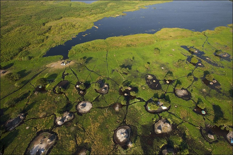
From the Air
The Sudd is centered around 8.00N, 31.00E in South Sudan and is visible from high altitude as a vast green wetland contrasting with surrounding brown savanna. The swamp extends roughly 500km south-north from Mongalla to Malakal. Look for the meandering channels of the White Nile and the partially excavated Jonglei Canal running north-south on the eastern edge. Key reference points include Bor (southern edge), Lake No (western junction), and Malakal (northern extent). Nearest airports include Juba (HSSJ) to the south and Malakal (HSSM) to the north. The wetland transforms dramatically between dry and wet seasons, expanding to cover up to 130,000 square kilometers during peak flooding.