Sugar Loaf Islands
When James Cook sailed past the west coast of the North Island on 11 January 1770, a cluster of rocky islets reminded him of the way Europeans stored sugar in conical heaps. He named them the Sugar Loaf Islands and moved on. But the Ngati Te Whiti iwi had known these rocks as Nga Motu for centuries, and every island, reef, and stack already carried a name. The islands are remnants of the oldest volcanic activity on the Taranaki peninsula, lava plugs dated to 1.75 million years ago. Taranaki Maunga, the snow-capped stratovolcano visible from these shores, is a relative newcomer by comparison, barely 200,000 years old.
Ancestors in Stone
The geology tells a story of volcanic migration. The Sugar Loaf Islands, along with the onshore pinnacle Paritutu (153 meters), are composed of porphyritic hornblende andesite, volcanic rock formed 1.75 million years ago. After this first phase of volcanism, the activity shifted southeast to the Kaitake Range 580,000 years ago, then further southeast to the Pouakai Range 230,000 years ago, and finally to Taranaki Maunga, which last erupted around 1755. The islands are the type locality of taranakite, a phosphate mineral that forms when bird guano reacts with the aluminium-rich rock. It was the first new mineral species discovered in New Zealand, born from the intersection of ancient geology and centuries of seabird habitation.
Oil, Dynamite, and a Power Station
Human ambition has reshaped these islands repeatedly. In 1865, the Alpha well was drilled near Mikotahi, a tidal island with a historic Maori pa. It was the first oil well in what is now the Commonwealth of Nations and one of the earliest in the world. In the early 20th century, Moturoa and Whareumu (Lion Rock) were blasted with explosives in an attempt to connect the islands to Mikotahi and the growing port. The plan was abandoned, but the explosions permanently altered the appearance of both islands. When the New Plymouth Power Station was built, earthworks for land reclamation reduced Mikotahi's size and connected it permanently to the mainland. A neighbouring stack called Fishing Rock, with its caves, rock pools, and surrounding beaches, was mostly destroyed for the cooling water inlet. What remains today is Mikotahi Point, a trig station on the ghost of an island.
Sanctuary in the Tasman
The islands became a marine park in 1986, and concern over oil exploration led to the Sugar Loaf Islands Marine Protected Area Act of 1991, covering 752.5 hectares of sea and 5.3 hectares of land. Four islands, Moturoa, Motumahanga, Waikaranga, and Whareumu, are classified as sanctuaries requiring a permit for entry. Reef herons, little blue penguins, New Zealand fur seals, and orca are among the monitored species. The islands sit on migration routes for oceanic birds, whales, and dolphins. In 2008, the adjacent 1,404-hectare Tapuae Marine Reserve was established, extending the protected zone southward to the Herekawe Stream. In 2013, the New Plymouth District Council unanimously voted to gift the protected area back to the government for Treaty of Waitangi settlement negotiations with the Taranaki and Te Ati Awa iwi.
Islands That Appear and Disappear
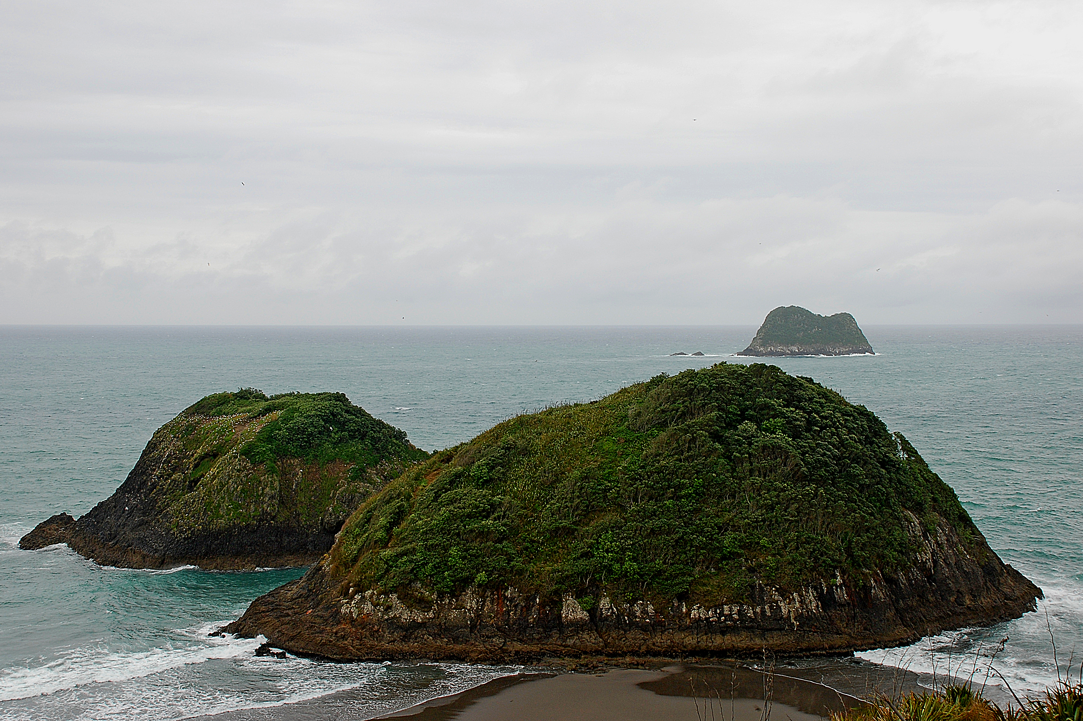
The inner islands play tricks with the tide. Mataora, known to settlers as Round Rock, connects to the mainland at low tide via a tombolo, a sand bridge that vanishes as the water rises. Motuotamatea, or Snapper Rock, does the same on very low spring tides. Pararaki, or Seagull Rock, sits just 20 meters from Mataora, separated by a narrow channel. The outer islands, Motumahanga (Saddleback Island) and Moturoa, the largest at approximately 1.4 hectares, remain permanently offshore. Motumahanga is the farthest from shore at roughly 1.5 kilometers. For hundreds of years, these islands served as hunting, fishing, and gathering grounds for the Taranaki and Te Ati Awa peoples, and as places of refuge. The Maori names persist alongside the English ones, each island carrying two identities like the coast itself.
From the Air
The Sugar Loaf Islands (Nga Motu) are located at 39.05S, 174.01E, immediately offshore from New Plymouth on the west coast of New Zealand's North Island. The cluster sits adjacent to Port Taranaki and is visible from low altitude as a series of dark rocky islets and sea stacks. Paritutu (153 m), the onshore pinnacle, is the most prominent landmark. New Plymouth Airport (NZNP) is approximately 8 km to the northeast. Taranaki Maunga (2,518 m) rises to the south. The marine protected area extends from Port Taranaki south to Herekawe Stream. Approach from the west over the Tasman Sea for the best view of the islands against the volcanic coastline.