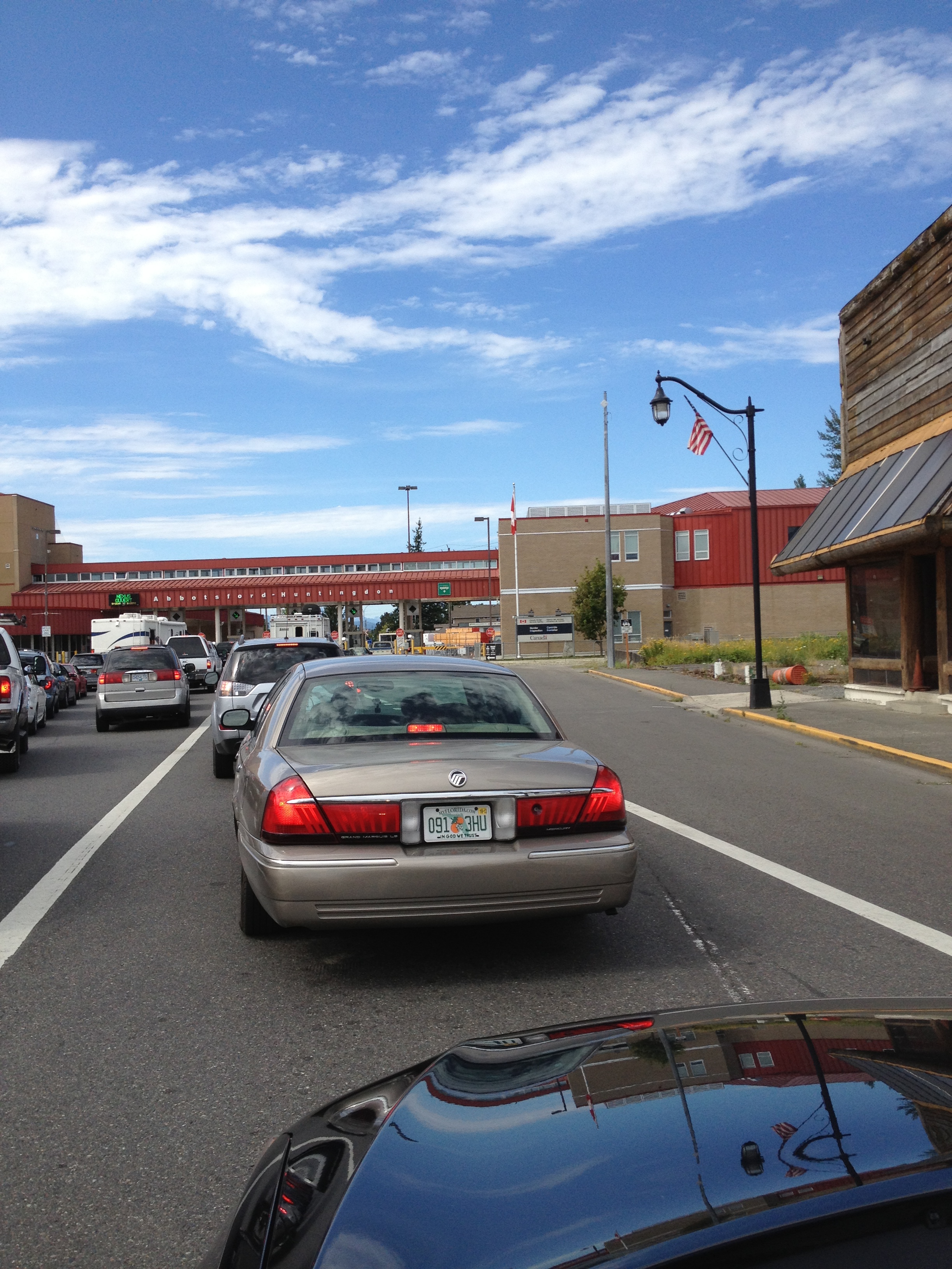
Sumas
Cherry Street runs eight blocks from the south edge of town to the international border, where Canadian customs officers check the traffic that backs up when the crossing gets busy. Sumas may be the smallest border town in Washington, but its position matters - this is a major crossing between Whatcom County and British Columbia's Fraser Valley, and Canadians stream south for cheaper gas, dairy, and packages shipped to American addresses. The town of 1,500 exists because the border exists, its gas stations and shipping services serving a clientele that mostly lives elsewhere. It's also, due to surveying errors when the 49th parallel was marked, actually north of the supposed border in some places - the northernmost incorporated community in the contiguous United States.
Border Economics
The gas stations tell the story. Sumas has more of them than a town of 1,500 could possibly support from local demand, their pumps busy with Canadian vehicles fueling up on American prices. The price differential fluctuates with currency exchange and tax policy, but American fuel has historically been substantially cheaper, making the short drive from Abbotsford or Chilliwack worthwhile for Canadians who cross regularly.
Beyond gas, the cross-border commerce extends to dairy, eggs, and alcohol - products that Canadian taxes make significantly more expensive north of the line. Shipping services let Canadian customers receive American packages without paying international shipping or customs duties, their deliveries waiting in Sumas storefronts for pickup. The businesses adapt to both currencies, their cash registers holding separate drawers for American and Canadian bills, exchange rates posted and sometimes unfavorable depending on who's doing the converting.
North of 49
The 49th parallel is supposed to mark the border from the Pacific to Lake of the Woods, a straight line of international separation. But surveying in the 1850s wasn't perfectly precise, and the monuments that actually mark the boundary meander slightly. In Sumas, the deviation works in America's favor - much of the town sits north of 49 degrees latitude, technically in Canada if the mathematical line prevailed over the actual markers.
This quirk makes Sumas the northernmost incorporated community in the lower 48 states, a piece of trivia that visitors can verify with a GPS. The practical difference is nil - the legal border follows the monuments, not the parallel - but it adds a layer of geographic curiosity to a town that might otherwise be just another small community in the Nooksack River valley. The Cascade foothills rise to the east; the flat Fraser Valley spreads north into Canada.
Small Town Border
Sumas feels different from the larger crossings at Blaine or Peace Arch. The scale is smaller, the wait times often shorter, the atmosphere more casual - though the US Homeland Security presence is unmistakable, cameras watching the streets of a town small enough that everyone knows everyone. The policing effect is unintended but real; serious crime is rare when federal agents are always nearby.
The downside is traffic. Cherry Street leads directly to the crossing, and when border waits extend, stopped cars clog the town's main artery. The varied speed limits - low throughout town - create additional friction, local police enforcing limits that strike some drivers as revenue generation. It's the price of position: a town that exists because of the border must accommodate the inconveniences that the border brings.
Gateway Community
Beyond the gas stations and shipping services, Sumas serves as a gateway for travelers in both directions. The crossing connects to Highway 11 on the Canadian side, leading to Abbotsford's services and the Trans-Canada Highway beyond. From the American side, Highway 9 runs south through Whatcom County farmland toward Bellingham, connecting to Interstate 5 and the rest of the Pacific Northwest transportation network.
The fairgrounds on the south edge of town host rodeo and community events, reminders that Sumas has a life beyond border commerce. The library offers WiFi; the restaurants serve both American travelers heading north and Canadians heading south. It's a functional community, shaped by its position but not entirely defined by it - a place where geography created opportunity and opportunity created a town that straddles an international seam.
From the Air
Located at 49.00N, 122.27W in Whatcom County, Washington, at the US-Canada border. The Sumas-Huntingdon border crossing is visible as the international boundary bisects the urbanized area. Cherry Street runs north-south through town to the crossing. The Nooksack River valley spreads to the south and west; the Cascade foothills rise to the east. Abbotsford, BC is visible to the north. Bellingham is approximately 25 miles south. Mount Baker is visible to the east on clear days. The town sits in flat agricultural land characteristic of the Fraser-Nooksack lowland.