Sumidero Canyon: The Chasm That Swallowed Explorers
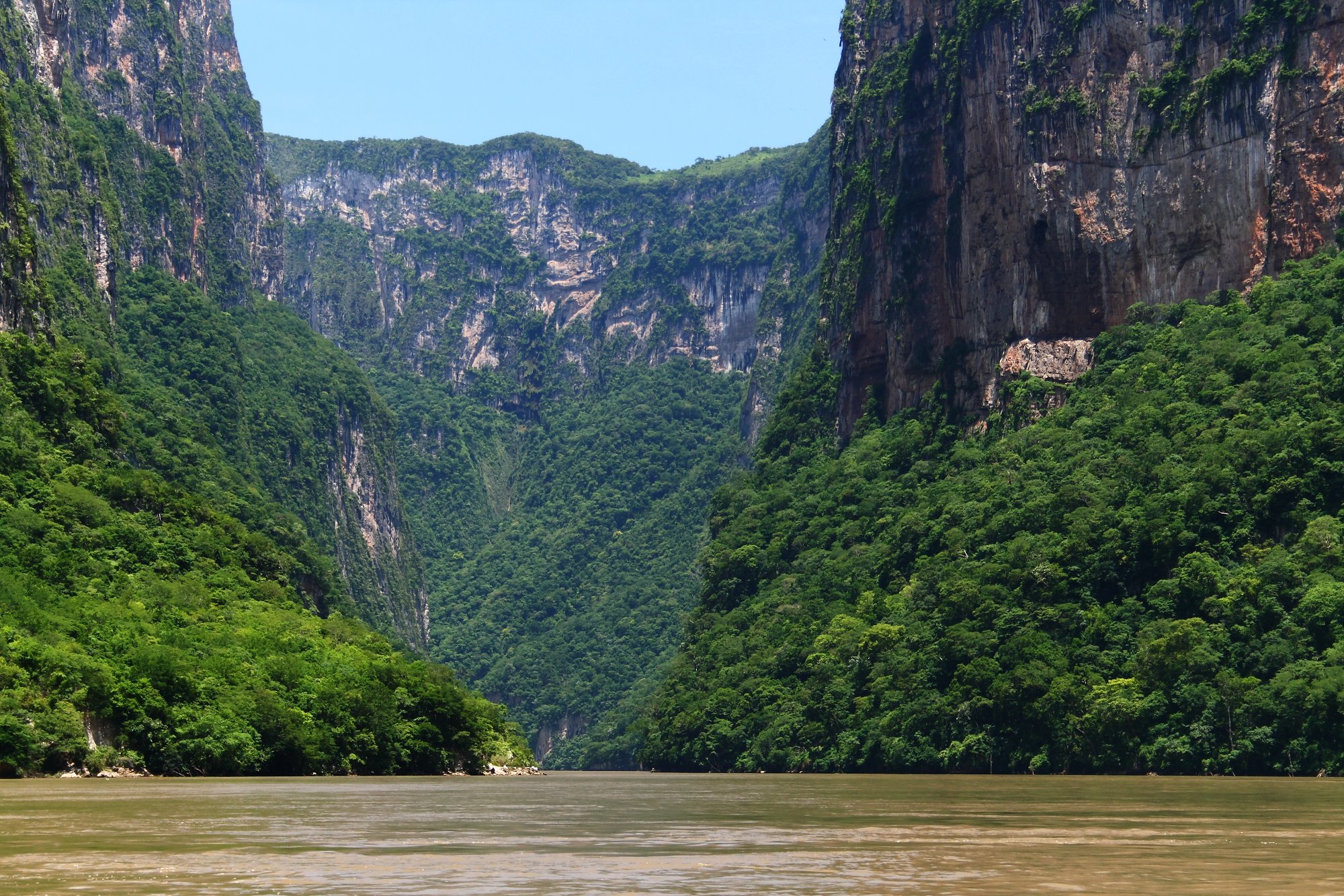
In 1895, three Frenchmen entered Sumidero Canyon by boat. They drowned. In 1932, an American attempted the same passage. He too perished. The locals were not surprised. Legends had long warned of the canyon's dangers - its crocodiles, its currents, its reputation for consuming those who ventured in uninvited. It took until 1960 for anyone to successfully navigate the full length, when a detachment of Mexican soldiers nicknamed the "red handkerchiefs" managed the twenty-kilometer crossing. What they found was a gash in the earth so deep and narrow that sunlight reaches the river only at midday: walls of limestone rising 1,000 meters, the Grijalva River making ninety-degree turns through a passage just thirteen kilometers long, and a geological history stretching back 35 million years - roughly contemporary with the Grand Canyon.
Thirty-Five Million Years of Splitting Rock
The canyon began forming when cracks in the Earth's crust met the relentless erosive force of the Grijalva River. The exposed walls tell the story in layers: limestone from the Upper Mesozoic containing fossils of marine creatures, evidence of a time when this highland landscape lay beneath an ancient sea. During the Mesocretaceous Period, the ocean floor elevated to form the mountains of the region, and the Grijalva began cutting its path through them. Seasonal streams cascade down the canyon walls as waterfalls, while underground water movements have carved caves and karst formations into the rock. In one small cave, a stalactite shaped like a seahorse - the Caballito de Mar - has become one of the canyon's most photographed features. American crocodiles still sun themselves on the riverbanks below, living remnants of a wilder era. The surrounding Sumidero Canyon National Park encompasses 21,789 hectares of mostly deciduous rainforest, with pockets of pine-oak forest at higher elevations.
The Chiapa's Last Defiance
The indigenous Chiapa people controlled the Central Valley before the Spanish arrived. Their origins remain debated - some theories trace their migration from as far south as Nicaragua or Paraguay - but their main settlement was at Chiapa de Corzo, near the canyon's southern entrance. When Diego de Mazariegos arrived in 1528 to claim the region for Spain, the Chiapa fought back with a ferocity that delayed conquest for years. Their last refuge was a fortified position high in the canyon walls, now known as the Ruins of Berlin, where they held out from 1528 to 1535 after the Spanish seized the lowland city. According to legend, when this final stronghold fell, the remaining Chiapa chose collective suicide over submission, throwing themselves from the canyon rim into the abyss below. Whether literal or mythologized, the story has defined the canyon's identity for nearly five centuries. Since the fall of the Chiapa, the canyon has served as the boundary between the Zoque and Tzotzil peoples.
A Dam That Powers a Nation
At the canyon's northern end sits the Chicoasen Dam - formally the Manuel M. Torres Dam - constructed between 1974 and 1980. Its reservoir covers approximately 2,193 hectares and employs about 600 workers. The dam's hydroelectric station is among Mexico's most productive, with thirty generators producing an installed capacity of 3,928 megawatts. That figure represents just over thirty percent of all hydroelectric energy generated in the country. The dam manages the flow of not just the Grijalva but also the Hondo River and several converging streams that form the Osumacinta River. The reservoir is considered one of Mexico's most strategically important water storage facilities. It also marks the northern boundary of the Sumidero Canyon National Park, with the Belisario Dominguez Bridge - carrying the Pan-American Highway - defining the park's southern edge.
Beauty and Twelve Tons of Garbage a Day
Sumidero Canyon is the second most visited tourist site in Chiapas. Boats depart from docks at Chiapa de Corzo, threading through the narrow passage while guides offer environmental, historical, and cultural commentary. But the canyon's popularity cannot mask a growing crisis. Up to 5,000 tons of solid waste are extracted from the Grijalva River each year, and workers with CONANP and the Chiapas tourism secretariat pull twelve tons of garbage from the river daily. The canyon's narrowness acts as a funnel, trapping refuse that washes downstream from Tuxtla Gutierrez and Chiapa de Corzo - plastic containers, raw sewage carried by the Sabinal River, and logging debris that accounts for 80 to 90 percent of the solid waste. The Chicoasen Dam prevents the debris from passing through, creating accumulations that require year-round cleanup efforts involving up to 600 people and 32 boats. The canyon endures, as it has for 35 million years. But what it must now endure includes the carelessness of the cities at its doorstep.
From the Air
Located at 16.85N, 93.11W, just north of the city of Chiapa de Corzo in southern Chiapas. The canyon is unmistakable from the air: a deep, narrow gash running roughly south to north through limestone highlands, with the Grijalva River visible at its base. The Chicoasen Dam and reservoir mark the northern terminus. The Belisario Dominguez Bridge (Pan-American Highway) crosses the canyon's southern end. Nearest airport: Angel Albino Corzo International Airport (MMTG/TGZ), approximately 35 km south of Tuxtla Gutierrez. Best viewed at 5,000-8,000 feet AGL, where the full depth of the 1,000-meter walls becomes apparent. The contrast between the green canyon rim and the dark river passage below is striking.