Sunset Crater
In 1928, the Famous Players-Lasky Corporation planned to blow up the side of a volcano. The Hollywood studio wanted a real avalanche for a Zane Grey western, and Sunset Crater - a rust-and-charcoal cinder cone rising north of Flagstaff, Arizona - looked like the perfect expendable backdrop. Public outrage stopped the explosives, and two years later President Herbert Hoover proclaimed the crater a national monument. It was an early lesson in what happens when spectacle collides with geology: the mountain that Hollywood wanted to destroy for a forgettable film turned out to be the youngest volcano in a field of six hundred, a place where the earth last split open less than a thousand years ago.
The Night the Earth Opened
Around AD 1085, a fissure tore open the landscape northeast of what is now Flagstaff. The eruption that followed reached a Volcanic Explosivity Index of 4 - Sub-Plinian in scale - sending an eruption column 20 to 30 kilometers into the sky. Lava poured from the largest vent in two directions: the Bonito flow pushed northwest and the Kana-a flow ran northeast. Additional vents along a fissure extending to the southeast threw up small spatter ramparts. The eruption ejected 0.52 cubic kilometers of material and blanketed the surrounding landscape with ash and lapilli - volcanic fragments the size of walnuts. The Sinagua people, who had farmed the region for generations, abandoned their settlements as the sky rained hot rock. Tree-ring dating initially placed the eruption between AD 1064 and 1065, but more recent geological and archaeological evidence has pushed the date forward to around AD 1085.
Fire and Ice at the Base
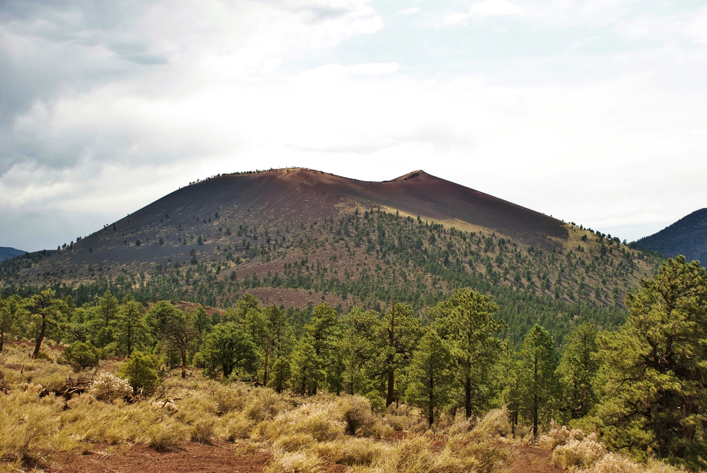
The Bonito Lava Flow sprawls across the base of Sunset Crater like a black, frozen river. Walk the trail that skirts its edge and the hardened lava looks startlingly fresh - jet-black rock that devastated the forest in its path and has barely weathered in nine centuries. The flow also created an ice cave, a lava tube where temperatures stayed cold enough to preserve ice year-round, though a partial collapse has closed it to the public. The crater itself rises as a textbook cinder cone, the youngest in the San Francisco volcanic field - a chain of roughly 600 volcanoes stretching across northern Arizona, all related to the towering San Francisco Peaks nearby. The cone's rim is stained with oxidized minerals that glow red and orange at sunset, the feature that gave the crater its name. Hikers once climbed to the top, but the National Park Service closed the summit trail in 1973 after foot traffic caused severe erosion on the loose cinder slopes. A one-mile loop trail at the base remains open.
A Volcano's Afterlife
Sunset Crater Volcano National Monument is managed by the National Park Service alongside nearby Wupatki National Monument, the two sites connected by a scenic loop road. A visitor center near the park entrance on U.S. Highway 89 introduces the volcanic geology of the region. In April 2022, the Tunnel Fire swept through the monument in its entirety, though the visitor center was spared. By December of that year, 98 acres including the visitor center and administrative facilities were transferred from Coconino National Forest to the national monument, expanding its formal boundaries. The crater made unexpected headlines in June 2015, when a website with satellite imagery reported steam rising from the cone, sparking brief fears of a new eruption. The culprit turned out to be a forest fire, and geologists confirmed what the science already showed: Sunset Crater is extinct. The earth will not open here again. But what it left behind - a black lava field, a rust-colored cone, and a landscape still recovering after nearly a millennium - remains one of the most vivid reminders in the American Southwest that the ground beneath our feet is never quite as permanent as it seems.
From the Air
Sunset Crater sits at 35.3644N, 111.5036W, approximately 15 miles north-northeast of Flagstaff, Arizona, along US Highway 89. The cinder cone rises to about 8,042 feet MSL and is unmistakable from the air - a dark, symmetrical cone with oxidized red-orange coloring on its rim, surrounded by the black Bonito Lava Flow. The San Francisco Peaks (Humphreys Peak at 12,633 feet) dominate the skyline to the southwest. Nearest airport: Flagstaff Pulliam Airport (KFLG), approximately 18 nm to the south-southwest. The monument is part of the San Francisco volcanic field; expect terrain rising well above 7,000 feet with associated density altitude concerns in summer. The scenic loop road connecting Sunset Crater and Wupatki National Monument is visible from altitude.