Superior Hiking Trail
In 1995, Paul Hlina became the first person to thru-hike the Superior Hiking Trail. He did it on crutches. Paralyzed from the waist down, Hlina hauled himself across ridgelines of billion-year-old volcanic rock, through forests of birch and balsam fir, past waterfalls that tumble over basalt ledges into the largest freshwater lake on Earth. He raised $16,000 in pledges for the trail association along the way. His journey captured something essential about this footpath: the Superior Hiking Trail demands effort, rewards stubbornness, and belongs to anyone willing to put one foot in front of the other across 310 miles of Minnesota's North Shore.
A Trail Built on Borrowed Inspiration
The idea was straightforward and audacious: build an Appalachian Trail for the upper Midwest. In 1986, a group of hikers formed the Superior Hiking Trail Association to turn that vision into dirt and stone. Construction began the following year, celebrated with a log-cutting ceremony at Britton Peak attended by state officials and trail founders. Grants from the Legislative Commission on Minnesota Resources funded the first years of building. By August 1990, the halfway mark earned another celebration -- a multi-day hike completed by about a dozen brave souls in 12 days. Construction continued for three decades. In 2016, the trail finally became a continuous footpath from the Minnesota-Wisconsin border to the 270 Degree Overlook near the Canadian border. The Superior Hiking Trail is now part of the North Country National Scenic Trail, a route stretching from North Dakota to Vermont.
Two Trails in One
The trail divides naturally into two distinct sections. The Duluth section covers roughly 50 miles, winding through Jay Cooke State Park, the Spirit Mountain Recreation Area, Enger Park, the historic downtown, and Canal Park before ending at a trailhead on Martin Road. This urban-to-wild stretch suits day hikers, with only one backcountry campsite near the Wisconsin border. The North Shore section is where the trail becomes something else entirely. Stretching approximately 260 miles northeast from Duluth, it passes through seven state parks -- Gooseberry Falls, Split Rock Lighthouse, and Tettegouche among them -- before ending near the towns of Lutsen and Grand Marais at the Canadian border. Northbound hikers accumulate 37,800 feet of elevation gain across this section, roughly equivalent to climbing from sea level to the summit of Everest and partway back up again. The trail association maintains 93 backcountry campsites along this stretch, all fee-free.
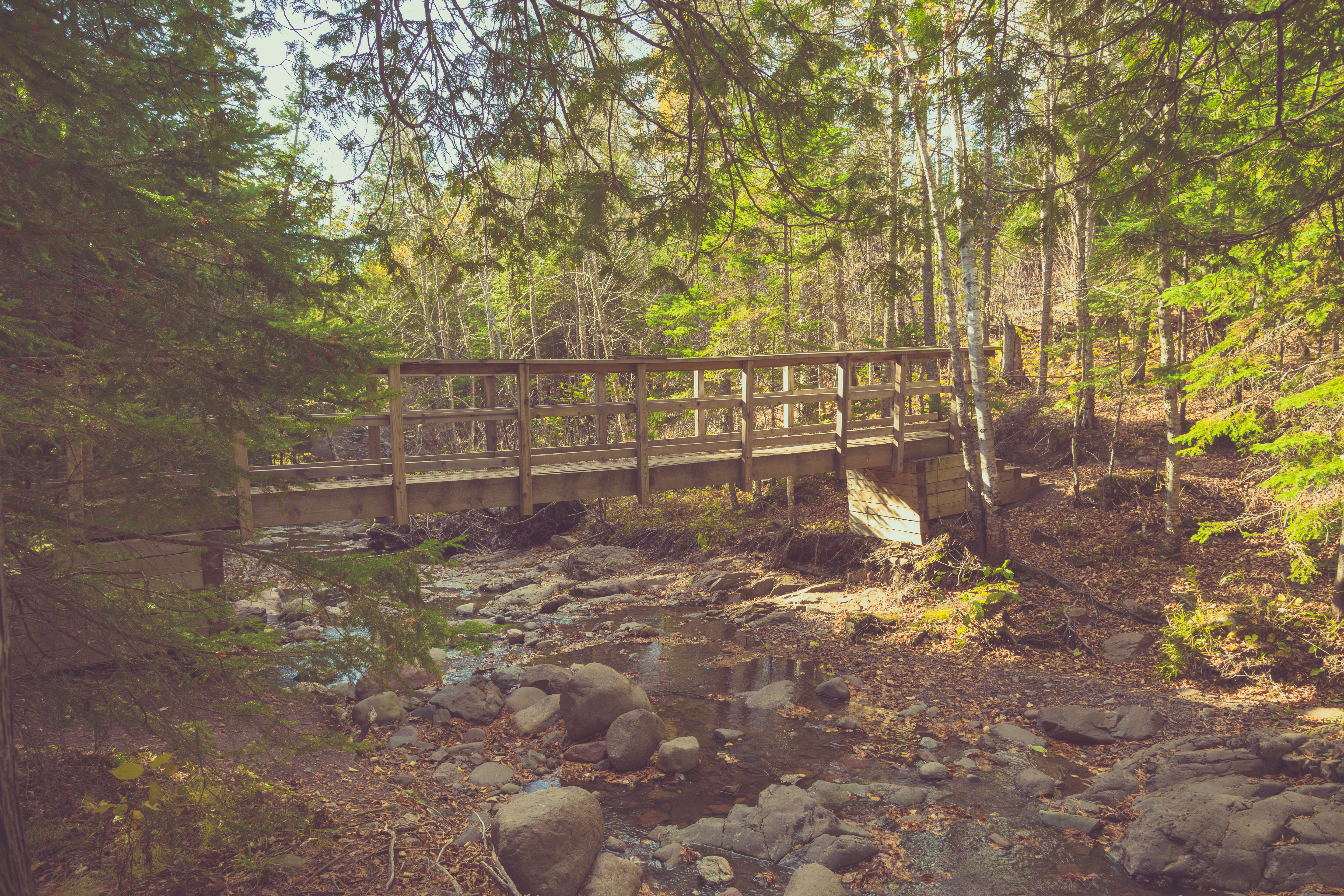
Ridgeline and Ruin
What makes the Superior Hiking Trail singular is its geology. The path follows the Sawtooth Mountains, a chain of ridges formed by ancient lava flows tilted and eroded into jagged profiles. From these ridgelines, hikers look down over Lake Superior, which stretches to the horizon like an inland sea. The lake moderates temperatures along the trail, creating a microclimate where boreal forests of spruce and fir mingle with hardwoods of birch and aspen. Streams cascade off the ridgeline toward the shore, carving gorges through basalt and rhyolite. The trail crosses dozens of these waterways, each with its own character -- from babbling brooks in midsummer to roaring torrents during spring snowmelt. Wildlife encounters are common: moose, black bear, timber wolves, and the occasional lynx inhabit these forests. In autumn, the hillsides ignite with color, and the contrast of red maple against dark Superior water draws hikers from across the country.
America's Underrated Classic
In 2005, Reader's Digest named the Superior Hiking Trail one of the five best hikes in America. A decade later, The Guardian listed it among the top ten long-distance hiking trails in the United States. Backpacker Andrew Skurka, who has logged thousands of miles on trails worldwide, ranks it among his ten favorite American hikes. Yet the SHT remains less crowded than its famous counterparts. While the Appalachian Trail sees millions of visitors annually and thru-hikers must compete for shelter space, the Superior Hiking Trail offers solitude. Its 94 backcountry campsites operate on a first-come basis with no permits or fees -- a philosophy that reflects the trail's community roots. The Superior Hiking Trail Association, still the trail's primary steward, relies on volunteers and donations to maintain every mile. Annual trail races, including ultramarathons, draw competitive runners to test themselves against the terrain. But the trail's deeper appeal is simpler: 310 miles of forest and rock and water, no motorized vehicles, no mountain bikes, no horses. Just the footpath and the lake.
From the Air
Located along Minnesota's North Shore, centered approximately at 47.57°N, 90.84°W. The trail extends roughly 310 miles from the Wisconsin border southwest of Duluth northeast to near the Canadian border. From the air, the Sawtooth Mountains ridgeline is visible paralleling the Lake Superior shoreline. Key visual references include Split Rock Lighthouse, Gooseberry Falls, and the town of Grand Marais. Duluth International Airport (KDLH) serves the southern end; Grand Marais/Cook County Airport (KCKC) serves the northern section. Sky Harbor Airport (KDYT) in Duluth is another option. Best viewed from 3,000-6,000 feet AGL following the shoreline northeast from Duluth, where the contrast between dark boreal forest, exposed ridgeline, and the lake creates a dramatic landscape.