Suruga Bay: Where Fuji Meets the Abyss
The pollution was so bad it spawned a monster. In 1971, Toho Studios released Godzilla vs. Hedorah, featuring a creature whose name derived from hedoro -- the Japanese word for sludge. The fictional beast fed on the heavy industrial contamination choking Suruga Bay. The real bay needed no exaggeration. By 1970, the small city of Fuji, population 180,000, was dumping wastewater equivalent to the daily sewage of nine-million-strong Tokyo into these waters, its paper mills pouring sulphur-laden sludge so thick it threatened to block the harbor entirely. That this ecological disaster was playing out in what is simultaneously Japan's deepest bay and the front yard of Mount Fuji -- the nation's most sacred peak -- makes Suruga Bay one of the most dramatic contradictions on the Pacific coast.
The Deepest Water Beneath the Highest Peak
Geography does not get more theatrical than this. Mount Fuji, Japan's loftiest peak, rises from the northern shore of Suruga Bay. Directly below the water's surface, the Suruga Trough plunges to extraordinary depths, making this the deepest bay in Japan. The contrast is staggering: from summit to seafloor, the vertical distance spans thousands of meters in a remarkably short horizontal span. This depth is no accident. Suruga Bay was carved by the relentless subduction of the Philippine Sea Plate grinding beneath the Eurasian Plate, a process that continues today and makes the bay a significant source of seismic activity. The trough runs straight up the bay's center like a spine, giving the waters a geological character unlike any other bay in Japan.
A Bay of Two Coasts
Suruga Bay's western and eastern shores could belong to different countries. On the west, from Shizuoka to Numazu, sandy beaches stretch along the coast at places like Yuigahama and Tagonoura. Major rivers -- the Fuji, the Oi, and the Abe -- empty into this side, carving submarine canyons into the seabed and dumping sediment that creates complex underwater terrain. The eastern coast tells a different story. From Numazu south along the Izu Peninsula to Irozaki Point, the shoreline turns rocky and dramatic. Only the Kano River feeds this side, emptying into a sheltered pocket called Uchiura-wan where the Izu Peninsula connects to Honshu. The water here runs clearer, the seabed flatter, interrupted only by small rocky islands, some connected to the mainland by tombolos -- narrow sand bridges that appear and disappear with the tides. The Izu Peninsula shields the entire bay from the open Pacific, creating conditions ideal for fishing, sailing, and deep-sea research.
Senoumi and the Fishermen's Bounty
At the bay's southwestern end sits Senoumi, an undersea plateau long celebrated as one of the richest fishing grounds in the region. The combination of depth, tectonic upwelling, and nutrient-rich river runoff creates an ecosystem that sustains remarkable marine diversity. Fishermen have worked these waters for centuries, hauling in catches that feed the markets of Shizuoka and beyond. The bay's open connection to the Philippine Sea and the Pacific Ocean to the south brings deep-ocean currents and migratory species into contact with the shallow-water communities near shore. Researchers have used Suruga Bay as a natural laboratory for studying deep-sea organisms, drawn by the rare accessibility of extreme depth so close to the coastline. Few places on Earth offer scientists the chance to study abyssal life just a short boat ride from a major city.
The Monster in the Mud
Japan's postwar industrial boom hit Suruga Bay hard. Paper mills in the city of Fuji became the worst offenders, their output so prodigious that the small city's wastewater matched Tokyo's daily sewage volume. The sulphur-laden sludge accumulated in the harbor, threatening to physically block shipping channels and requiring dredging operations that further damaged marine ecosystems. Local citizens and fishermen organized protests, pressuring the government to regulate industrial discharge. Regulations followed, but the damage ran deep. Surveys of marine life conducted in the mid-2010s continued to find intense contamination by PCBs and PBDEs -- persistent organic pollutants that accumulate in the food chain. The bay's infamy reached popular culture when Godzilla vs. Hedorah dramatized the pollution in 1971. The creature Hedorah, feeding on industrial waste, became a metaphor that resonated precisely because it barely needed to stretch the truth.
Hiroshige's View, Still Waiting
The great ukiyo-e artist Hiroshige immortalized Suruga Bay in his woodblock print The Sea off Satta, Suruga, capturing the dramatic view of waves, pines, and Mount Fuji that had captivated Japanese artists for centuries. That view still exists. From the Satta Pass on the bay's western shore, Fuji rises beyond the water exactly as Hiroshige rendered it. The Tomei Expressway now connects Suruga Bay to Tokyo in two to five hours via Numazu, and the bay's coastline hosts cities, ports, and industrial zones. But the fundamental drama of the place persists: the deepest water in Japan lying at the foot of the highest mountain, tectonic plates grinding beneath the surface, submarine canyons dropping away into darkness just offshore. Suruga Bay remains a place where the Earth's violence and beauty occupy the same frame.
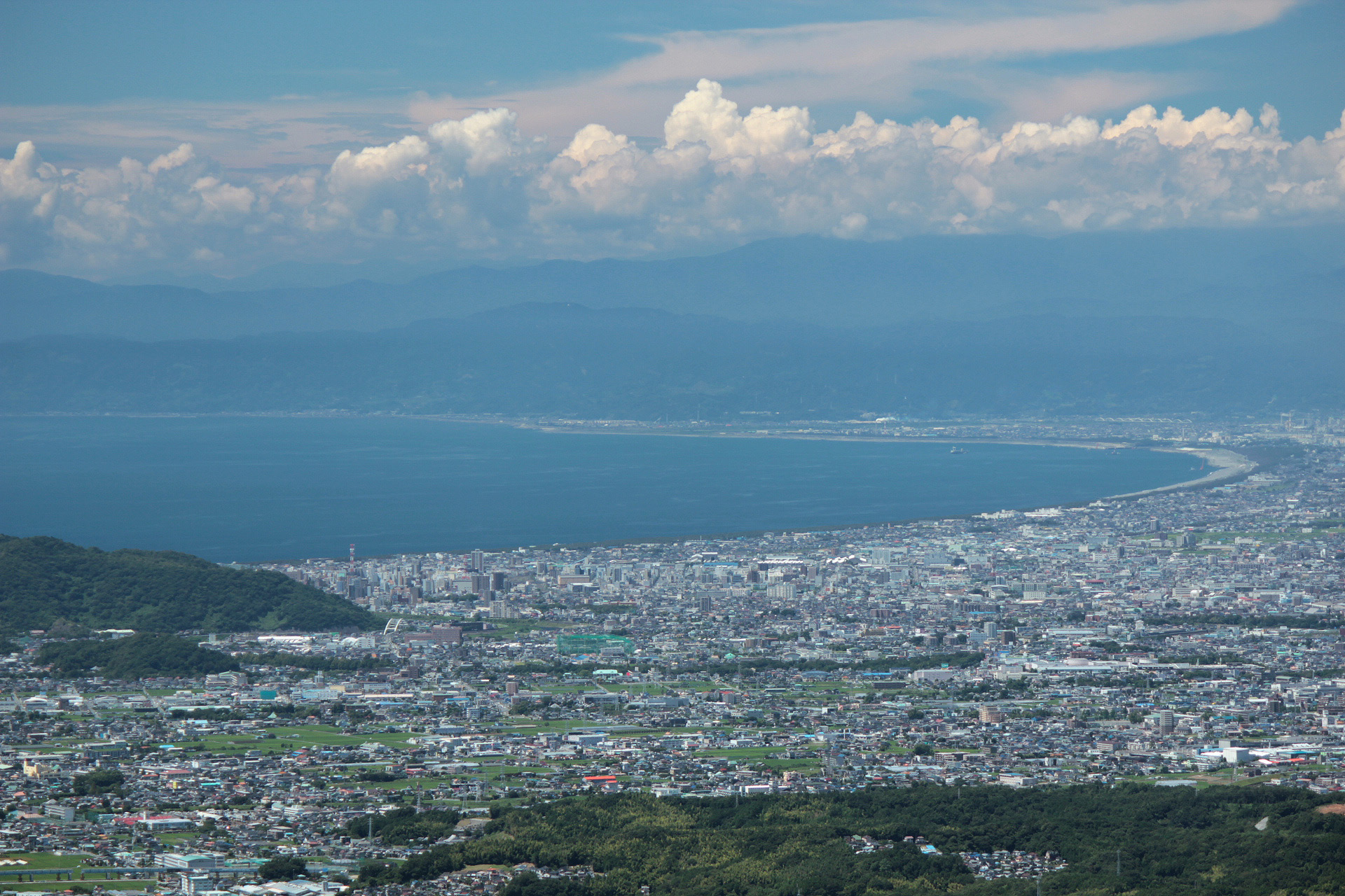
From the Air
Located at 34.85N, 138.55E on the Pacific coast of Honshu, Shizuoka Prefecture. The bay is bounded by Omaezaki Point to the southwest and Irozaki Point at the southern tip of the Izu Peninsula to the southeast. Mount Fuji dominates the northern horizon. From altitude, the bay's crescent shape is clearly visible, with the Izu Peninsula forming the eastern arm. Best viewed at 5,000-10,000 feet AGL for the full Fuji-to-bay panorama. Mt. Fuji Shizuoka Airport (RJNS) sits on the western shore. Shimizu Port and the city of Numazu are visible along the northern coast.