Tomei Expressway
Take the first character of Tokyo. Take the first character of Nagoya. Put them together and you get Tomei -- a name that is itself a compression of distance, a shorthand for the 346 kilometers of asphalt connecting Japan's two largest economic engines. The Tomei Expressway, designated E1, opened its first sections in 1968 and was completed in 1969, an act of national ambition that stitched together the industrial heart of Honshu in a single ribbon of highway. More than half a century later, some stretches carry over 100,000 vehicles a day, making the Tomei the most heavily traveled road operated by Central Nippon Expressway Company and one of the busiest corridors in Asia.
Following the Old Road
The Tomei does not blaze a new path so much as modernize an ancient one. Its route parallels the historic Tokaido, the great coastal highway that connected Edo to Kyoto during the shogunate era. For centuries, feudal lords and their retinues, merchants, pilgrims, and poets walked the Tokaido's fifty-three post stations, immortalized in Hiroshige's famous ukiyo-e woodblock prints. The expressway traces much of the same geography -- departing western Tokyo, cutting through Kanagawa Prefecture north of Yokohama, and sweeping west into Shizuoka Prefecture past the unmistakable silhouette of Mount Fuji. Where the old road hugged the coastline, the expressway follows the curve of Suruga Bay, one of the deepest bays in Japan, before climbing inland through tea country toward Nagoya. It is a corridor that has carried Japanese commerce and culture for over four hundred years; only the speed has changed.
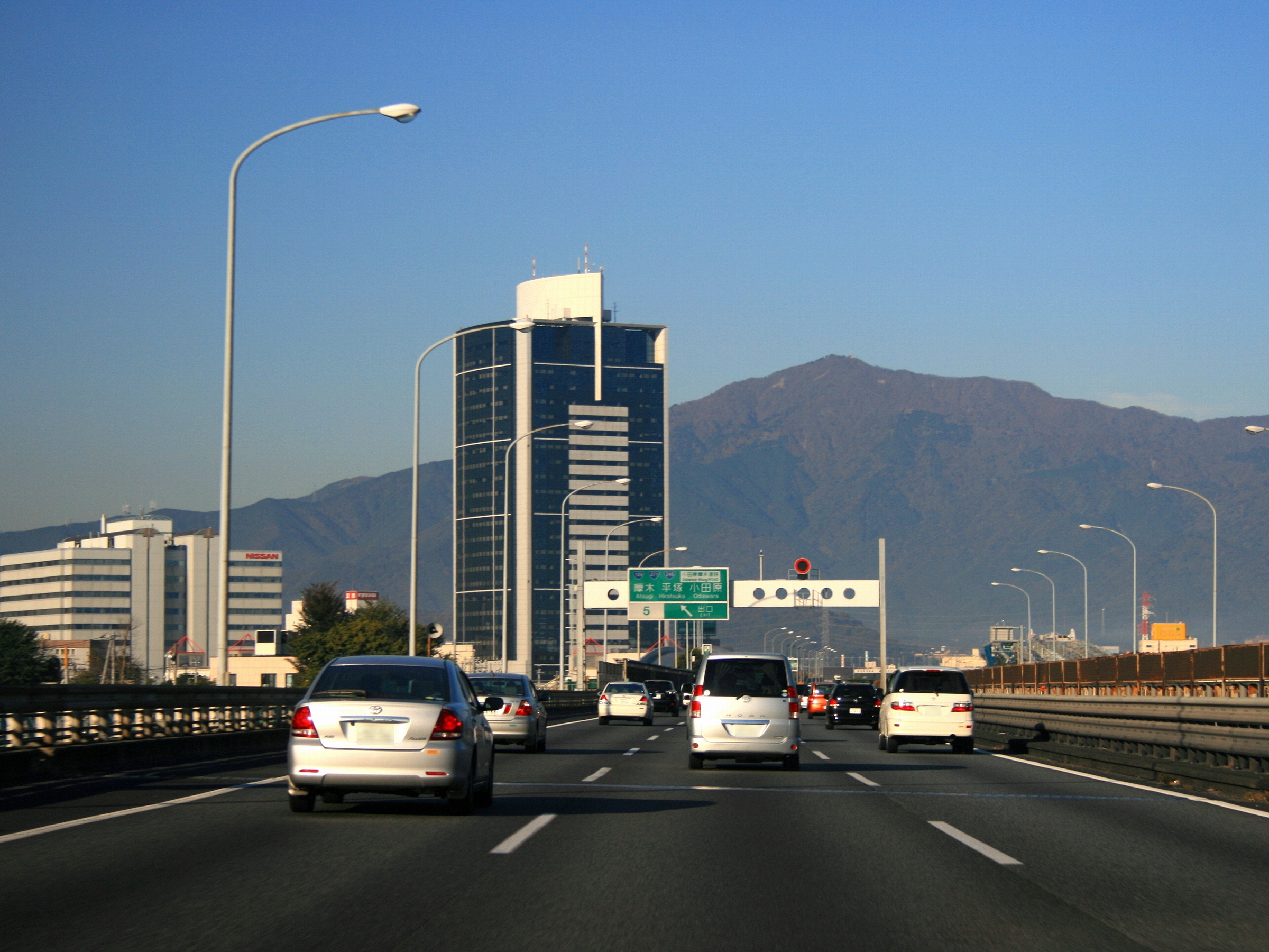
The View from the Windshield
Few expressways anywhere in the world offer the Tomei's range of scenery. The journey begins in the dense urban fabric of Tokyo, threads through the suburban sprawl of Kanagawa, and then opens up dramatically as Mount Fuji rises to the north -- its snow-capped cone visible on clear days as a fixed landmark that seems to rotate slowly as you pass. South of the mountain, the road skirts the Pacific coast along Suruga Bay, where the ocean appears between gaps in the guardrails. Lake Hamana, a brackish lagoon famous for its eel farms, marks the transition into Aichi Prefecture. The final stretch runs northwest past the industrial outskirts of Nagoya before terminating at Komaki, where the roadway continues seamlessly as the Meishin Expressway toward Kyoto, Osaka, and Kobe. Service areas along the route are destinations in themselves -- rest stops with regional food stalls, hot-spring foot baths, and observation decks oriented toward Fuji.
Congestion and the Parallel Solution
The Tomei's success created its own crisis. By the 1990s, chronic congestion plagued key sections, particularly between Tokyo and the Shizuoka coast, where holiday traffic and daily freight formed bottlenecks measured in hours rather than minutes. The government's answer was not to widen the Tomei but to build an entirely new expressway alongside it. The Shin-Tomei Expressway -- 'New Tomei' -- runs parallel on a slightly inland route, designed with gentler curves and wider lanes to handle modern traffic volumes. Sections of the Shin-Tomei have been opening in stages, and the two roads now function as a paired system. On the original Tomei, stretches that once carried two lanes in each direction have been reconfigured: a new parallel roadway handles three lanes in one direction while the original four lanes are converted for opposing traffic. It is infrastructure solving infrastructure, a distinctly Japanese approach to a problem that most countries would address by simply adding lanes.
An Asian Artery
The Tomei is more than a domestic highway. It forms part of the Asian Highway Network, the international road system coordinated by the United Nations Economic and Social Commission for Asia and the Pacific. Specifically, it carries the designation AH1, a route that -- on paper, at least -- stretches from Tokyo all the way to the border of Turkey and Bulgaria, connecting the eastern and western edges of the Asian continent. In practice, the Tomei's significance is closer to home. It is the spine of the Tokaido Megalopolis, the industrial corridor between Tokyo and Osaka that generates a disproportionate share of Japan's GDP. Trucks carrying parts from Toyota's factories in Aichi, shipping containers bound for Yokohama's port, and commuters bridging the gaps between satellite cities all share the same six lanes. The expressway does not just connect two cities. It connects the economic logic of modern Japan.
From the Air
The Tomei Expressway originates near 35.594N, 139.573E in western Tokyo and runs approximately 346 km southwest to Komaki, north of Nagoya. From the air, it is one of the most prominent linear features across the Kanto and Tokai regions of Honshu. The highway is clearly visible as a major divided roadway running roughly parallel to the Pacific coast. Key aerial landmarks along the route include Mount Fuji (visible to the north near Gotemba), Suruga Bay's coastline, and Lake Hamana near the Aichi border. Nearest airports to the Tokyo terminus: Haneda (RJTT) approximately 10 nm southeast, Narita (RJAA) approximately 38 nm east. Chofu Airport (RJTF) is closer at about 5 nm northeast. Best viewed at 5,000-10,000 feet AGL to appreciate the full corridor.