Tafi del Valle
The Cacán-speaking people who first settled here called it Taktikllakta -- "Town of the Magnificent Entrance" -- and the name was not hyperbole. Provincial Route 307 climbs through the Quebrada de los Sosa nature reserve, threading dense subtropical forest before emerging, almost without warning, into a vast valley cradled between the Sierra del Aconquija to the south and the Cumbres Calchaquíes to the north. The Spaniards, unable to pronounce the original name, shortened it to Tafí. But the entrance remains magnificent.
Stones That Remember
Human presence in the Tafí valley stretches back more than 7,000 years, but the most striking evidence of its ancient inhabitants stands in the Parque de los Menhires near the village of El Mollar. Dozens of carved monoliths, shaped by the people of the Tafí culture some 2,300 years ago, rise from the ground like sentinels. Some still bear visible carvings -- faces, geometric patterns, forms that archaeologists interpret as phallic symbols of fertility. Originally scattered across the valley at their creators' chosen sites, they were relocated during the 1970s under controversial governor Antonio Domingo Bussi, ostensibly to protect them from damage. Whether concentration preserved or diminished their meaning depends on whom you ask. What is certain is that they remain among the oldest sculptural traditions in Argentina, and standing among them, with the Andes filling the horizon, the weight of deep time is palpable.
Where the World Splits in Two
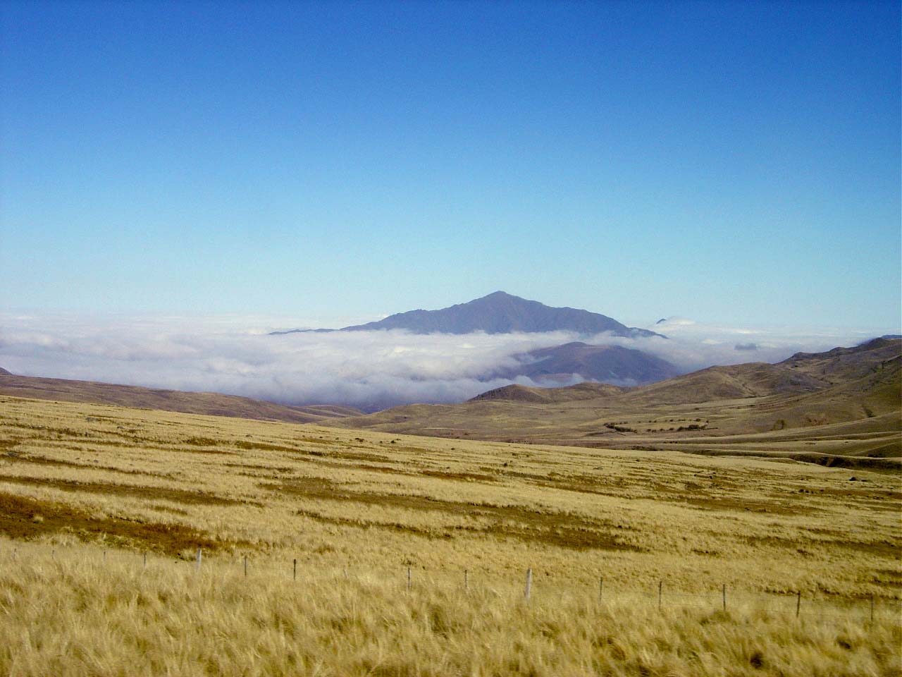
At Abra del Infiernillo, the pass northwest of town, the landscape performs an act of geographic theater. Step to the east and you look down on grasslands, groves of pepper trees, and cloud forest dripping with moisture. Step to the west and the earth turns to semidesert, studded with towering cardón cacti and bleached rock. The contrast is so abrupt it feels like peering into two different continents from a single ridgeline. This ecological divide defines the valley's character. The eastern side, where the town sits at roughly 2,000 meters, enjoys a temperate climate with summer highs around 26 degrees Celsius and winter lows that can plunge to minus 20. Snowfall dusts the surrounding peaks, and the grasslands stay green most of the year. It is, by Argentine standards, a place of unusual coolness and gentleness -- which is precisely why people have been settling here for millennia.
Jesuits, Cheese, and the National Festival
When the Spanish arrived in the mid-16th century, the Diaguita people and the Calchaquí tribe resisted fiercely enough to delay colonization for decades. It was not until 1636 that the valley was granted as a Merced Real to the Leguizamo y Guevara family, who established an estancia. The Jesuits, present in the area since 1617, eventually purchased it and introduced what would become the valley's most enduring legacy: dairy farming and high-quality cheese production. Three centuries later, that tradition persists. Tafí's cheeses, along with quesillo -- a soft cottage cheese served with honey or cayote preserve -- remain a point of regional pride. Each February, the town hosts the National Cheese Festival, drawing visitors from across Argentina. Pair the local cheese with grilled trout from nearby Lake Angostura and a glass of white Torrontés wine from the Calchaquí valleys to the north, and you have a meal that belongs entirely to this place.
Gateway to the North
Tafí del Valle sits at a geographic crossroads, and the routes radiating from it lead to some of northwest Argentina's most compelling destinations. Continue north through the Infiernillo pass and the road descends to Amaicha del Valle, then on to the ruins of Quilmes -- the remains of a pre-Columbian city that once housed thousands. Further still lies Cafayate, in Salta province, where the high-altitude vineyards produce some of Argentina's finest wines. The approach to Tafí itself is an attraction: the RP307 from San Miguel de Tucumán passes three landmarks whose names capture the drama of the route -- the "El Indio" monument, "The Freezer," and "The End of the World." Closer to town, the Jesuit chapel of La Banda, built in the early 18th century and now a museum, and the Casa Duende museum of local myths and traditions offer quieter rewards. For the more active, paragliding launches from the surrounding ridges offer a perspective on the valley that the Tafí culture's menhir carvers could only have imagined.
From the Air
Located at 26.87°S, 65.68°W in the Tafí valley between the Sierra del Aconquija and Cumbres Calchaquíes ranges, at roughly 2,000 meters elevation. From altitude, look for the elongated green valley with Lake Angostura visible as a blue patch near El Mollar. The nearest airport is Teniente Benjamín Matienzo International Airport (SANT) in San Miguel de Tucumán, approximately 126 km to the east. The dramatic shift from cloud forest to arid landscape at Abra del Infiernillo pass is visible from cruising altitude.