Tafjord
At 3:10 AM on April 7, 1934, the residents of Tafjord woke to a sound like the earth cracking open. The Langhammaren mountainside, 730 meters above the fjord, had sheared away, shoving a massive scree field called Heggurda ahead of it and into the water. Roughly two million cubic meters of rock hit the Tafjorden in seconds. The resulting wave reached 62 meters at its highest point near the slide -- a wall of water in a narrow fjord, in the middle of the night, with no warning system and no time. Thirty-four people died in their beds or in the darkness just outside their doors. It remains one of Norway's worst natural disasters of the 20th century.
The Valley at the End of the Tunnels
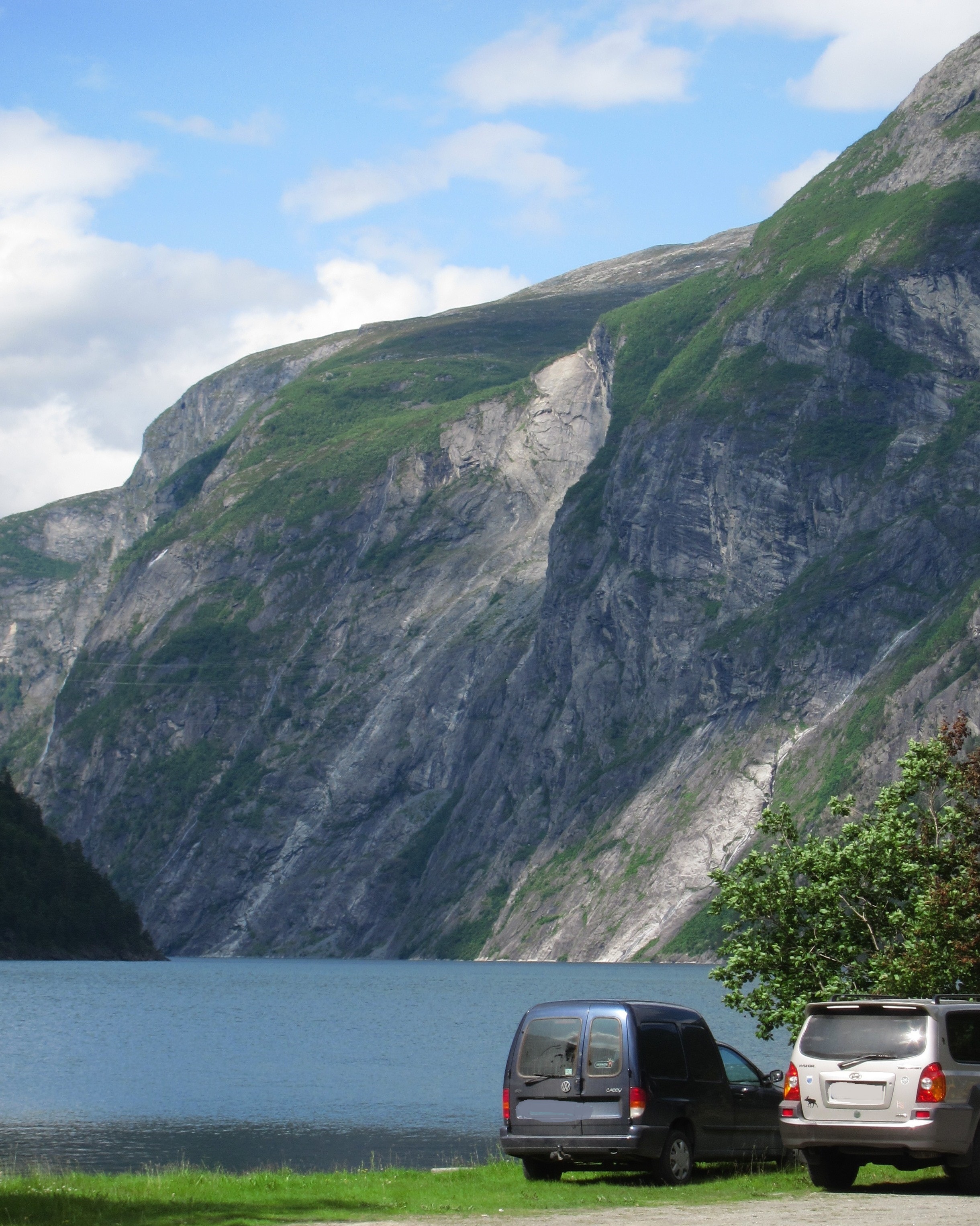
Tafjord is a place defined by its isolation. The village sits at the inner end of the Tafjorden, a narrow branch of the larger Storfjorden system in Fjord Municipality, More og Romsdal county. Aside from boat access, the only road in passes through two tunnels bored through sheer mountain walls: the 5.3-kilometer Heggur Tunnel and the 700-meter Skjegghammar Tunnel. The mountains rise so steeply on all sides that the village feels less like a settlement at the bottom of a valley and more like one at the bottom of a well. This geography -- steep rock, deep water, confined space -- is what made the 1934 disaster so lethal and what continues to make Tafjord one of the most dramatically situated villages in Norway.
Three Minutes of Darkness
The tsunami split into two waves upon impact -- one racing inward toward Tafjord, the other outward toward the village of Sylte at the fjord's mouth. At Tafjord, the wave reached roughly 16 meters. At Sylte, about 7 meters. Both arrived within minutes. Houses were swept from their foundations. Boats were tossed inland. The 34 dead included entire families who never made it out of their homes. Among the survivors, remarkably, there was only one serious injury. The disaster was the first of its kind in Norway to receive extensive media coverage -- newspapers and radio broadcasts from across the country and beyond reported on the destruction, bringing national attention to a village that most Norwegians had never heard of. A memorial stands in Tafjord today, marking the site where the wave hit hardest.
When the Wind Brings Summer in January
Tafjord holds a distinction that seems impossible for a village at 62 degrees north: it has recorded the highest November temperature anywhere in Norway -- 21.8 degrees Celsius. In January 2024, the station recorded 18.7 degrees, another national record. The cause is the foehn effect. When moist Atlantic air rises over the coastal mountains and descends into the enclosed valleys on the far side, it compresses and heats dramatically. The steep walls around Tafjord act like a funnel, concentrating the warm downslope wind into the narrow valley floor. On foehn days, Tafjord can be 20 degrees warmer than the surrounding region -- a surreal pocket of warmth in the Norwegian winter, where snow vanishes from the ground and the air feels like late spring while nearby villages remain locked in frost.
Living with the Mountain
The 1934 disaster did not empty Tafjord. People rebuilt. The hydroelectric potential of the surrounding mountains attracted industry -- the Tafjord Kraft power company has operated here for decades, harnessing the steep terrain and abundant water that make the valley both beautiful and dangerous. The village today is small and quiet, its few hundred residents accustomed to the isolation that the tunnels impose and the history that the mountains hold. But the geology that produced the 1934 slide has not changed. Across the broader fjord system, the mountain Akerneset -- monitored continuously by geologists -- threatens a similar collapse into the neighboring Geirangerfjord. In these narrow Norwegian valleys, the relationship between settlement and mountain is never entirely settled.
From the Air
Tafjord is located at 62.23N, 7.42E at the inner end of the Tafjorden, a branch of Storfjorden in western Norway. The village is visible as a small cluster of buildings at the base of extremely steep mountain walls. The 1934 rockslide scar on Langhammaren (730m) may be visible on the south side of the fjord. The two road tunnels (Heggur and Skjegghammar) are not visible from altitude but the absence of any road along the cliff face underscores the isolation. Nearest airports: Alesund Airport, Vigra (ENAL) ~80 km west, Molde Airport, Aro (ENML) ~90 km north. Altitude recommendation: 2,000-4,000 ft to see the fjord's narrow profile and the village's position at its head. The neighboring Geirangerfjord is visible to the northwest.