Taihang Mountains
Shanxi means "west of the mountains." Shandong means "east of the mountains." The mountains in question are the Taihang, a 400-kilometer wall of Jurassic-era rock that runs north to south through the heart of northern China, dividing the Loess Plateau from the North China Plain so decisively that two provinces took their names from their position relative to this range. Few mountain chains in the world have shaped human geography so legibly. The Taihang are not merely scenery. They are the boundary that organized northern Chinese civilization into its eastern and western halves.
Born in the Jurassic
The Taihang Mountains formed during the Jurassic period, the same geological epoch that produced the dinosaurs, and their bones are among the oldest exposed rock in northern China. Averaging 1,500 meters in elevation, with the principal peak at Mount Xiaowutai rising higher still, the range creates a formidable barrier between the elevated plateaus of Shanxi to the west and the low-lying agricultural plains of Hebei and Henan to the east. Brown forest soils and cinnamon soils characterize the range, supporting ecosystems that transition from deciduous forest on the eastern slopes to the drier, wind-scoured landscapes of the Loess Plateau behind them.
The Foolish Old Man's Mountain
Chinese mythology features the Taihang range in one of its most enduring parables. In "The Foolish Old Man Removes the Mountains," an elderly farmer decides to level two mountains, one of them the Taihang, that block his family's path. When mocked for the impossibility of the task, he replies that his sons will continue after him, and their sons after them, generation upon generation, until the mountains are gone. The story became one of the most quoted texts in modern Chinese political culture. Mao Zedong invoked it in 1945, and it remains a touchstone for perseverance against overwhelming odds. The Taihang, in this telling, are not a feature of the landscape but a metaphor for every obstacle that seems permanent until someone refuses to accept it.
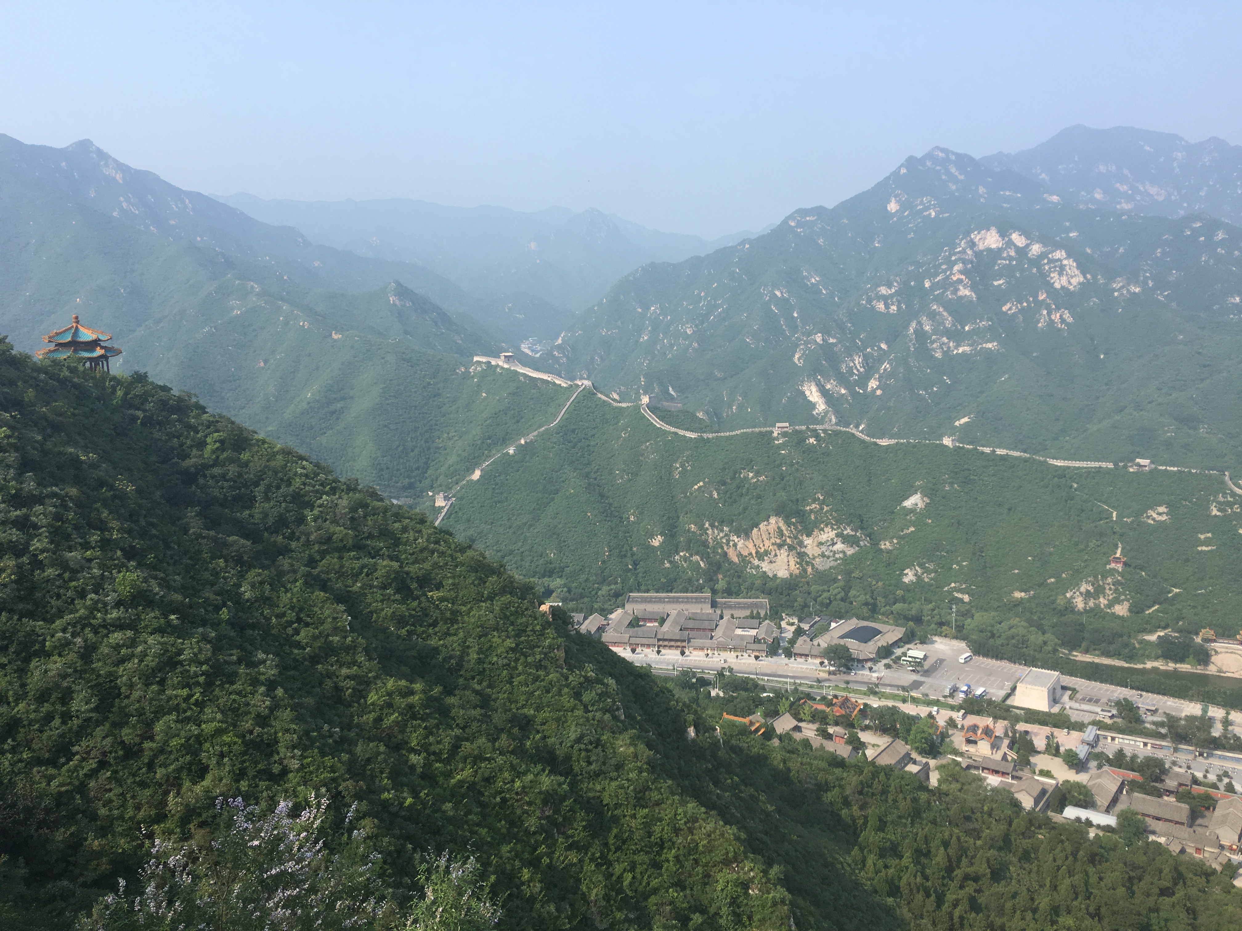
Tunnels Through Stone
The mountains have been pierced rather than removed. The Shijiazhuang-Taiyuan high-speed railway passes beneath the Taihang range through the Taihang Tunnel, the third longest rail tunnel in China, connecting the capitals of Hebei and Shanxi in a journey that once required days of winding mountain road travel. Perhaps more remarkable is the Guoliang Tunnel in Huixian, Henan, a road carved by hand through a cliff face by thirteen villagers in the 1970s who grew tired of the treacherous mountain path that was their only connection to the outside world. The Hai River system threads through the range as well, and the Red Flag Canal, one of Mao-era China's most ambitious infrastructure projects, runs along the southern edge of the mountains.
A Border That Made History
Every army that has sought to control northern China has had to reckon with the Taihang Mountains. The range's passes, including the famous Niangzi Pass, served as chokepoints where small forces could hold off much larger armies. The Great Wall incorporated sections of the Taihang into its defensive network, and the Battle of Xinkou during the Second Sino-Japanese War was fought in the shadows of these peaks. Even in peacetime, the mountains function as a cultural frontier. Dialects shift as you cross the range. Food changes, weather patterns change, and the pace of life slows as the flat, densely populated plains give way to terraced hillsides and narrow valleys where villages cling to slopes too steep for modern agriculture.
From the Air
Located at approximately 37.00N, 113.93E, the range extends over 400 km from north to south through Shanxi, Henan, and Hebei provinces. Peaks average 1,500 meters. Maintain safe altitude well above ridgeline and be aware of mountain weather including sudden cloud formation, updrafts, and reduced visibility. The range is visually dramatic from the east, where it rises sharply from the plains. Nearest airports: Taiyuan Wusu International (ZBYN) to the west, Shijiazhuang Zhengding International (ZBSJ) to the east. Recommended viewing altitude: 8,000-12,000 feet.