Taipei Bridge
Every version of Taipei Bridge has been destroyed. The first, a wooden railway bridge completed in 1889, was battered by an 1897 typhoon. Its 1920 replacement lasted less than six months before the Tamsui River flooded and tore it apart. The 1925 iron truss bridge -- locals called it the Seven-Pillar Iron Bridge -- endured for decades but eventually gave way to the modern concrete span that carries traffic today. Each time, the bridge was rebuilt, because the connection it provides between Taipei and the district of Sanchong has always been worth the trouble of starting over.
A Governor's Railway, a Cantonese Contractor
The first bridge at this site existed because of a railway that no longer runs this way. In the 1880s, Qing Governor Liu Mingchuan secured imperial approval to build a rail line from Keelung to Hsinchu, passing through the commercial quarter of Twatutia in Taipei. The Tamsui River stood in the way. Engineers proposed an iron bridge, but the cost was prohibitive, so the administration hired a Cantonese contractor who built a wooden structure spanning 1,498 chi. Completed in 1889, the Tamsui Wooden Bridge carried only rail traffic across the wide, flood-prone river. When Japan took control of Taiwan in 1895, the new colonial government rerouted the railway south through Banqiao. By 1899, the tracks were pulled up and the bridge was converted for general use -- carts, pedestrians, the daily commerce of a city still finding its shape.
The Bridge That Named a Neighborhood
The 1925 replacement was the first bridge at this crossing built specifically for modern vehicular traffic. It was an iron truss structure, and it transformed the relationship between Taipei and the largely rural area to its west. Sanchong's population surged as migrants from southern Taiwan used the district as a staging ground -- a cheaper place to live while they accumulated enough resources to move into the capital proper. The bridge was so central to civic identity that the Japanese colonial administration named an entire ward after it: Ohashicho, literally 'great bridge town.' Trade flowed across the river in both directions, linking the commercial hubs of Dalongdong and Twatutia to a growing suburban frontier. The bridge was not just infrastructure; it was a social membrane, permeable in both directions, that allowed two very different communities to grow together.
Steel, Concrete, and Motorcycles
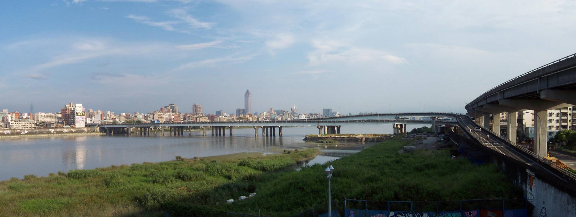
The current Taipei Bridge, completed in 1996, is a study in the particular traffic culture of northern Taiwan. The central span, 481.6 meters long, carries automobile traffic. But flanking it on both sides are narrower companion bridges dedicated almost entirely to motorcycles, bicycles, and pedestrians. During rush hour, the motorcycle lanes produce one of Taipei's most distinctive spectacles: a dense river of scooters pouring across the Tamsui in a tight, choreographed swarm that has become a minor internet sensation. The approaches on both sides are squeezed tight by decades of urban development that crowded in long before anyone thought to protect the right-of-way, creating bottlenecks where the bridge meets the city grid.
Parallel Lines
Today, the Taipei Metro's Zhonghe-Xinlu line runs beneath the Tamsui River parallel to the bridge, with stations on both banks named for it. The surface bridge still carries Provincial Highway 1A, having surrendered its original Highway 1 designation to the Zhongxiao Bridge downstream. Above and below, Taipei Bridge remains what it has been since 1889: the primary thread stitching together two halves of a metropolitan area that grew up on opposite sides of a river. The Huanhe Expressway passes overhead on elevated ramps, adding yet another layer to a crossing that has never stopped evolving. Four bridges, four eras, one stubborn insistence that Taipei and Sanchong belong to the same story.
From the Air
Located at 25.064°N, 121.506°E, spanning the Tamsui River between Taipei's Datong District and Sanchong District in New Taipei City. Clearly visible from the air as a multi-span bridge with distinctive parallel motorcycle lanes. Best viewed below 2,000 feet. The Huanhe Expressway overpass is visible crossing above. Nearest airport: Taipei Songshan (RCSS), approximately 6 km east. Taoyuan International (RCTP) is 30 km southwest.