Takeda Castle
They call it the Machu Picchu of Japan, and for once the comparison is not hyperbole. On autumn mornings, when cold air settles into the Maruyama River valley and warm currents pass above, Takeda Castle's stone walls appear to float on an ocean of clouds. The castle itself is gone. Only foundations and walls remain, the skeleton of a Sengoku-era fortress perched 353 meters above sea level on Mount Shiroyama. But those walls, weathered and mossy and perfectly silent, are enough.
Crossroads of Power
Takeda Castle occupied one of the most strategically valuable positions in western Japan. Mount Shiroyama commands the intersection where the San'indo highway, running from Tanba Province to Inaba Province, crosses the road south to Harima Province and the Seto Inland Sea. Whoever controlled this junction controlled movement between the Sea of Japan coast and the inland trade routes. The nearby Ikuno mine, one of Japan's largest silver mines during the Muromachi period, added economic urgency to the military calculus. Silver meant wealth, and wealth meant armies. The mountain above the crossroads was the obvious place to put a fortress, and the Yamana clan, who dominated the region, did exactly that.
The Yamana and the Unraveling
The Yamana clan arrived as a cadet branch of the Nitta clan during the Muromachi period and quickly accumulated power. They cultivated close relations with the Ashikaga shogunate, securing hereditary rights to the Samurai-dokoro, the military police organ of the shogunate. At their peak, the Yamana claimed the position of shugo over 11 of Japan's 66 provinces. The concentration of power alarmed Shogun Ashikaga Yoshimitsu, who began sponsoring the rival Hosokawa clan and encouraging fractures within the Yamana ranks. His strategy worked, slowly eroding Yamana dominance. By the mid-fifteenth century, as shogunal authority itself decayed, a succession dispute within the Ashikaga house ignited the Onin War in 1467. The conflict lasted a decade, devastated Kyoto, and ushered in the Sengoku period of constant warfare that would define Takeda Castle's most turbulent century.
Ruins Above the Clouds
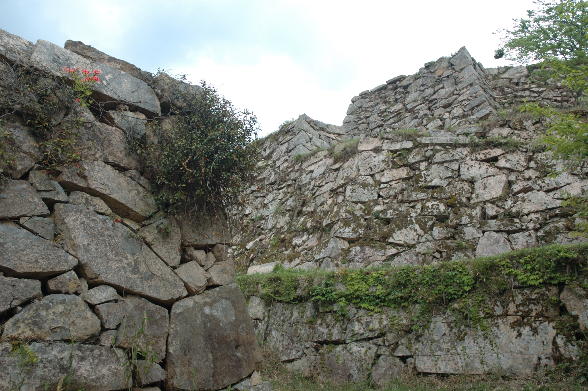
The castle was destroyed during the Sengoku period, and what remains is both less and more than a building. The stone walls trace the outline of compounds, gates, and tower foundations across the mountaintop, their shapes legible enough to reconstruct the castle's layout in your mind but empty enough to fill with imagination. The Honmaru compound at the summit, the Hanayashiki compound with its carefully fitted stone walls, the Minami Senjojiki terrace, all are open to the sky and carpeted in grass. The ruins were designated a National Historic Site in 1943, recognition that came decades before the site became famous for its cloud-sea phenomenon. It is the clouds that draw the crowds now, but the stones deserve attention on their own merits.
The Sixty-Minute Climb
Reaching Takeda Castle requires commitment. From Takeda Station on the JR West Bantan Line, the walk to the summit takes approximately sixty minutes, much of it steeply uphill along a mountain path. There is no road to the top, no bus, no shortcut. The climb filters out casual visitors, which means that those who reach the summit tend to linger. On clear days, the views extend across the valley in every direction, the Maruyama River winding through farmland below. On the mornings when the clouds come, the valley disappears entirely, and the mountain becomes an island. Photographers arrive before dawn for those mornings, setting up on the opposite mountainside at the Ritsuunkyo viewing platform to capture the castle's silhouette hovering in the mist. The images have made Takeda Castle one of the most photographed ruins in Japan, a fortress that became more famous in death than it ever was in life.
From the Air
Takeda Castle ruins sit at 35.30N, 134.83E atop Mount Shiroyama in the city of Asago, northern Hyogo Prefecture. From the air, look for a ridge-top cleared area with visible stone wall outlines surrounded by forest, above the Maruyama River valley. The site is especially dramatic during autumn mornings when clouds fill the valley below the summit. Located north of Himeji and northwest of Kyoto. Nearest airports: Tajima (RJBT) approximately 20nm north, Kobe (RJBE) approximately 50nm south. Best viewed at 2,000-4,000 feet AGL.