Tanzawa Mountains
Thirty million people live within commuting distance of these mountains, yet the upper ridges of the Tanzawa range feel as remote as anywhere in Japan. The chain sprawls across northwestern Kanagawa Prefecture, brushing the borders of Shizuoka to the west and Yamanashi to the north, with its highest point -- Mount Hiru at 1,673 meters -- standing as the tallest peak in the prefecture. On clear autumn mornings, hikers on the Tanzawa ridgeline can look east toward the skyscrapers of Yokohama and west to the snow-draped cone of Mount Fuji. The mountains are close enough to Tokyo that you can leave Shinjuku Station after breakfast and be climbing through cedar forests by mid-morning, yet wild enough to harbor bears, serow, and flying squirrels in their interior valleys.
A Ridge of Seven Peaks
The Tanzawa range organizes itself around a central spine of summits, each with its own character. Mount Hiru (Hiru-ga-take, 1,673 meters) anchors the range as its highest point, demanding a full-day commitment from even fit hikers. Mount Tanzawa (Tanzawa-san) gives the range its name and carries designation as one of Japan's Hundred Famous Mountains. Mount To (To-no-dake, 1,491 meters) and Mount Oyama (O-yama) draw the largest crowds, largely because Yabitsu Pass -- the highest point along Kanagawa Route 70 -- provides the most accessible trailhead, just eleven kilometers from the city of Hadano. Mount Hinokiboramaru, Mount Fudo, and Mount Shindainichi round out the principal summits. The eastern peaks see heavy foot traffic on weekends, while the western reaches remain comparatively quiet, offering sawanobori -- the Japanese tradition of ascending mountain streams by climbing directly through the watercourse.
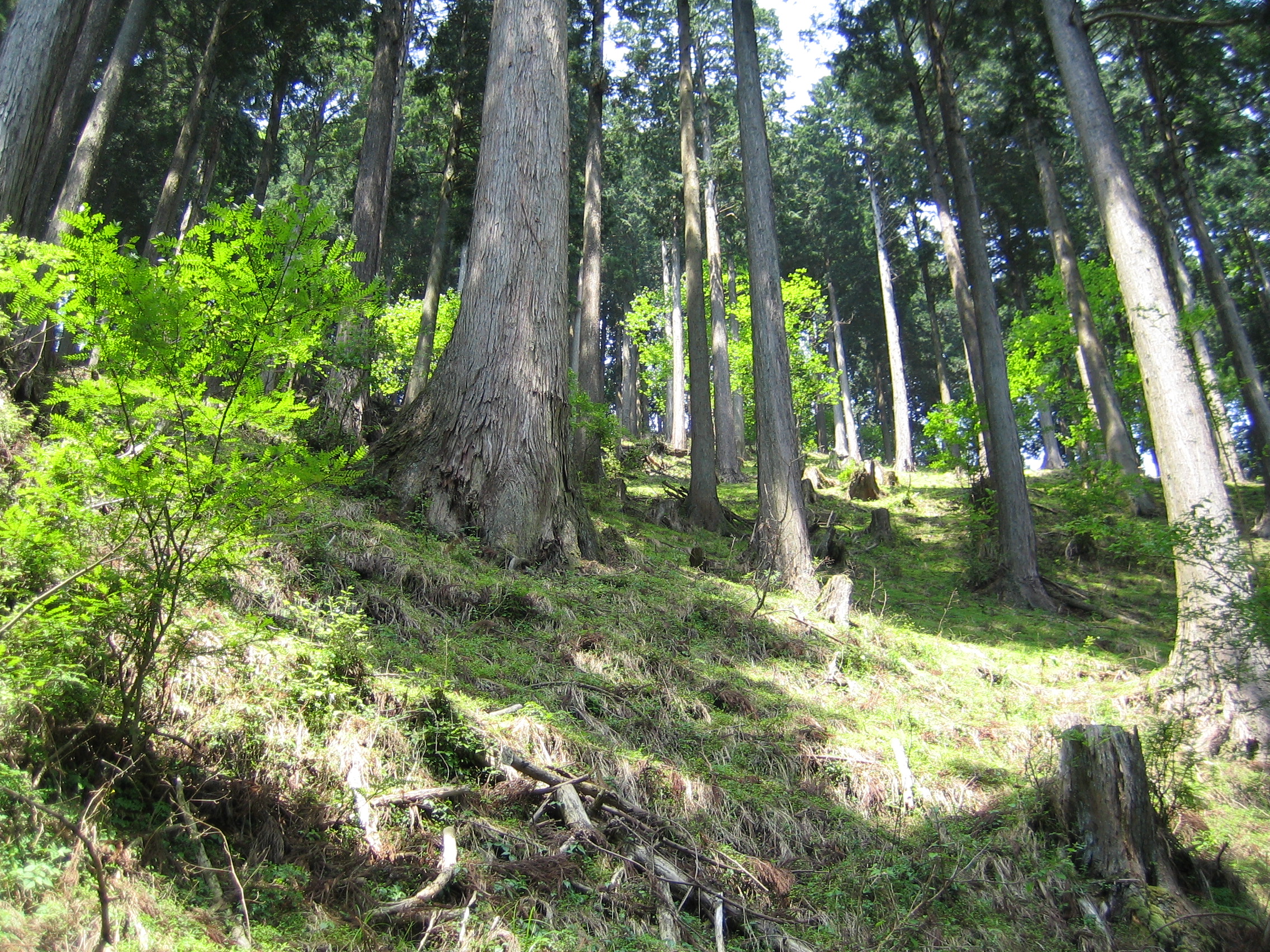
Two Forests, Stacked by Altitude
The Tanzawa landscape divides itself into vertical zones. In the lower valleys, Japanese cedar (sugi) and hinoki cypress dominate -- their straight trunks planted centuries ago for timber, now forming dense corridors of dark green that filter the sunlight into narrow shafts. Higher up, the planted conifers yield to natural deciduous forest: Japanese mountain maple, whose leaves ignite in autumn reds and golds, and Japanese beech, with smooth grey bark and broad canopies that let dappled light reach the understory. The split is roughly even -- about half the forest cover is coniferous, half deciduous -- creating a visible boundary line on the mountainsides where the dark cedars give way to the lighter, more varied broadleaf canopy. Rhododendrons bloom across the elevations, splashing color through the understory from spring into early summer. Rivers and streams cut through it all, their banks lined with mossy boulders and populated by frogs and lizards.
Where the Wild Things Still Are
For a range this close to one of the world's great megacities, the Tanzawa Mountains harbor a surprising diversity of wildlife. Japanese deer are abundant -- sometimes too abundant, as their grazing pressure on alpine vegetation has become a management concern. Japanese raccoon dogs, the tanuki of folklore, forage through the lower forests at dusk. Japanese flying squirrels glide between the cedar canopies after dark. The Japanese serow, a goat-antelope designated as a national natural monument, picks its way along the steeper ridgelines. Most impressive and most elusive is the Asiatic black bear, which maintains a population throughout the mountain interior. Hundreds of bird species have been recorded across the range, including kingfishers that flash electric blue along the stream corridors. The rivers themselves hold trout and yamame, drawing anglers to the Tanzawa waterways throughout the fishing season.
Weekend Refuge for a Restless City
The Tanzawa range serves as the primary mountain escape for the greater Tokyo metropolitan area. Kanagawa Route 70 threads between Hadano and the Miyagase area, passing through Kiyokawa Village, which offers lodging, campsites, and trailheads. Lake Miyagase, a man-made reservoir created by damming the Nakatsu River, provides a quieter destination for those seeking water rather than summits. Campsites dot Route 70, and the mountain huts on the higher peaks offer overnight stays for those tackling multi-day traverses. The trails range from moderate half-day walks on Mount Oyama -- which also hosts an ancient Shinto shrine -- to strenuous full-day slogs up Mount Hiru and along the main ridge. International climbers have been arriving in growing numbers, drawn by the combination of accessible wilderness, well-maintained trail infrastructure, and the sheer improbability of finding this much solitude so close to thirty million people.
From the Air
The Tanzawa Mountains are centered at approximately 35.49N, 139.14E in northwestern Kanagawa Prefecture. The range runs roughly east-west, with Mount Hiru (1,673m / 5,489ft) as the highest point. From the air, the range appears as a densely forested block of terrain between the Kanto Plain to the east and Mount Fuji to the west. Maintain altitude above 6,000 feet MSL for safe clearance over all peaks. Nearest airports: Tokyo Haneda (RJTT) approximately 40nm east-southeast, Atsugi Naval Air Facility (RJTA) approximately 15nm south-southeast. Mountain wave turbulence possible in strong westerly winds. Visibility can drop quickly in the valleys due to orographic cloud formation.