Taxila
Before Oxford, before Bologna, before anything the Western world would call a university, there was Taxila. On the Pothohar Plateau of Punjab, about thirty-five kilometers northwest of modern Rawalpindi, the ruins of four successive cities lie stacked across a valley floor -- each one built by a different civilization, each one destroyed by the next. Persians, Greeks, Mauryans, Scythians, and Kushans all ruled here. Alexander the Great accepted the city's surrender without a fight in 326 BCE. Chanakya taught statecraft to the young Chandragupta Maurya in its classrooms. The grammarian Panini codified Sanskrit within its walls. For nearly a thousand years, this was where the ambitious came to learn.
City of Cut Stone
The Sanskrit name Takshashila means "City of Cut Stone" or "Rock of Taksha," a reference to the Ramayana legend that Bharata, brother of the deity Rama, founded the city and named it for his son. The Greeks, arriving with Alexander, rendered it as Taxila -- and that pronunciation stuck. The Chinese Buddhist pilgrim Faxian, who traveled the Silk Road to reach the city, offered a more dramatic translation: "cut-off head," linking it to a Jataka tale in which the Buddha, in a previous life, offered his own head to a hungry lion. A hill range south of the Taxila Valley is still called Margala, and the area in front of the ancient ruins at Sirkap -- itself meaning "cut-off head" -- was known in the nineteenth century as Babur Khana, the "House of the Tiger." Every name carries a story, and every story points to sacrifice.
An Empire at Every Turn
The settlement at Taxila dates to at least 1000 BCE, with Neolithic remains going back further. By 900 BCE, pottery shards show trade connections with Pushkalavati, the other great city of Gandhara. The Achaemenid Persians absorbed the city around 540 BCE, making it the capital of their Hindush satrapy. Darius I spent the winter of 516-515 BCE in the Gandhara region preparing to conquer the Indus Valley. When Alexander arrived in 326 BCE, King Ambhi surrendered the city peacefully -- Greek historians described Taxila as "wealthy, prosperous, and well governed." The Mauryans took it from Alexander's successors by 303 BCE, making it a provincial capital on the Royal Highway connecting Pataliputra in Bihar to Peshawar and Central Asia. Under Emperor Ashoka, Buddhism flourished here. Then came the Indo-Greeks, the Scythians, and finally the Kushans, who razed the old city around 30 CE and built their own -- Sirsukh -- to the north.
Where Knowledge Was Sacred
Taxila's university was not a campus with dormitories and lecture halls. It was a constellation of individual teachers, each running an autonomous school from his own house, answerable to no central authority and bound by no standardized curriculum. A student studied until his teacher judged him ready -- specialization typically took about eight years, though this varied with ability. The subjects ranged from religious texts to linguistics, law, astronomy, medicine, mathematics, and even archery. Knowledge was considered too sacred to barter for money. Wealthy parents and merchants provided financial support, but no student was turned away for poverty; those who could not pay received free room and board in exchange for household labor. Paying students were taught during the day, and non-paying students at night. This system predated Nalanda by centuries and influenced every major South Asian seat of learning that followed.
Chanakya's Classroom
The roster of Taxila's students and teachers reads like a who's who of ancient South Asia. Chanakya -- also known as Kautilya -- taught statecraft and political philosophy here before mentoring Chandragupta Maurya, who studied at Taxila for eight years and went on to found the Mauryan Empire. Charaka, called the "father of medicine" in the Ayurvedic tradition, both studied and practiced at Taxila. Panini, whose grammar codified classical Sanskrit, was part of the intellectual community. Jivaka, the court physician who treated the Buddha himself, trained here. King Pasenadi of Kosala, a close friend of the Buddha, studied at Taxila, as did Angulimala, whose story of a brilliant student driven to violence by jealous classmates and a manipulative teacher became one of Buddhism's most haunting parables. Plutarch even records that Alexander the Great met the young Chandragupta while campaigning in the Punjab -- a collision of the Greek and Indian worlds at Taxila's doorstep.
Four Cities in One Valley
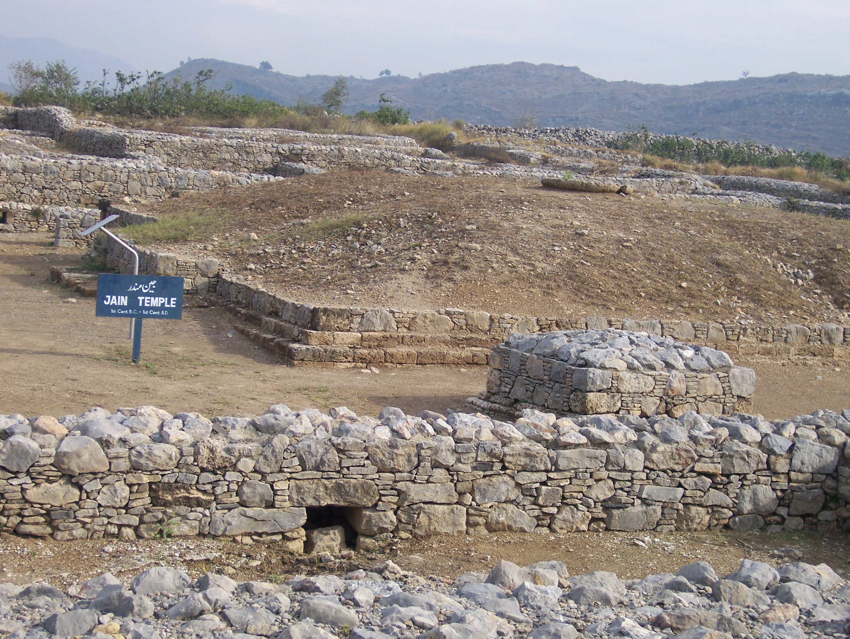
The lost city of Taxila was not identified until 1863, when Alexander Cunningham, founder of the Archaeological Survey of India, corrected errors in Pliny's distances by cross-referencing the travel accounts of seventh-century Chinese pilgrim Xuanzang. What Cunningham found -- and what UNESCO designated a World Heritage Site in 1980 -- was not one city but four, layered across the valley floor. The earliest settlement at Hathial yielded pottery from the late second millennium BCE. Bhir Mound, dating from the sixth century BCE, sits adjacent. Sirkap, built by Greco-Bactrian kings after Alexander's invasion, dates to the second century BCE. And Sirsukh, the Kushan city, represents the final phase. Eighteen individual monuments make up the serial World Heritage Site, including the Dharmarajika stupa, the Jaulian monastery, and the Mohra Muradu monastery. In 2010, the Global Heritage Fund identified Taxila as one of twelve worldwide sites "on the verge" of irreparable damage, citing looting, development pressure, and insufficient management as primary threats.
From the Air
Located at 33.75°N, 72.79°E on the Pothohar Plateau, approximately 35 km northwest of Rawalpindi and 25 km from central Islamabad. The archaeological sites are spread across the Taxila Valley, visible from altitude as open terrain amid agricultural land. Nearest major airport is Islamabad International Airport (OPIS), about 20 km to the southeast. The Margalla Hills and Haripur District lie to the north. Best viewed at 3,000-5,000 feet AGL for the layout of the four ancient city sites.