Taylors Falls, Minnesota
In 1886, three miles of white pine logs piled up against Angle Rock on the St. Croix River at Taylors Falls, creating the largest log jam the region had ever seen -- enough timber to build 20,000 three-bedroom houses. The spectacle was so extraordinary that excursion trains ran from Duluth so people could watch 200 loggers spend six weeks dismantling it. That collision of wilderness industry and tourist curiosity captures the spirit of Taylors Falls perfectly: a town of just 1,055 residents perched on the edge of a basalt gorge, where the dramatic has always arrived in proportion to the landscape rather than the population.
A Politician's Namesake on the Dalles
The city takes its name from Jesse Taylor, a territorial politician who recognized the strategic value of this stretch of the St. Croix River early on. Platted in the early 1850s at the junction of what would become U.S. Highway 8 and Minnesota State Highway 95, Taylors Falls sits directly adjacent to St. Croix Falls, Wisconsin, at the Dalles of the St. Croix -- an area of forested bluffs and high basalt cliffs where the river narrows into a dramatic gorge. The geography that made the site valuable for the lumber trade also made it a natural landmark. In 1895, the states of Minnesota and Wisconsin jointly founded Interstate Park immediately south of the city, creating the first interstate state park in the United States. The park straddles the border and protects the Dalles, with its world-famous glacial potholes and billion-year-old volcanic rock.
The Oldest Schoolhouse in Minnesota
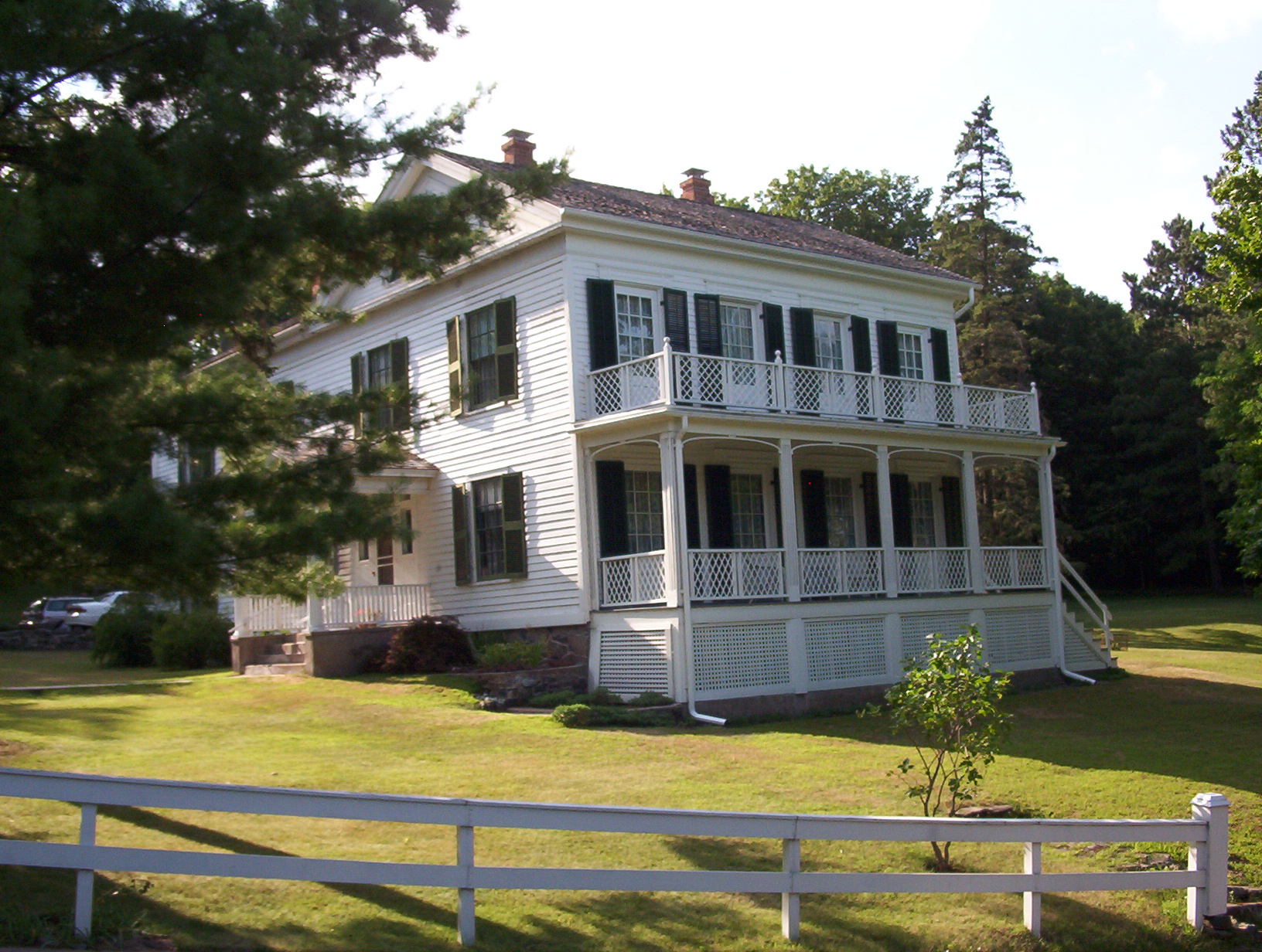
Taylors Falls preserves several structures that anchor it to Minnesota's earliest territorial period. The 1852 Town House School, now maintained by the Taylors Falls Historical Society, is the oldest public schoolhouse in the state. Originally serving dual duty as both town hall and school, the small frame building was later moved and renovated but still stands as a testament to the settlement's early ambitions. Nearby, the Folsom House -- completed in 1855 by lumber baron W.H.C. Folsom in the New England Greek Revival style -- offered a grander vision. Folsom, who had made his fortune in the St. Croix River lumber mills, designed the home to reflect his wealth while remaining modest enough for the frontier. The house stayed in the Folsom family until 1970, when it was donated to the Minnesota Historical Society and opened as a museum. Together with the Old Jail, these landmarks compose the Angel Hill Historic District, a compact hillside neighborhood that feels transplanted from coastal New England.
Sweden's Fictional Frontier
For millions of Swedish readers, Taylors Falls is not just a Minnesota river town but the promised land at the end of a harrowing Atlantic crossing. Vilhelm Moberg, considered one of Sweden's greatest twentieth-century novelists, chose Taylors Falls and the surrounding Chisago Lakes region as the destination for his fictional Nilsson family in The Emigrants, a four-part novel series published between 1949 and 1959. Moberg spent much of 1948 bicycling around Chisago County, absorbing the landscape and local history that would fill his pages. The novels were adapted into a critically acclaimed 1971 film and later into Kristina fran Duvemala, a Swedish-language musical. The connection is fitting: Chisago County was indeed a center of Swedish immigration in the nineteenth century, and the region's Scandinavian heritage remains visible in everything from local festivals to place names.
Cliffs, Climbing, and the River's Edge
The recreational draw of Taylors Falls centers on the St. Croix and the basalt walls that contain it. Interstate State Park, located on the east side of town, offers scenic river views, canoeing, camping, fishing, and access to glacial potholes that rank among the most numerous and deepest in the world. Rock climbers come for the Minnesota side's variety of routes -- bouldering, toprope, and traditional climbing ranging from 5.5 to 5.13 on the Yosemite Decimal System. The forested bluffs above the river provide a canopy that shifts from brilliant green in summer to fiery color in autumn, drawing visitors from the Twin Cities metropolitan area less than an hour to the south. For a town that has never topped 1,100 in population, Taylors Falls punches well above its weight as a destination, just as it did when those excursion trains arrived to see the great log jam of 1886.
From the Air
Located at 45.41°N, 92.66°W in Chisago County, Minnesota, on the west bank of the St. Croix River at the Minnesota-Wisconsin border. The town is identifiable by the narrow gorge of the Dalles where the river cuts between forested basalt bluffs. St. Croix Falls, Wisconsin is directly across the river. Interstate Park's rock formations and potholes are visible along the gorge. Minneapolis-Saint Paul International Airport (KMSP) lies approximately 45 miles south-southwest. The St. Croix River corridor provides a clear navigational reference running north-south. Best viewed at 2,000-4,000 feet AGL to appreciate the gorge and the compact town layout along the bluffs.