Taymyr Autonomous Okrug
Imagine a territory larger than France, Germany, and the United Kingdom combined, with a population that would barely fill a mid-sized American sports stadium. The Taymyr Dolgano-Nenets Autonomous Okrug covered 862,100 square kilometers of Arctic and subarctic Siberia, and as of the 2002 census, just 39,786 people called it home. It was the northernmost federal subject in Russia, named after the Taymyr Peninsula and the indigenous Dolgan and Nenets peoples whose ancestors had survived here for generations. In 2007, it ceased to exist as an independent entity, absorbed into Krasnoyarsk Krai after a 2005 referendum. But the land and the people it was named for remain.
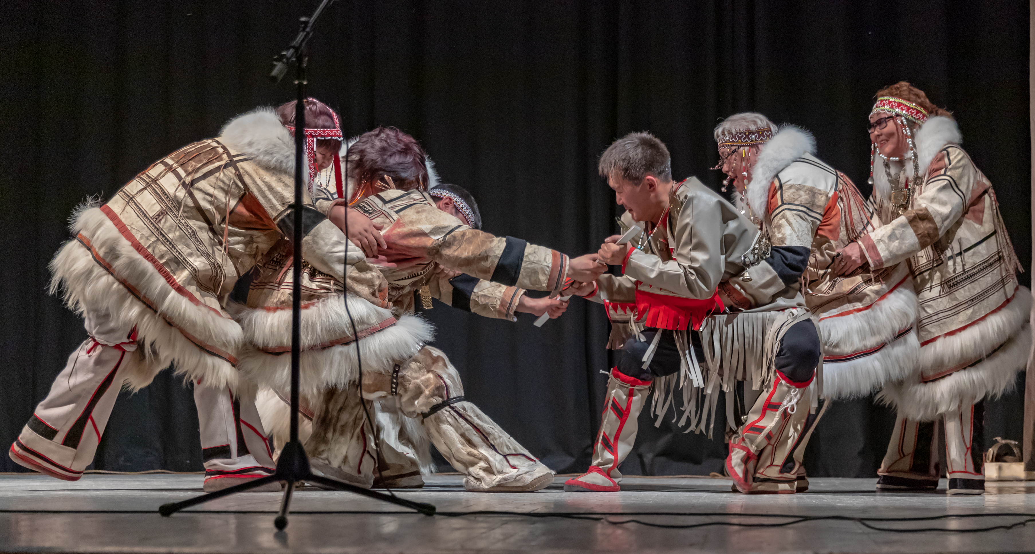
A Quarter Indigenous
What made Taymyr unusual among Russian administrative units was the composition of its population. Roughly a quarter of residents identified as indigenous Siberians in the 2002 census: Dolgans, Nenets, Nganasans, Evenks, and Enets. Ethnic Russians made up 58.6 percent, with Ukrainians at 6.1 percent, Volga Germans at 1.5 percent, Volga Tatars at 1.1 percent, Belarusians at 0.7 percent, and Azeris at 0.6 percent. The indigenous groups were not a monolith. The Dolgans speak a Turkic language; the Nenets and Enets speak Samoyedic languages from the Uralic family; the Nganasans have their own distinct Samoyedic tongue; and the Evenks speak a Tungusic language. Five language families coexisted in a single frozen territory, each carrying distinct traditions of reindeer herding, fishing, and survival.
Dudinka and the Norilsk Anomaly
More than half of Taymyr's inhabitants lived in Dudinka, the administrative center perched on the Yenisei River above the Arctic Circle. But the okrug's most famous city was not technically part of it. Norilsk, the massive industrial center built around one of the world's largest nickel and palladium mining complexes, sat geographically within Taymyr's boundaries but was administered directly by Krasnoyarsk Krai. The same applied to the urban-type settlement of Snezhnogorsk, subordinated to Norilsk. This administrative peculiarity meant that Taymyr's census figures excluded one of the most significant population centers within its borders, making the okrug appear even emptier than it was.
The Merger and What Followed
On April 17, 2005, residents voted in a referendum to merge Taymyr and the neighboring Evenk Autonomous Okrug into Krasnoyarsk Krai. The merger took effect on January 1, 2007. Taymyr received special status within the krai and was reconstituted as the Taymyrsky Dolgano-Nenetsky District. The administrative change reflected a broader trend in Russian governance toward consolidating smaller, sparsely populated federal subjects into larger regional units. For the indigenous communities, the practical effects were mixed. Dudinka remained the district center. The tundra remained the tundra. But the political identity that the okrug's name had conferred, linking this territory explicitly to the Dolgan and Nenets peoples, was diluted into a larger administrative structure.
Tundra on Screen
Taymyr has appeared in unexpected cultural contexts. The 1985 film White Nights, starring Mikhail Baryshnikov and Gregory Hines, depicts the region in its opening sequence: Baryshnikov's character, a Soviet defector, is on a passenger plane that crash-lands at "Norilsk Air Base" and wakes to learn he is in Taymyr. The film was not actually shot there, but the mere invocation of the name served as shorthand for the most remote, most frozen, most impossibly far corner of Russia. More recently, the 2020 simulation game SnowRunner featured Taymyr as its third playable region, challenging players to navigate vehicles across terrain that real drivers would approach with deep reluctance. Both depictions capture something true: Taymyr is the kind of place that exists more powerfully in the imagination of those who have never been than in the daily experience of those who live there.
From the Air
The former Taymyr Autonomous Okrug centered on approximately 69.40N, 86.18E, covering most of the Taymyr Peninsula and surrounding lowlands. Dudinka (UODD) served as the administrative center. Norilsk (UOOO) lies within the territory. The Yenisei River runs north-south through the western portion. The terrain is flat tundra and permafrost with no tree cover at higher latitudes. Cape Chelyuskin, the northernmost point of mainland Eurasia, lies at the peninsula's tip. Expect severe weather year-round, with polar night in winter.