Te Anau
In 1948, two extraordinary things happened in the mountains west of Te Anau. A doctor named Geoffrey Orbell tramped into the remote Murchison Mountains and found a colony of takahe, a large flightless bird that had been declared extinct half a century earlier. The same year, an explorer named Lawson Burrows located the entrance to a cave system on the western shore of Lake Te Anau that Maori legends had described for generations. Inside, he found a grotto glittering with thousands of glowworms. Both discoveries happened within sight of a quiet lakeside town that most travelers passed through on the way to somewhere else. Te Anau has been the gateway to Fiordland ever since, but 1948 proved it was also the gateway to things people had given up looking for.
The Cave of Swirling Water
The town's name holds a story of its own. Te Ana-au is Maori for "the cave of swirling water," though this interpretation only gained acceptance after Burrows rediscovered the caves in 1948. Before that, many believed Te Anau was named for a granddaughter of Hekeia, a chief of the Waitaha tribe. The caves themselves are part of the Aurora Cave System, a labyrinth of limestone passages roughly 15,000 years old, carved by underground rivers that still churn through them. Visitors reach the caves by boat across Lake Te Anau, then walk through passages of sculpted rock to a grotto where thousands of Arachnocampa luminosa, the New Zealand glowworm, suspend their bioluminescent threads from the ceiling. In the absolute darkness of the underground chamber, the effect is like looking up at a clear night sky, except these stars are alive and hungry, each glowing thread a tiny fishing line baited with light.
A Bird Back from the Dead
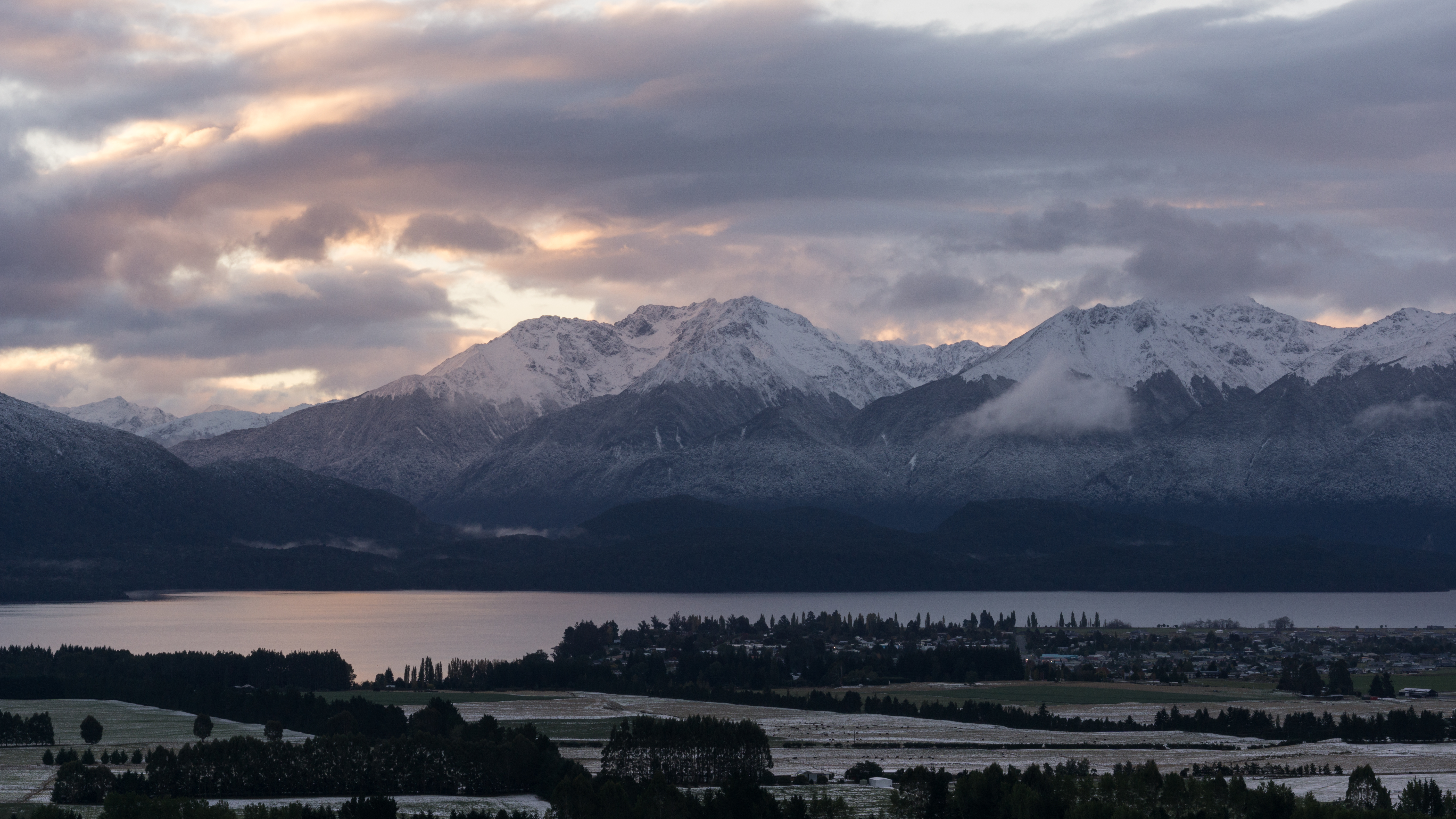
The Murchison Mountains rise directly across the lake from Te Anau, their peaks forming a natural fortress that protected the takahe when the rest of New Zealand assumed the species was gone. Geoffrey Orbell, a physician from Invercargill, refused to accept the extinction. In November 1948, he led a small expedition into the Murchison range and found a breeding population in the tussock-covered valleys near a lake that now bears his name. The takahe is a striking bird, stocky and flightless, with iridescent blue-green plumage and a massive red bill. Te Anau's bird sanctuary, near the start of the Kepler Track, now houses several takahe alongside kaka parrots and other native species. The sanctuary gives visitors a close encounter with birds they would otherwise never see, since the wild population in the Murchisons remains strictly protected.
Where the Roads End
Te Anau sits at a geographic crossroads where civilization yields to wilderness. State Highway 94, the Milford Road, runs 120 kilometers north to Milford Sound through some of the most dramatic scenery in New Zealand, past mirror lakes, through the Homer Tunnel, and into the heart of Fiordland. About 2,500 visitors a day travel this road at peak times, and the free car parks at Milford often fill by late morning. To the south, State Highway 95 connects Te Anau to Manapouri in 20 minutes, opening access to Doubtful Sound and the wild southern fiords. Three of New Zealand's Great Walks begin within reach of town: the Milford Track from the northern tip of Lake Te Anau, the Kepler Track from the control gates at the lake's southern end, and the Routeburn Track from the road to Milford. The town calls itself the walking capital of the world, and few places have a stronger claim.
Small Town, Big Landscape
With a population under 3,000, Te Anau is not a large place. The town center runs along the lakeshore, compact enough to walk end to end in minutes. There are a handful of restaurants, a supermarket, three pubs that locals sort roughly by age group, and enough accommodation to house the summer crowds, though bookings in December and January are essential. Outside peak season, the pace drops to something quieter, the kind of small-town rhythm where everyone knows each other and the lake reflects the mountains without a single boat to disturb the surface. But the landscape around Te Anau never lets you forget the scale of what lies beyond the town limits. Lake Te Anau alone stretches 65 kilometers from end to end, the largest lake in the South Island, with three inland fiords cutting deep into mountains that rise 1,400 meters above the water. Fiordland National Park, the largest in New Zealand, begins at the western shore.
From the Air
Te Anau lies at 45.41S, 167.72E on the southeastern shore of Lake Te Anau. The town is clearly visible from altitude as a small settlement on the lake's edge, with the Kepler Mountains rising to the southwest and the Murchison Mountains across the water to the west. The nearest airport is Te Anau/Manapouri (NZMO), approximately 10 nautical miles south of town. Queenstown Airport (NZQN) is about 90 nautical miles northeast. Lake Te Anau itself, stretching 65 km north-south, is an unmistakable navigation reference. The Milford Road (SH94) is visible as a thin line running north through the Eglinton Valley toward the Homer Tunnel.