Tehran Metro
A ride on the Tehran Metro costs about five cents. For that price -- 5,300 Iranian toman, regardless of distance -- passengers descend into a system that took three decades, two political upheavals, and billions of dollars to build. The first and half of the last two carriages on every train are reserved for women, though women may ride anywhere they choose. Seniors ride free. It is the largest rapid transit network in the Middle East, stretching 292 kilometers across seven operational lines beneath a city of nine million people, and its history mirrors every fracture and ambition that has shaped modern Iran.
A French Blueprint, an Iranian Revolution
The idea predates the Islamic Republic. In 1970, Tehran's Plan and Budget Organisation awarded an international tender to SOFRETU, a French firm affiliated with the Paris transit authority RATP. By 1974, SOFRETU had delivered a sweeping proposal: an eight-line metro network integrated with expressways and bus routes. Geological surveys began in 1976. Construction started in northern Tehran in 1978. Then everything stopped. The Iranian Revolution swept through the country in 1979, followed by the Iran-Iraq War in 1980. SOFRETU ceased operations in December of that year. On March 3, 1982, the Iranian cabinet formally ended the French company's involvement. The blueprints survived. The ambition survived. But the metro itself would have to wait.
Building Through Isolation
Work resumed in 1985, when the Iranian parliament re-approved the Tehran Metro Execution Plan -- essentially the same French design, now to be built without French help. Progress was agonizingly slow. The Iran-Iraq War consumed the nation's resources and attention, and construction frequently ground to a halt. The Metro Company received extraordinary government concessions to fund the work: rights to exploit iron ore mines in Bandar Abbas, diatomite mines in Azerbaijan province, and refinery residues from Isfahan. Hundreds of millions of dollars flowed through these unconventional channels. China stepped in where France had stepped out. The Chinese company NORINCO built what became Line 5, which began operating in 1999 as Iran's first functioning metro line -- a commuter rail connecting Tehran to the satellite city of Karaj, 31 kilometers to the west.
Underground City
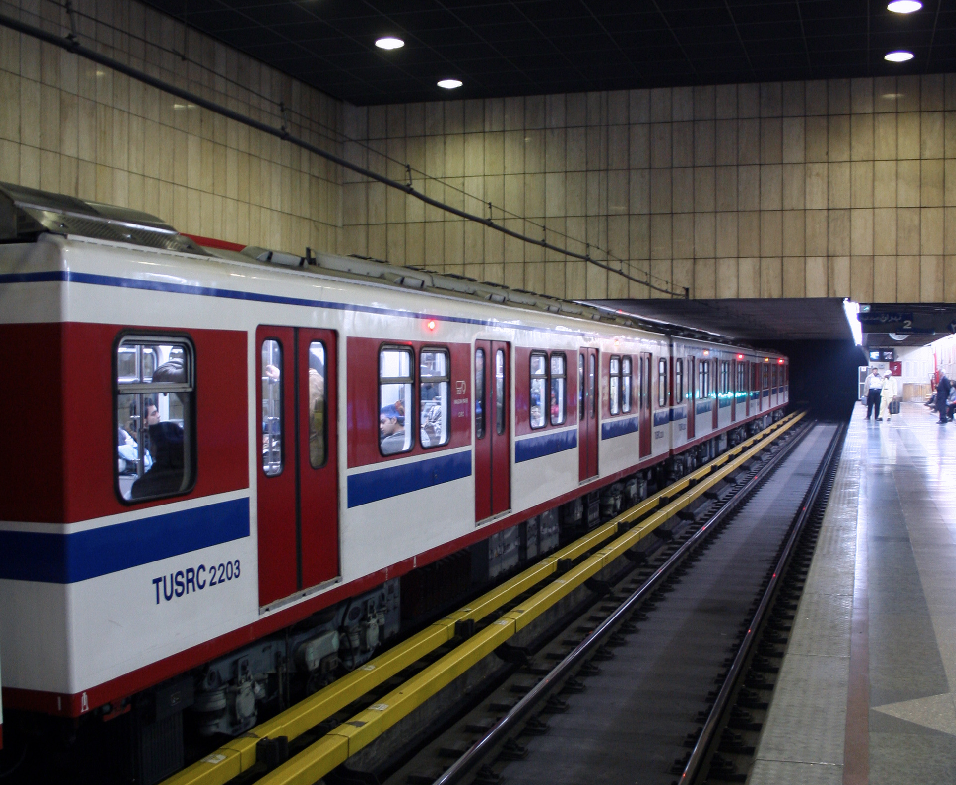
Lines 1 and 2 opened for commercial service beginning in 2000, using rolling stock from China's Changchun Railway Vehicles and Austrian-manufactured track from Voestalpine. The system grew steadily. A branch of Line 4 reached Mehrabad International Airport in 2016. An express line to Imam Khomeini International Airport opened in 2017, covering 31 kilometers. By the time Line 1 was extended to the satellite city of Parand in 2023, it had become an express subway running at 120 kilometers per hour -- the first of its kind on the network. Today, the Tehran Metro moves roughly three million passengers daily across its seven lines. The system runs from 4:30 in the morning until 10 at night, every day of the week.
The Weight of a City Above
Building a metro beneath an ancient city produces collisions between old and new. Iran's Cultural Heritage Organization has lodged formal complaints that vibrations from passing trains threaten the Masoudieh Mansion in the Baharestan neighborhood, the Golestan Palace, and the National Museum of Iran -- structures that predate the metro by centuries. In April 2012, heavy rains burst the safety walls of the Mianrood River, sending 300,000 cubic meters of water flooding into the Line 4 tunnel. Water reached an estimated 18 meters deep at Habib-o-llah station, the line's deepest point. No one died -- the nearest stations were still under construction, giving operators time to evacuate -- but it took two weeks to reopen the flooded sections. The metro's ambitions continue to outpace its capacity: plans call for eleven lines totaling over 430 kilometers by 2040, with three additional LRT tramlines and more commuter rail.
Five Cents to Cross a Megacity
The Tehran Metro is a study in contrasts. It is thoroughly modern -- equipped with automatic train protection, centralized traffic control, and SCADA systems -- yet it costs less than a pack of gum to ride. It connects ancient neighborhoods where Persian dynasties built palaces to sprawling suburbs where millions arrived in the rapid urbanization of the past four decades. Approximately two billion dollars have been invested in the system to date, funded through a patchwork of government appropriations, mining concessions, and international partnerships spanning France, China, and Austria. What began as a French consultant's plan in the era of the Shah has become, through revolution and war and isolation, something distinctly and stubbornly Iranian.
From the Air
The Tehran Metro system underlies central Tehran at approximately 35.70N, 51.42E. From the air, Tehran is a vast urban expanse filling a plain between the Alborz Mountains to the north and the desert to the south. Mehrabad International Airport (OIII) lies within the city to the west, connected to the metro via Line 4. Imam Khomeini International Airport (OIIE) is approximately 30 km southwest, connected by a dedicated express metro line. The city's grid of highways and dense blocks is visible at cruising altitude in clear weather.