Telegraph Avenue
Before it carried students and street vendors and tear gas, Telegraph Avenue carried electricity. In 1859, the Alta Telegraph Company strung a wire between Oakland and Martinez, and the dirt roads running alongside it inherited a new name: Telegraph Road. That act of renaming set a pattern. Over the next century and a half, this four-and-a-half-mile corridor would be renamed, rerouted, shortened, fought over, and reinvented so many times that the street itself became a metaphor for the restless East Bay communities it connects.
A Street of Many Names
Telegraph Avenue is actually a patchwork of older roads stitched together by transit and ambition. Its southern stretch once bore the name Peralta Road, after the rancho family whose estate it reached in Temescal. The segment climbing into the Berkeley Hills was Harwood's Road, named for an Oakland politician who leased grazing land in the canyon above. In Berkeley, the street was originally Choate Street, the third in an alphabetical grid laid out by trustees of the College of California to finance their new campus. Oakland extended its own road to meet Choate but called it Humboldt Avenue, because apparently no one was consulting anyone else. It took decades of horsecar lines, steam dummies, and real estate interests to unify these fragments under a single name. Berkeley finally changed Choate to Telegraph in 1890, completing a renaming process that had begun thirty years earlier with a telegraph wire no one remembers.
Horsecars, Amusement Parks, and Frog Farms
Oakland's first horsecar line rolled along Telegraph Road in 1869, and the corridor never stopped moving after that. The line extended to Temescal, then to the university campus after UC relocated from Oakland in 1873. Neighborhoods crystallized along the route. Between 56th and 58th Streets, Idora Park opened as an amusement park, drawing crowds from across the East Bay. Further up, where Telegraph Road once climbed toward the Berkeley Hills, the Oakland Trout Company operated a fish and frog farm near what became Fish Ranch Road. The horsecars gave way to steam dummy trains, which gave way to electric streetcars. Each transportation upgrade pulled development northward, knitting Oakland's downtown to Berkeley's campus. By the early twentieth century, Sather Gate marked Telegraph's northern terminus, and the Fox Theatre anchored its southern end in downtown Oakland. The street had become a spine connecting two cities that shared a border but rarely agreed on much else.
The Burning Sidewalks
The 1960s turned Telegraph Avenue into a national symbol. When UC Berkeley expanded south to Bancroft Way in the 1950s, it shortened Telegraph by a block and a half, demolishing buildings to create Sproul Plaza. That plaza became the staging ground for the Free Speech Movement and the protests that followed. But the defining confrontation came in 1969, over a muddy lot the university owned and activists had converted into People's Park. On May 15, Alameda County Sheriff's deputies fired buckshot-loaded shotguns at demonstrators on and near Telegraph Avenue. James Rector, watching from a rooftop, was killed. Alan Blanchard was permanently blinded. Deputies chased protesters down Telegraph as far as Willard Junior High School, firing tear gas onto the school grounds. The violence cemented Telegraph's reputation as contested ground, a place where the distance between a college bookstore and a battlefront could be measured in city blocks.
Layers of Arrival
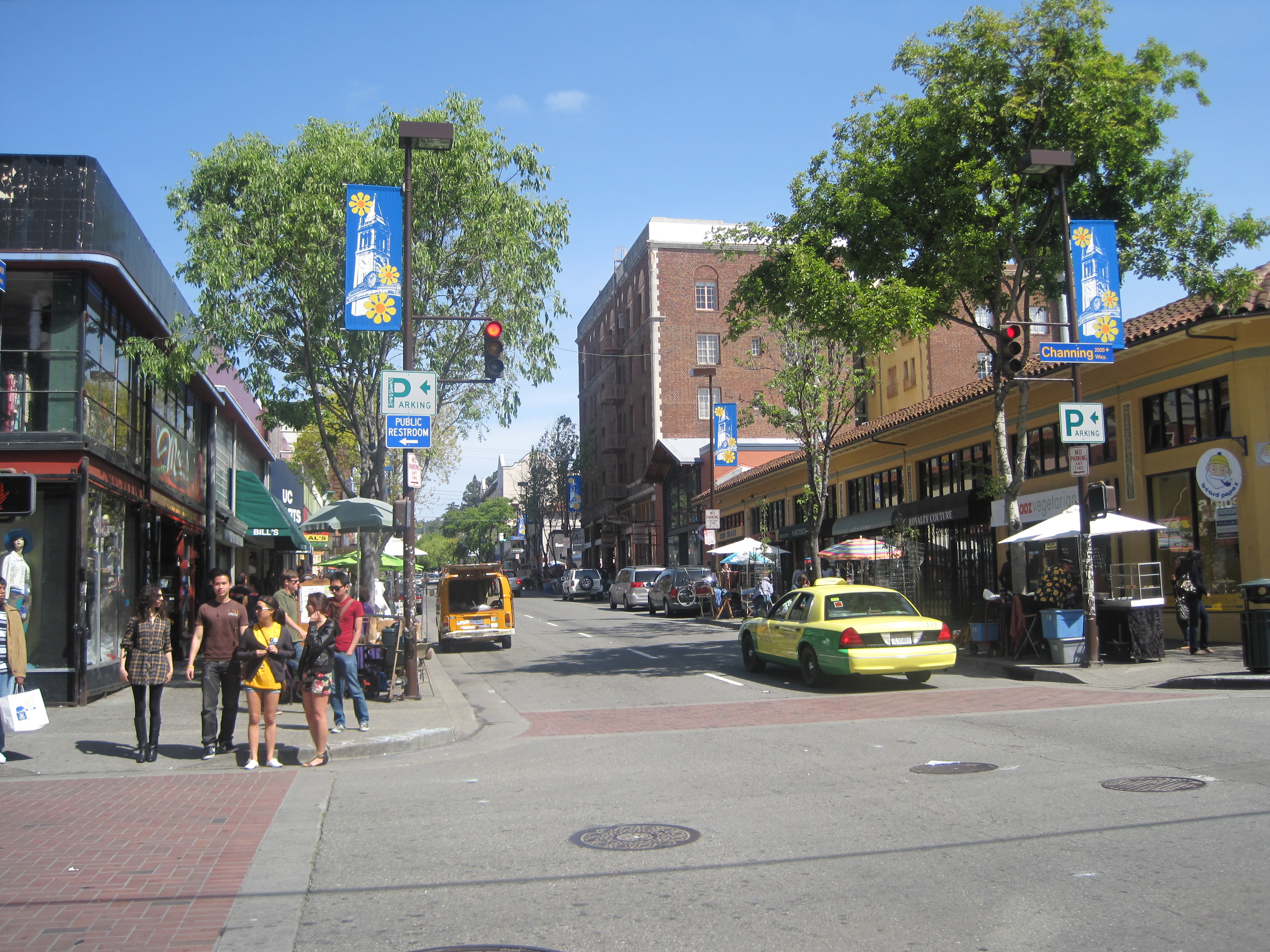
Walk Telegraph today and you cross invisible borders between communities that claimed the avenue in successive waves. South of Temescal, Korean-owned businesses have clustered so densely that some proposed renaming the stretch Koreatown, a suggestion that drew pushback from longtime residents who did not share that identity. Further along, Ethiopian and Eritrean restaurants, cafes, and social clubs line the sidewalks from around 30th Street in Oakland well into Berkeley, their injera platters and coffee ceremonies transforming the streetscape. Near the campus, the four blocks between Bancroft and Dwight still function as Berkeley's de facto town square. Street vendors spread their wares across the wide sidewalks. Record stores and bookshops hold on. The foot traffic is heavy enough that the city has designated sections as one-way, and debates about banning cars entirely have become a perennial feature of council meetings.
Still Carrying the Signal
The original telegraph line is long gone, and the horsecars and steam dummies are museum pieces. The Grove Shafter Freeway, built in the 1960s, sliced through Temescal half a block to the west, creating a concrete wall that severed Telegraph from the neighborhoods on the other side. Yet the avenue endures as a transit corridor, a commercial strip, and a cultural seismograph for whatever is happening in the East Bay. AC Transit has proposed a bus rapid transit line along Telegraph, a plan that has generated its own controversy about parking and access. The arguments echo the ones that accompanied every previous transformation, from horsecar extension to freeway construction. Telegraph Avenue has been carrying signals since 1859. The technology changes. The impulse to connect does not.
From the Air
Telegraph Avenue runs roughly north-south at 37.87N, 122.26W, connecting downtown Oakland to the UC Berkeley campus. From the air, trace the corridor between the I-580/CA-24 interchange (Grove Shafter Freeway) and the UC Berkeley campus. Nearest airports: Oakland International (KOAK) approximately 8nm south, Hayward Executive (KHWD) 12nm southeast. Best viewed at 3,000-5,000 feet AGL on a clear day; the Fox Theatre and UC Berkeley campanile mark the southern and northern anchors respectively.